


Project: Infrasurface
Location: Keelung River, Taipei, Taiwan
Designer: Jonathan Reyes
Program: Yale University School of Architecture
Faculty Advisor: Heneghan-Peng Architects
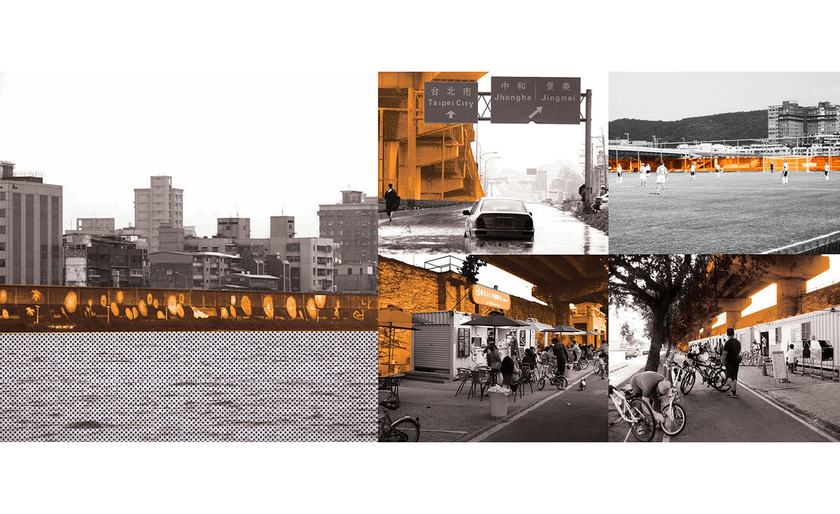
Project Description: A city situated at the bottom of a flood basin, Taipei’s urban dynamics are direct consequences of infrastructural systems and urban forms that enable to city to function throughout regular inundation and inclement weather. Typically, flood-resistant infrastructure employs strategies of resistance, most evident in the enormous floodwalls along . Unsurprisingly, the urban spaces adjacent to these walls are frequently devoid of activity beyond parking and storage.
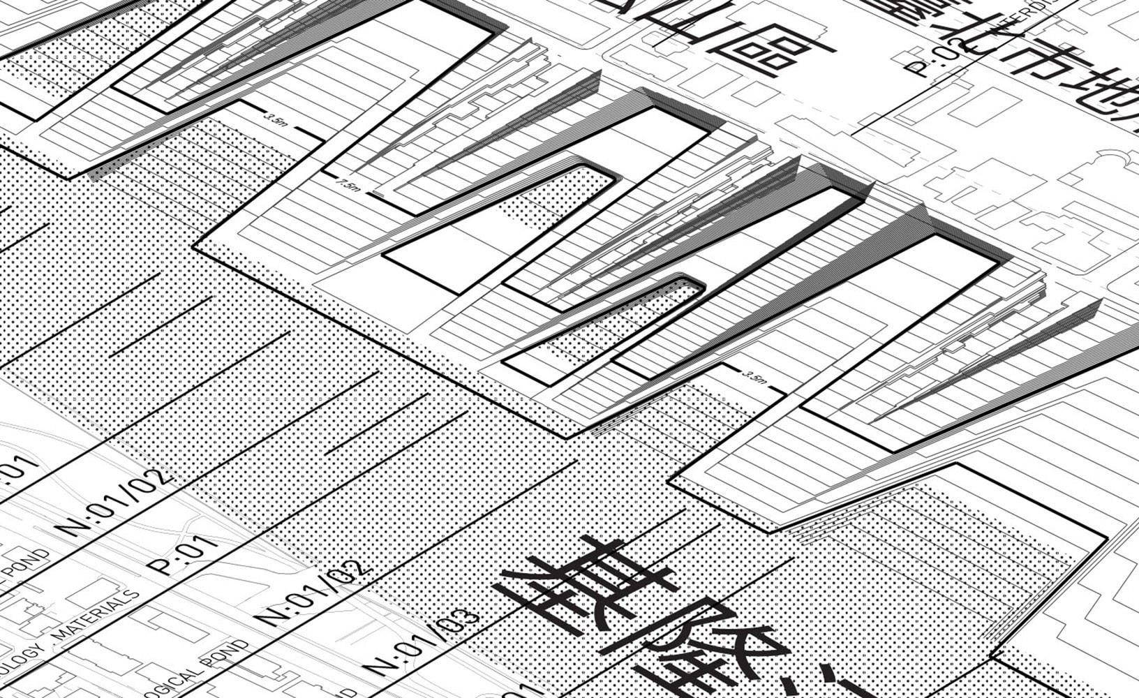
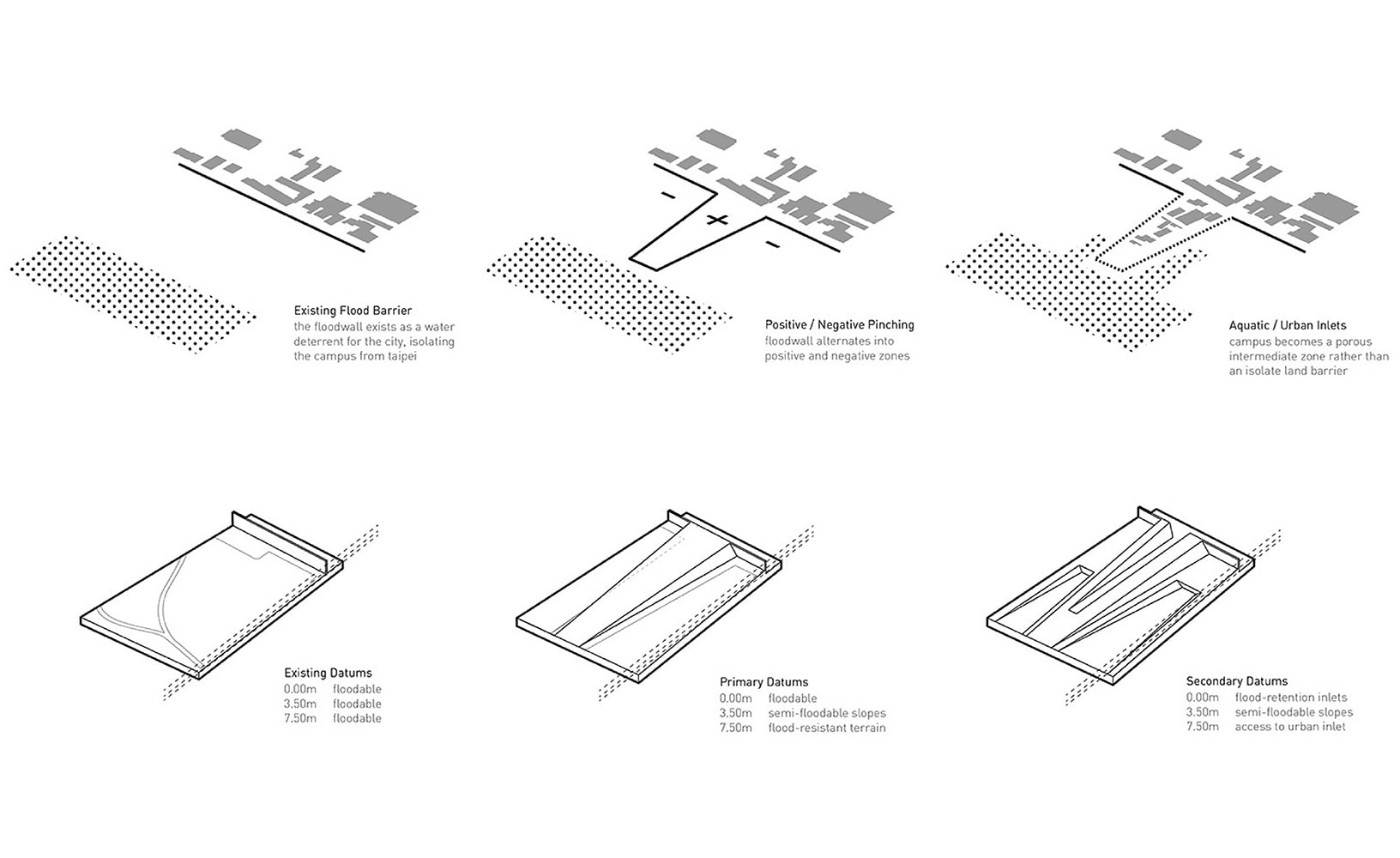
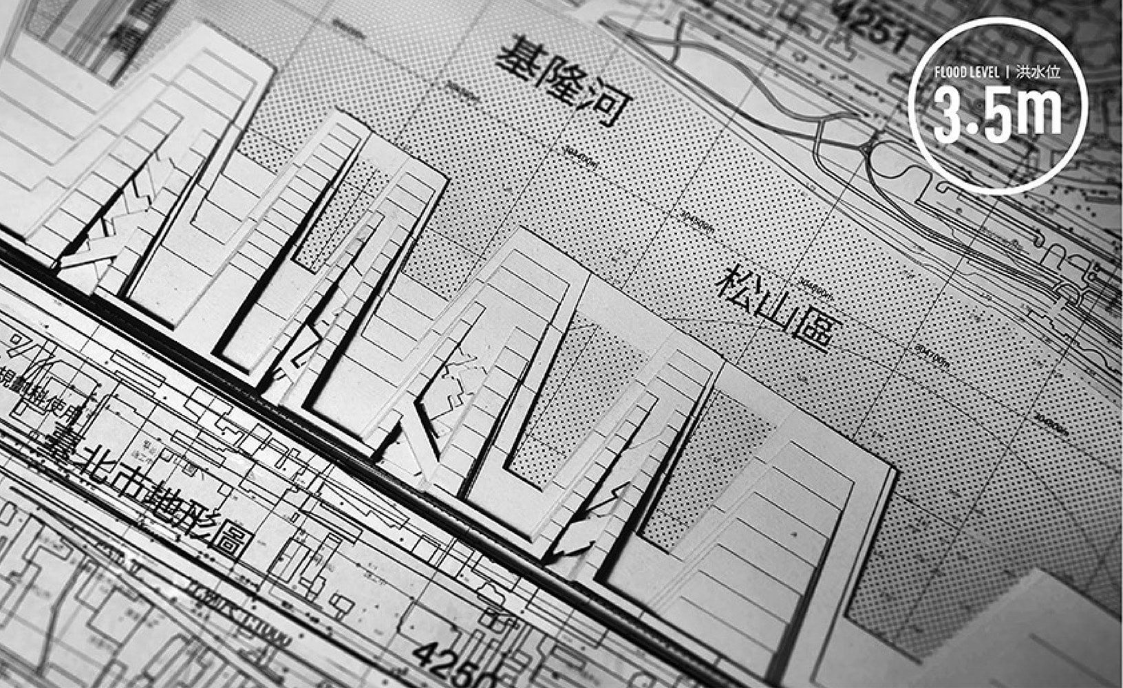
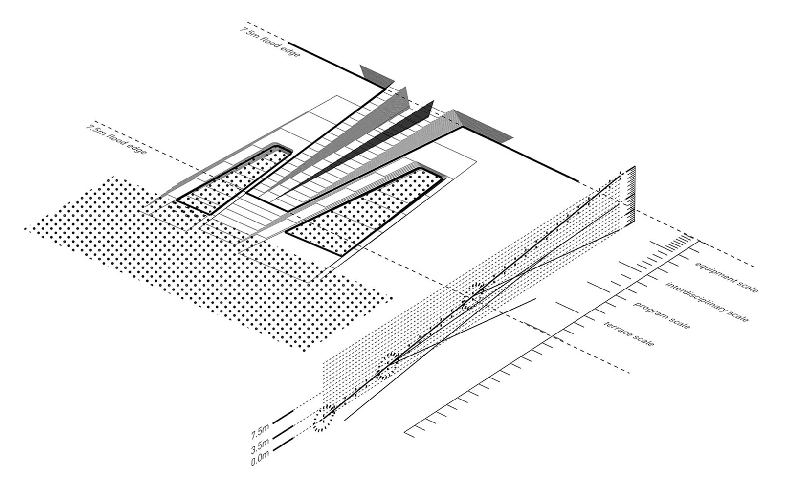
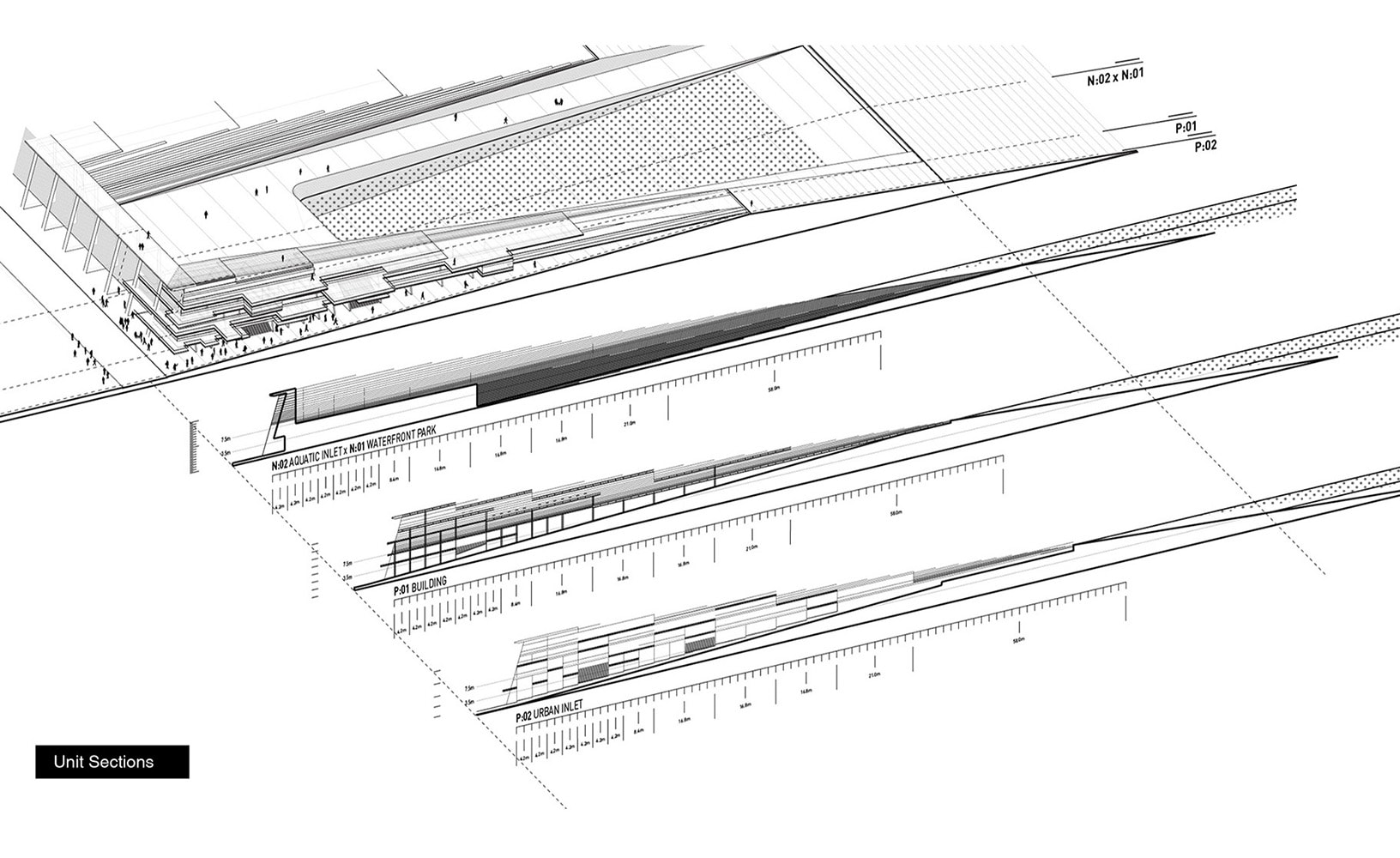
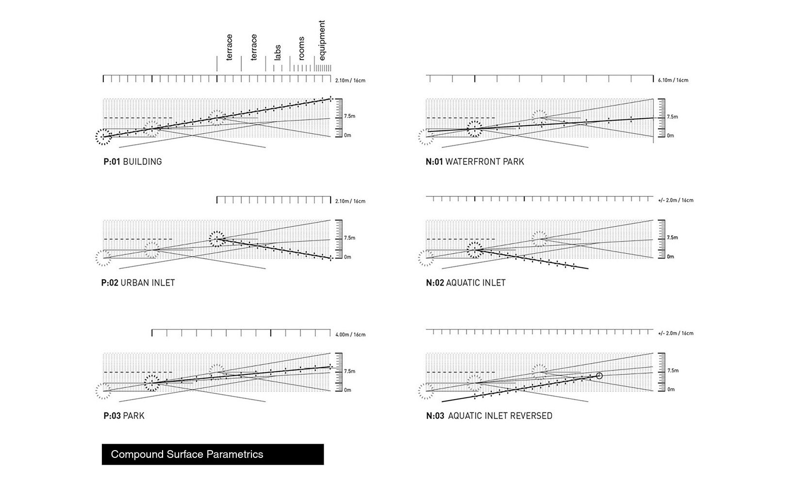
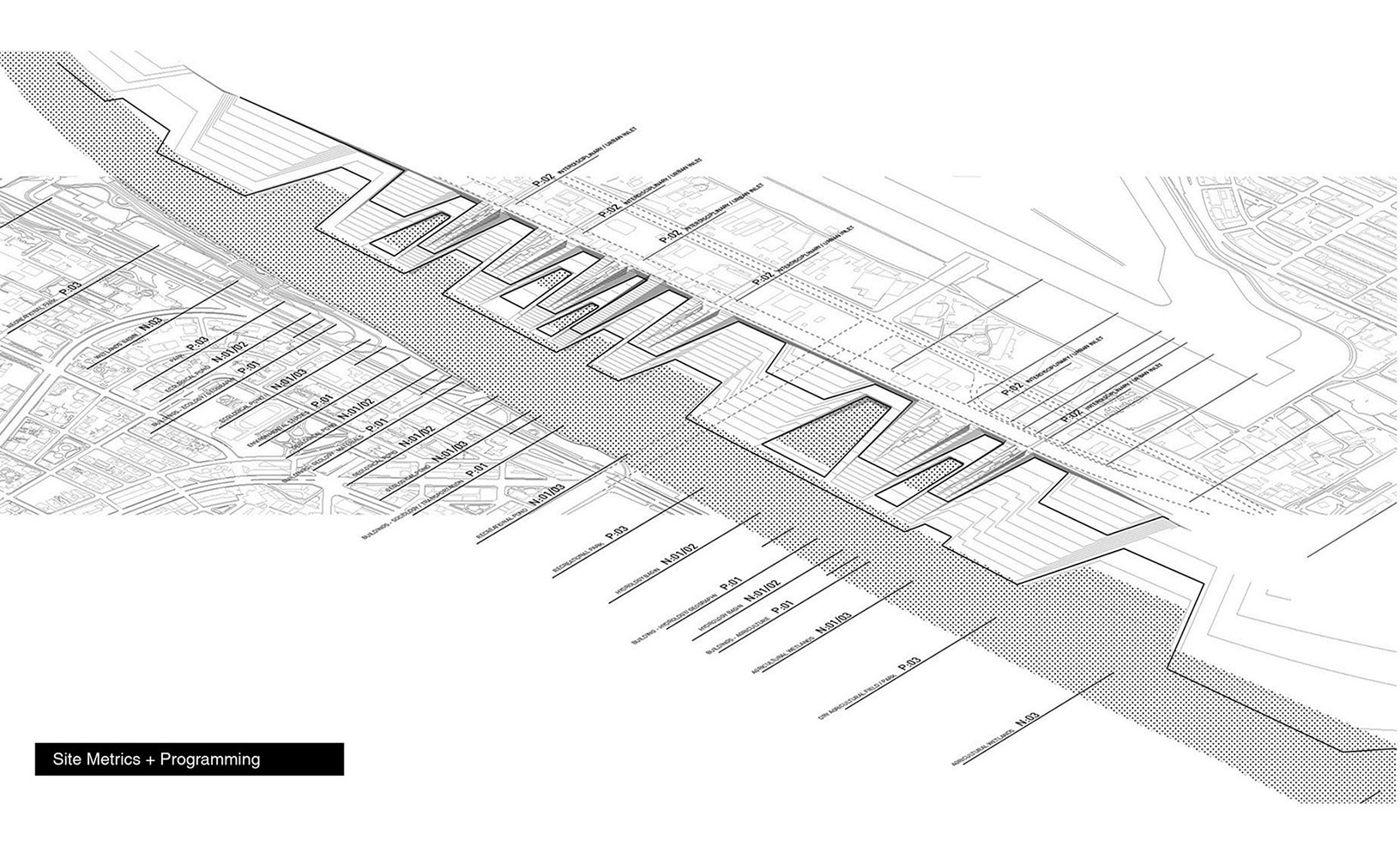
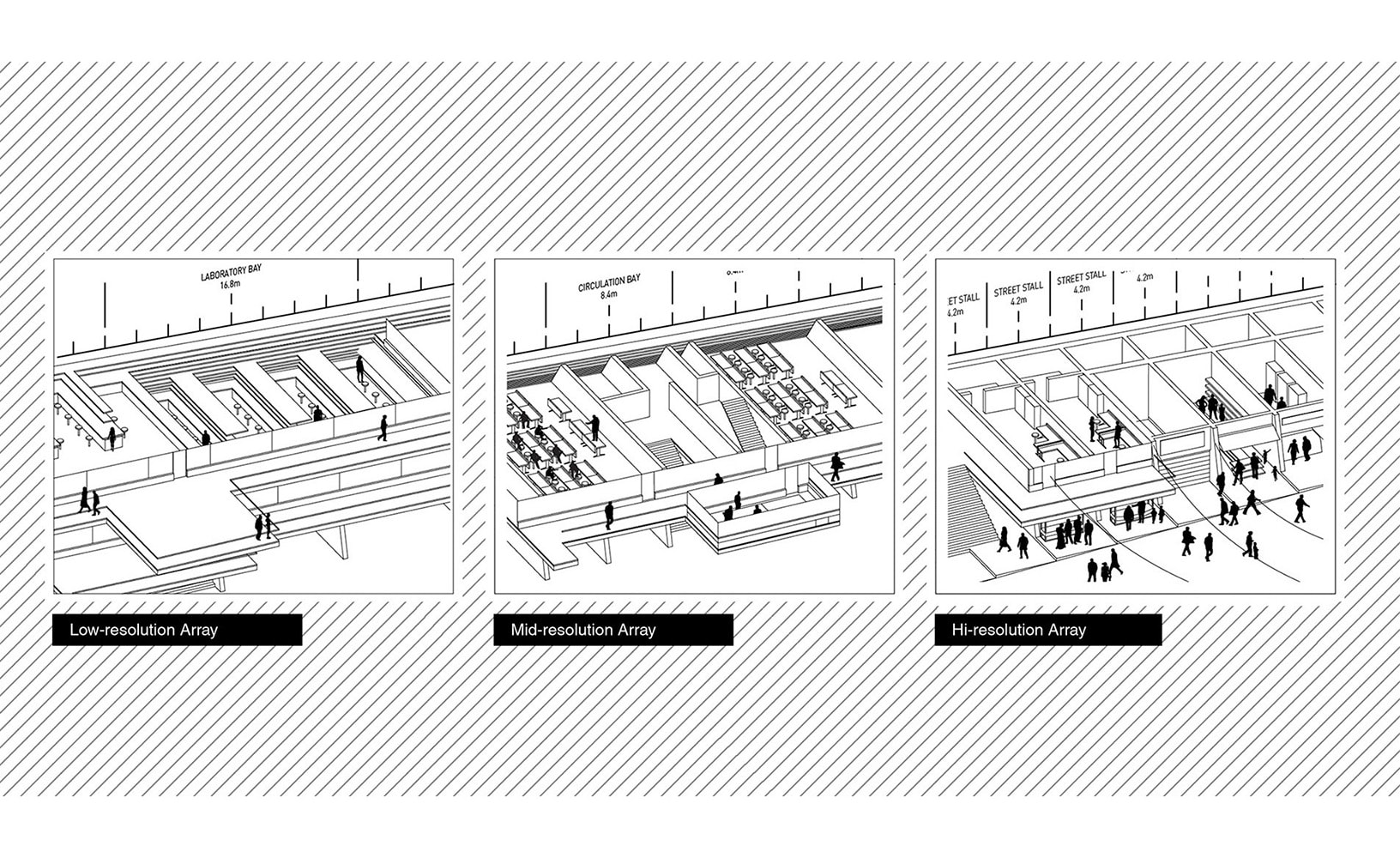
This design for a research campus near the meeting point of the Damsui and Keelung Rivers adapts conventional urban logics to produce an integrated system of infrastructure and architecture. Through the manipulation of the floodwall on the south bank of the Keelung, the resultant terrain simultaneously resists and embraces floodwater inundation to establish two distinct programmatic functions. By pinching and stretching this wall into alternating positive and negative incursions, or inlets, into the site, the formerly vertical flood barrier becomes a compound, contoured, and traversable surface.
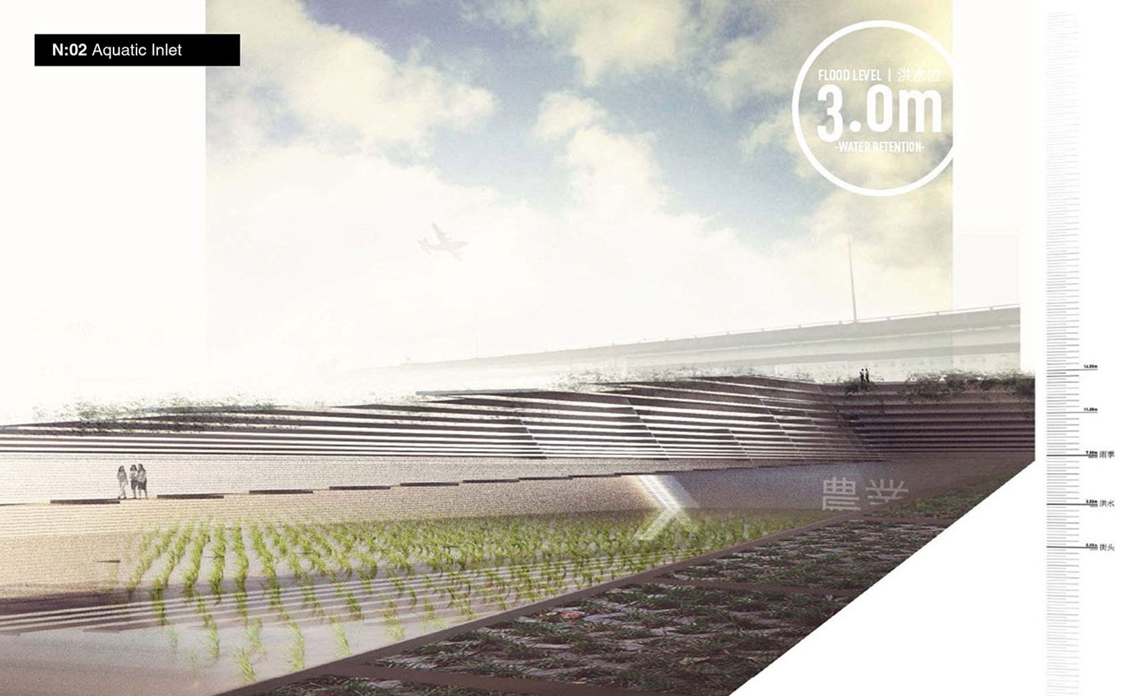
Negative depressions serve as inlets for floodwater retention, appropriately contoured to accommodate external laboratories, wet agricultural fields, recreational landscapes and other outdoor programming for the campus.
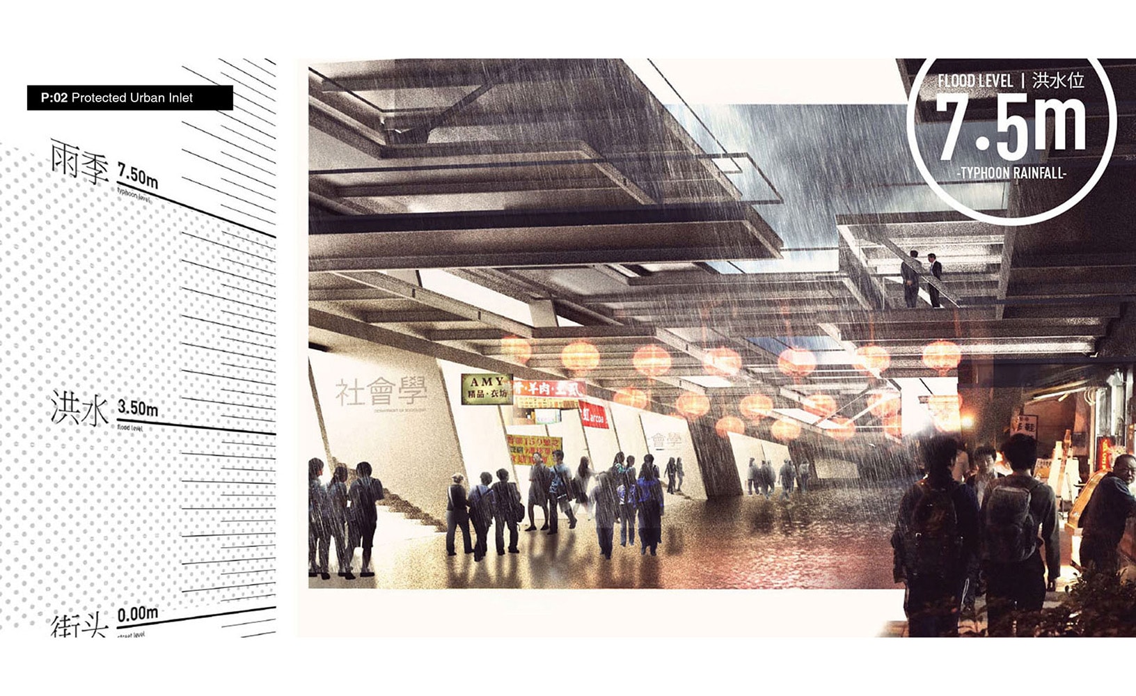
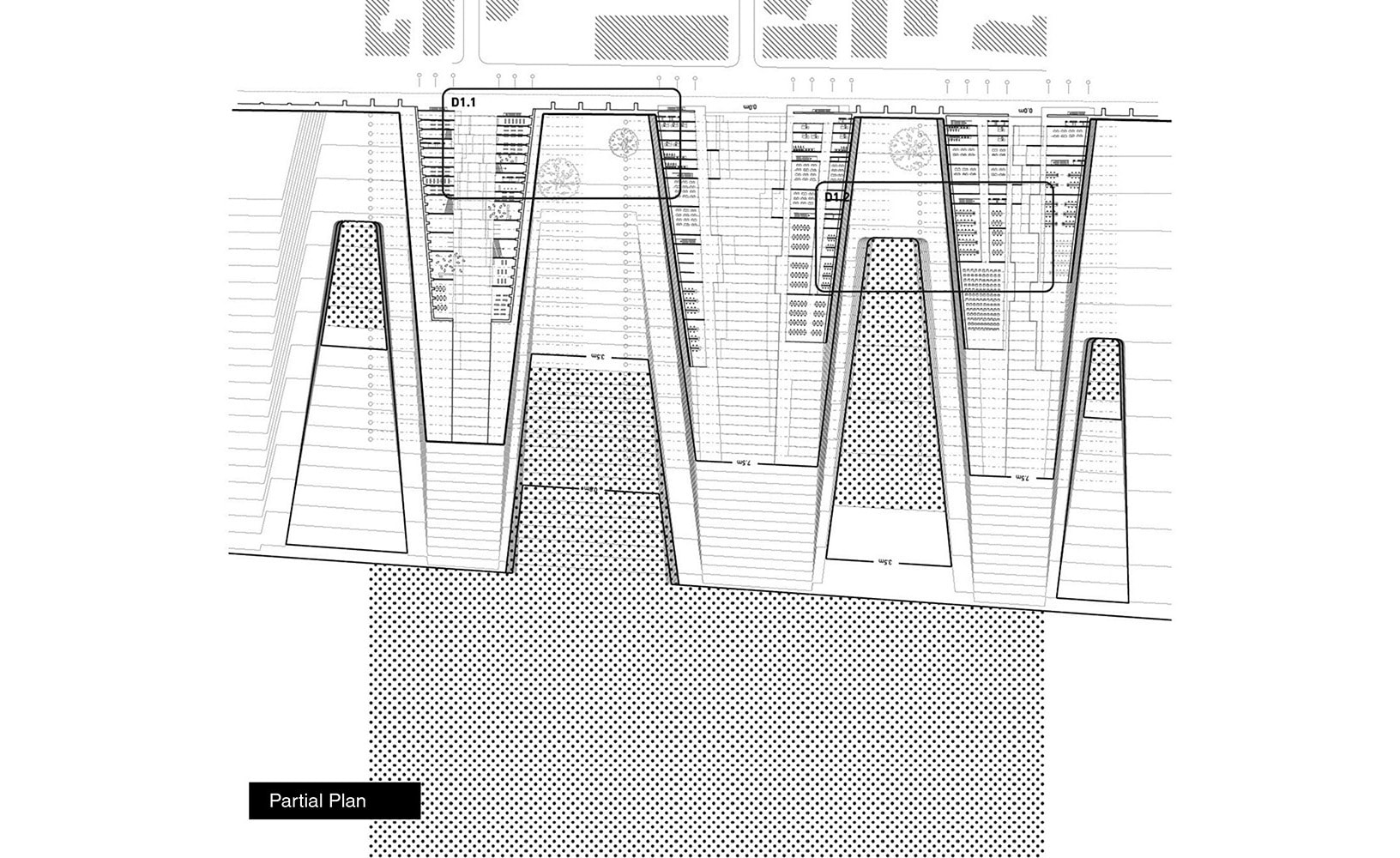
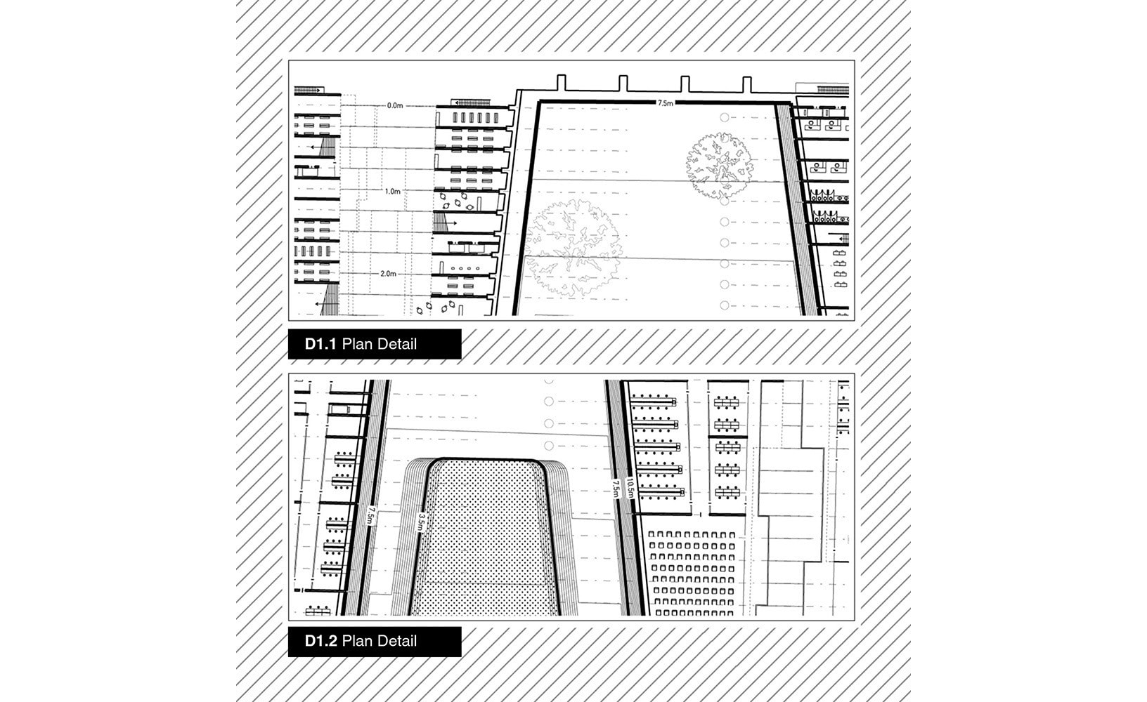
Positive extrusions become building masses and inlets for the infiltration of the city into the site and campus. This topographic infrastructure serves as a series urban frames that protect the zones of infiltration from inundation while cultivating Taipei’s informal urban character within them.A site-wide contour logic serves as a physical demarcation of flood levels and event boundaries. The contours and the density of spacing between them establish a parametric system of slopes and modules employed across the campus.
A site-wide contour logic serves as a physical demarcation of flood levels and event boundaries. The contours and the density of spacing between them establish a parametric system of slopes and modules employed across the campus.
| previous project | next project |