


Project: Perimeter City 238
Location: Lincoln, NE
Designer: Andrew Ferentinos
Year: 2012
Program: Massachusetts Institute of Technology
Faculty Advisors: Alan Berger, Alexander D’Hooghe
Project Description: Even though the U.S. metropolitan area population is an expanding suburbia, most research on cities is focused on high density, compact urban areas. Metropolitan horizontal scale has largely been neglected even though it is likely to remain the model for many years to come. Lincoln, Nebraska is taken as a model to research innovative models of suburbanization that can be applied to other U.S. cities.
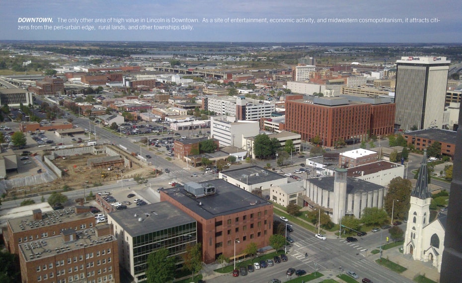
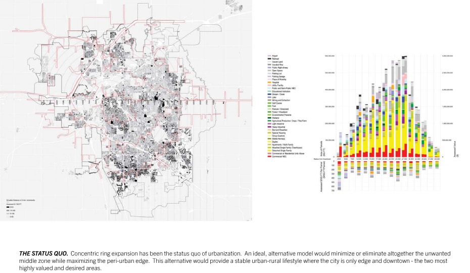
The issues Lincoln face are common to many cities. Majority of inhabitants share the suburban desire to have both city and country at their fingertips. Unfortunately, under the status quo of concentric-ringed expansion, the peri-urban edge—the interface where countryside and city meet—is constantly unstable and fleeting. It is only a matter of time until the edge is consumed by expansion, turning it into a massively thick, low value middle ground, neither city nor country. Agricultural land is constantly consumed, pushing food sources further from their demand.
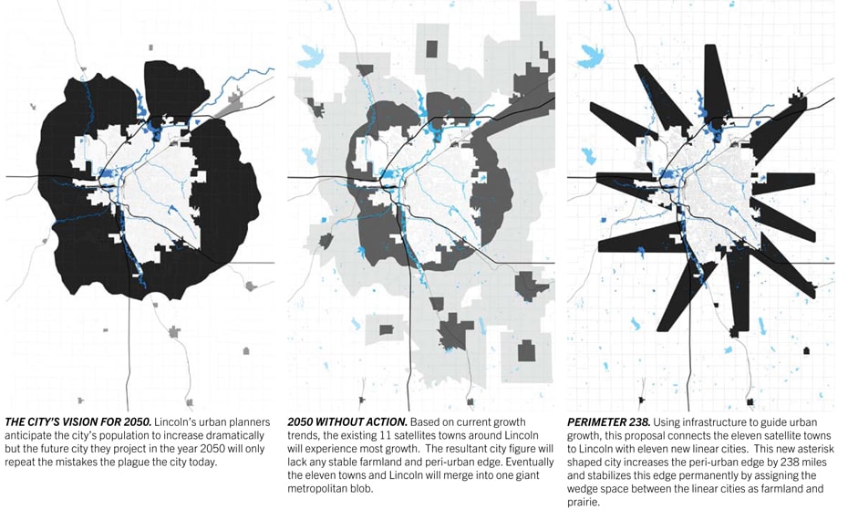
PERIMETER CITY 238 provides an alternative. It accommodates a doubling population—an increase of 250,000 people by 2050—into a plan that achieves three main goals. It stabilizes, protects, and maximizes the highly sought after peri-urban edge. It distributes a network of relatively higher density urban nodes easily accessible to the low/mid density peri-urban edge. It minimizes and eliminates low value, unwanted middle ground.
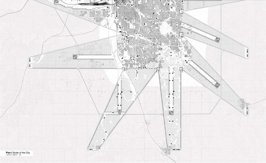
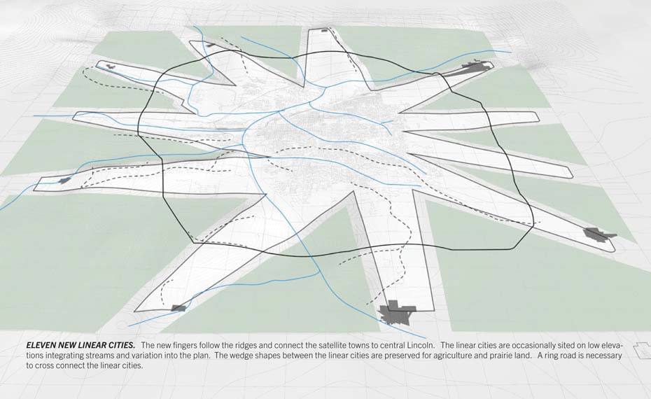
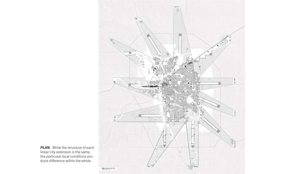
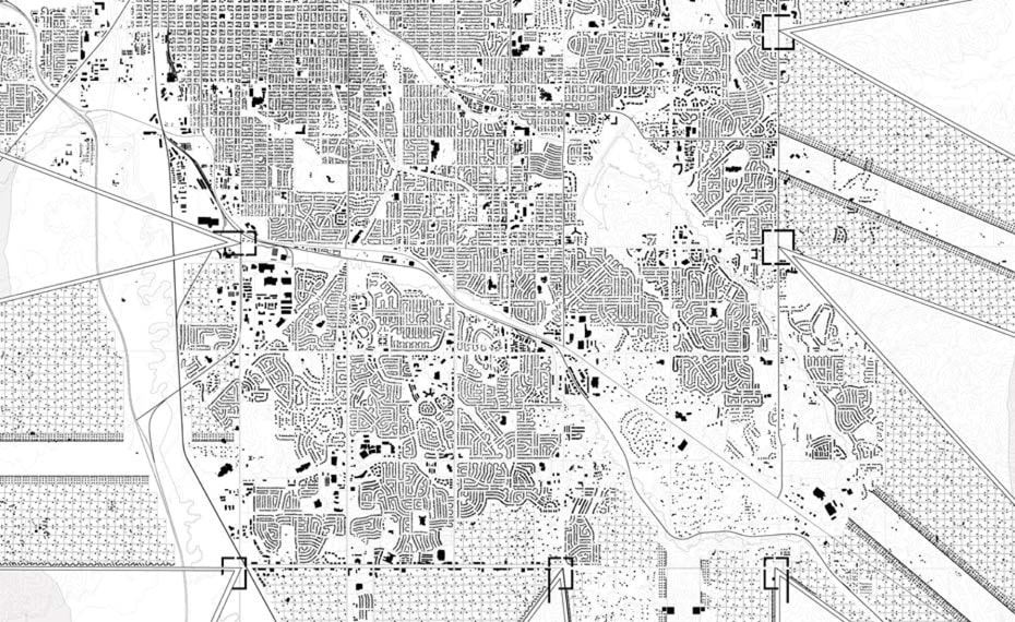
This plan is achieved by using infrastructure to focus growth into eleven new linear cities, or Fingers, that link Lincoln’s satellite towns to the existing city. The result is a new asterisk shaped city that maximizes perimeter and radically increases contact between city and agricultural land from 107 to 228 linear miles. This plan maintains Lincoln’s scale and character as a mid/low-density city, and ensures the continued presence of the agriculture, industry, and prairie landscapes that define its origins and productive future.
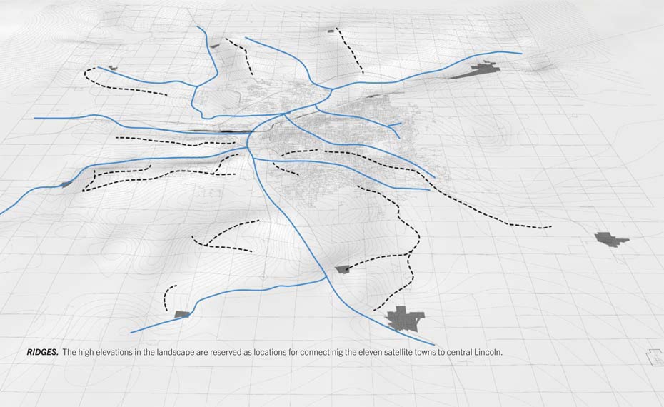
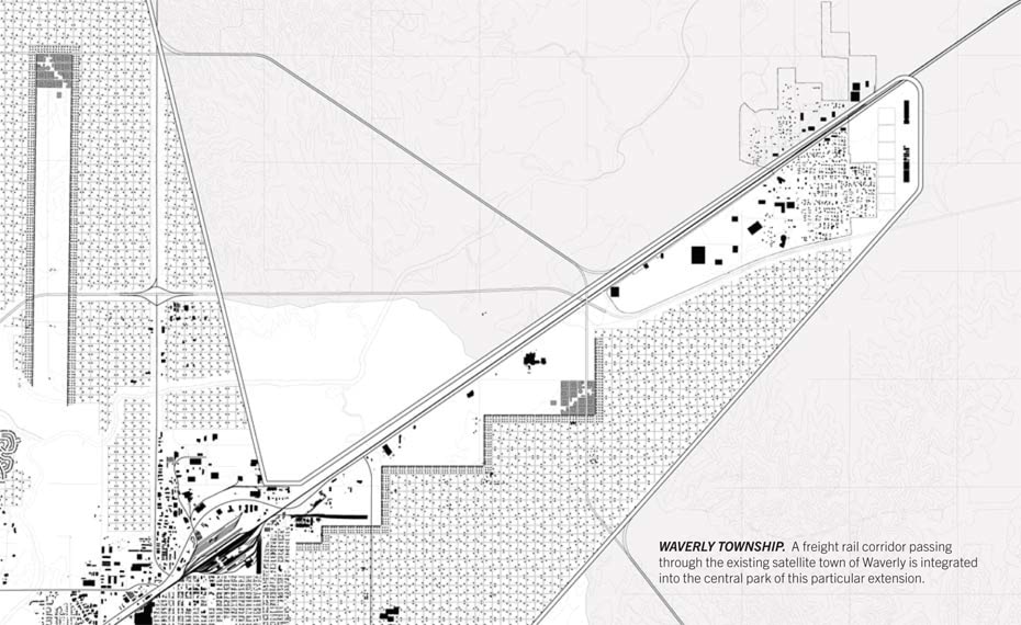
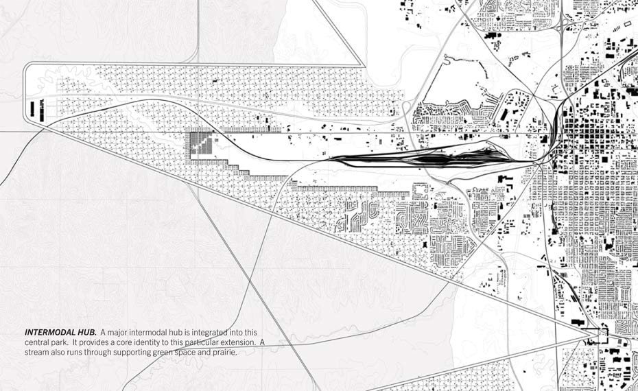
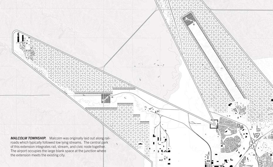
Finger-Structure: The particulars of local topography serve as an organizing principle for the plan. Each of the Fingers, roughly 7 miles long by 1.5 miles wide, contain a population of roughly 25,000. These linear footprints are aligned roughly along ridgelines, leaving lowlands and floodplains to the areas in-between serving as agricultural and prairie habitat.
Transportation: A new continuous parkway, the Cornbelt, traces the outer edges of all eleven Fingers, clearly defining the boundary between city and countryside. An Interior Belt marks the threshold between Lincoln’s existing urban fabric and the new finger extensions. Another highway, the Ring Road, runs perpendicularly across the center of each finger and provides a cross connection between each Finger.
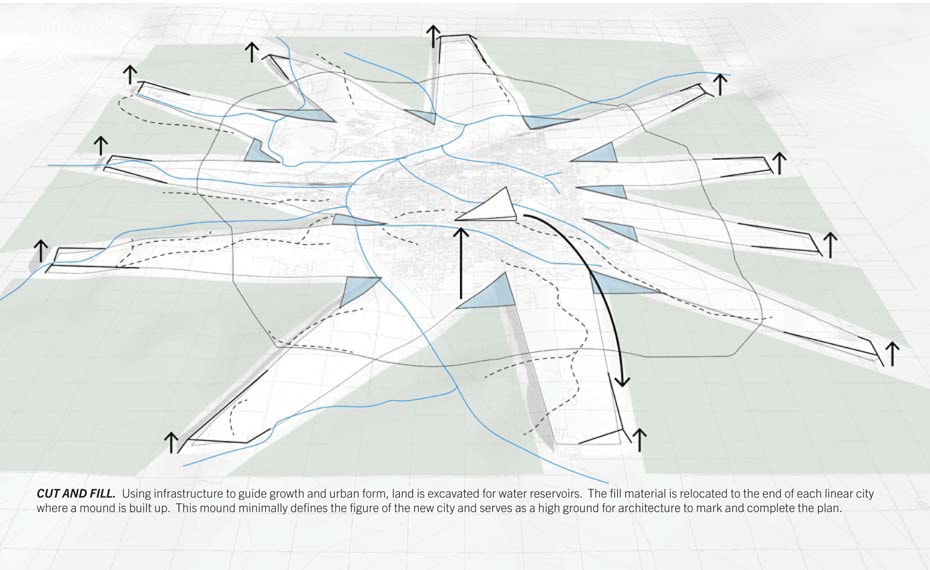
Nodes: Three types of architectural and landscape interventions organize the structure of the Fingers. First, within each Finger, a centrally located Civic Node acts as a growth magnet and center of economics, commerce, entertainment, culture, and civic space. Second, Water reservoirs and constructed wetlands are located at the junctions between each Finger. This helps block suburban expansion into farmland. It will comprise a significant element of the future city’s water infrastructure, improving regional water quality as well as providing wildlife habitat and recreational opportunities. Third, land that is excavated in the process is used as fill to raise the elevations of the terminal ends of each Finger. Upon these terminal mounds, ethanol plants and Waste-to-energy facilities are located.
Open Space: Each linear city will have a network of linked open spaces and natural areas that preserve features such as floodplains and forest while connecting existing parklands. A Constructed Central Park culminates at each finger’s Civic Node. Ringed with higher-density housing, this park accommodates a variety of public activities. The large areas of land lying beyond each finger will be preserved as a mix of productive farmland and prairie, maintained as a publicly accessible landscape preserve.
| previous project | next project |