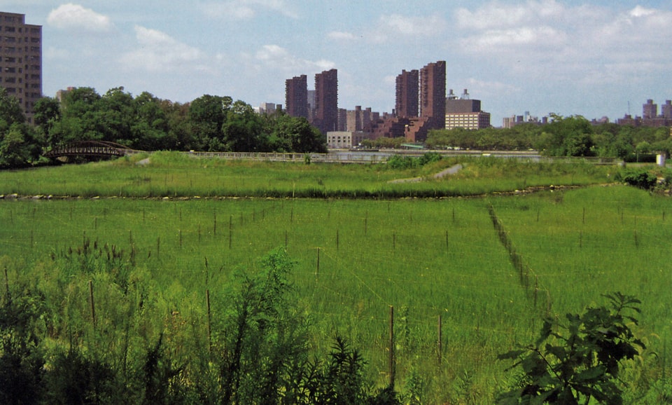
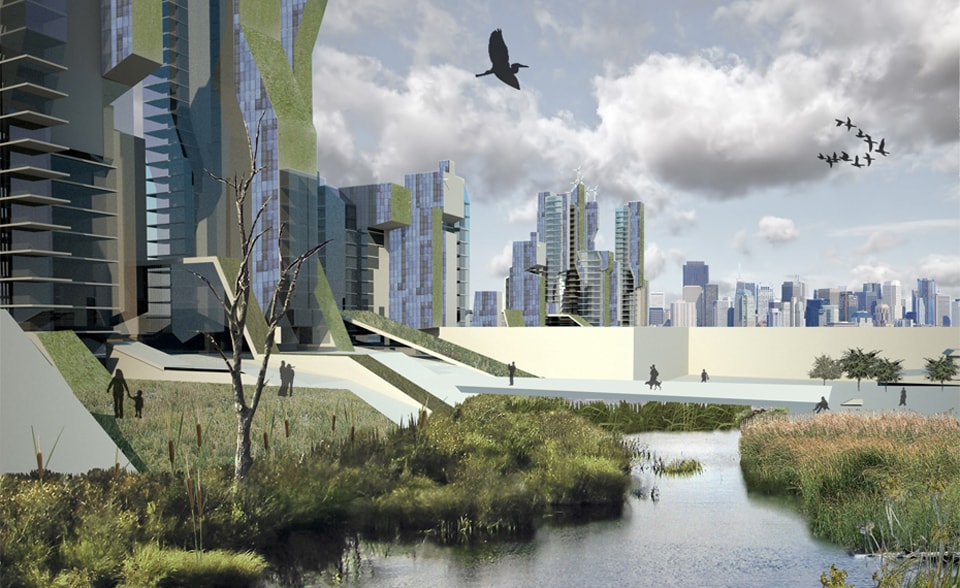
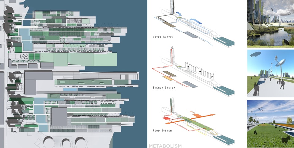
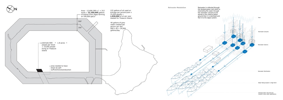
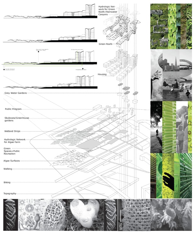
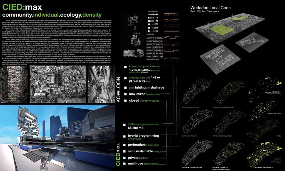
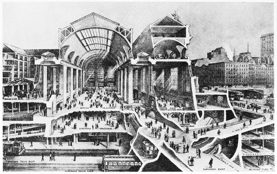
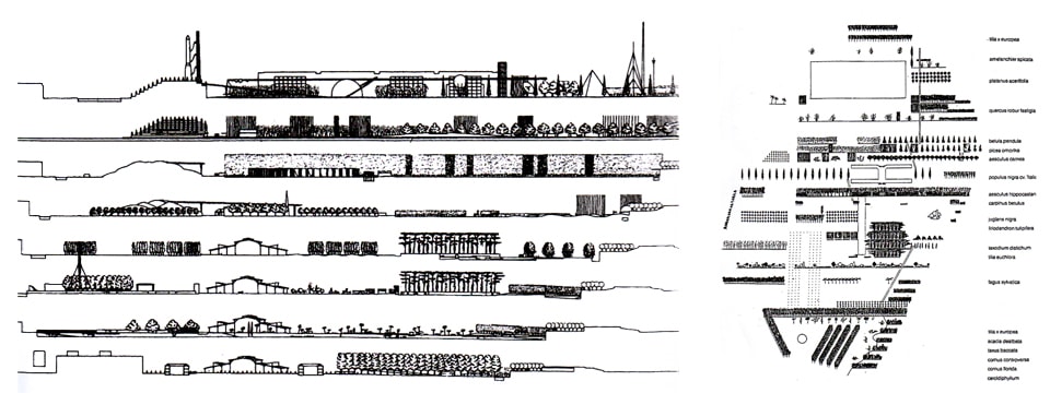
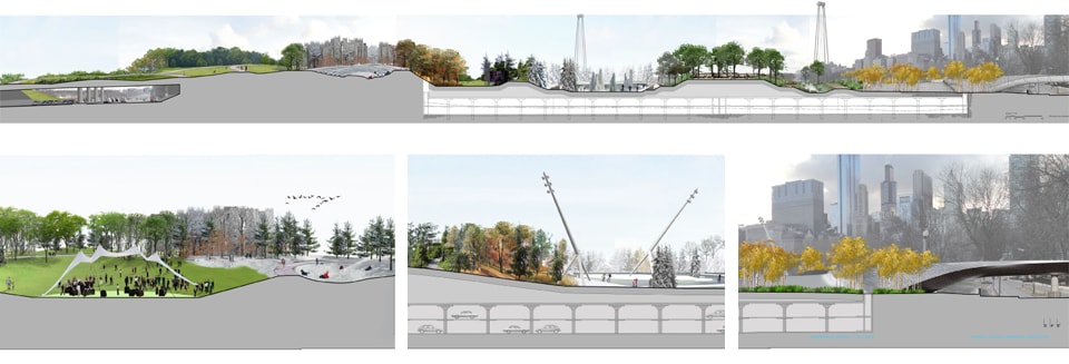
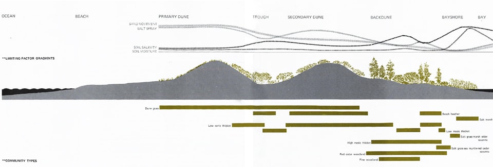
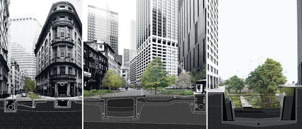
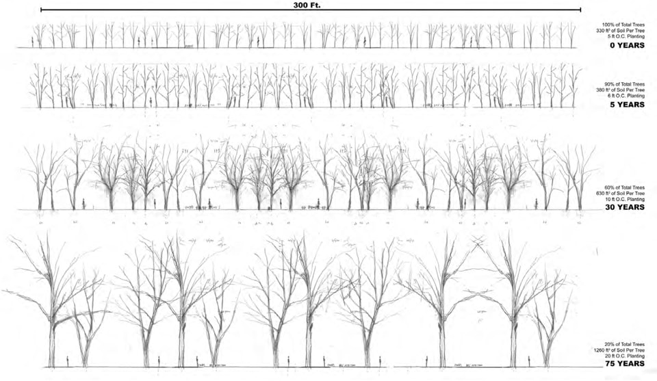
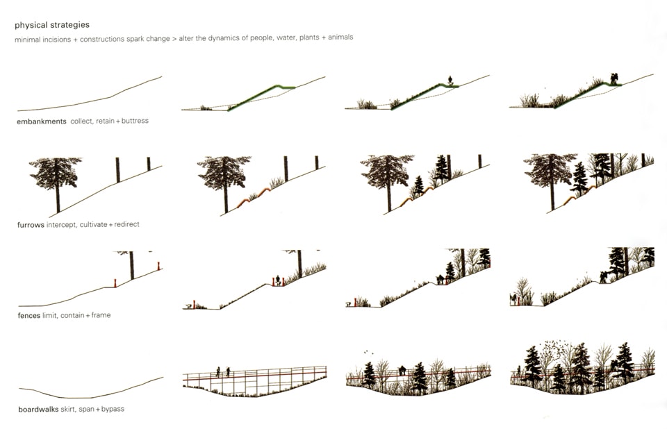
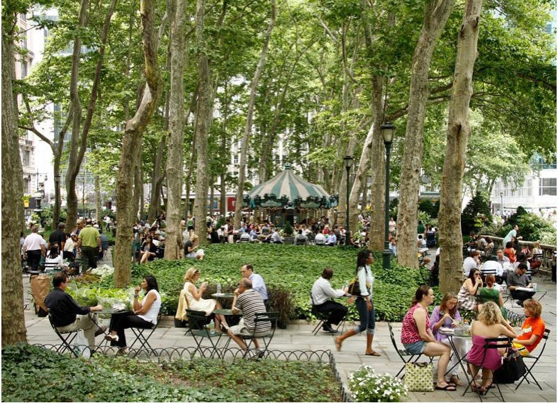
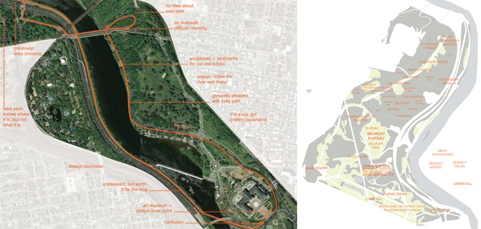
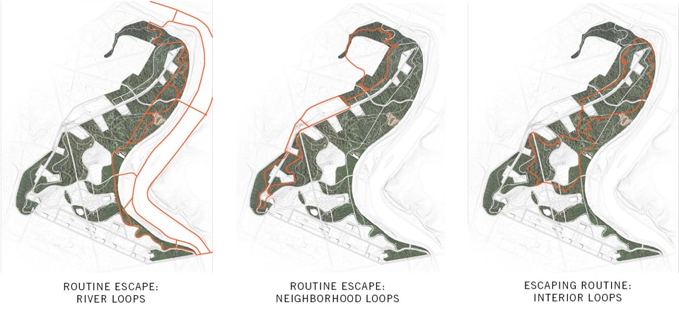
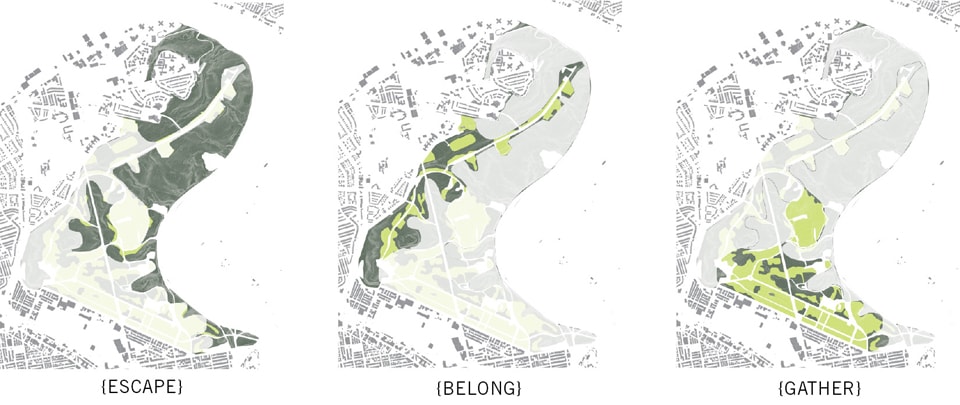
Tomorrow’s cities will need to perform better than today’s. To meet this challenge, designers (and their clients) have assembled a host of goals for urban projects—from encouraging smart transportation to protecting wildlife, from remediating toxic sites to building diverse neighborhoods—and increasingly, landscape projects are sold on such claims rather than their formal or aesthetic value alone.
Blog Archives
Introduction: Performance
Tomorrow’s cities will need to perform better than today’s, and the challenges of the coming decades demand high performance design. To meet these challenges, designers (and their clients) have assembled a host of ambitious goals for urban projects—from encouraging smart transportation to protecting wildlife, from remediating toxic sites to building diverse neighborhoods—and increasingly, landscape projects are sold on such claims rather than their formal or aesthetic value alone.
As landscape projects become more daring and complex, how do we ensure the quality of our work? How can landscape urbanists speak authoritatively about innovative strategies and experiment at the scale of our interventions? How can we ensure that our projects perform as advertised? The essays in this issue explore the ways in which performance is being understood, advertised, evaluated, and communicated by a range of disciplines involved in the creation of better-performing cities, parks and neighborhoods.
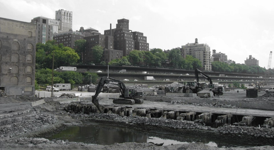
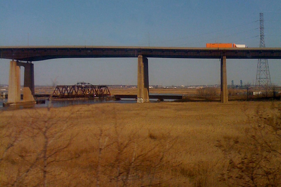
Image by Nicholas Pevzner
Digging deeper into sustainability
It is time for landscape architecture and landscape urbanism to actively join the conversation about sustainability and the impact of urban development. While architecture has gone through much of the growing pains of developing a nuanced vocabulary for talking about sustainability, moving from vague generalizations about “green” projects and products, towards the development of clear and peer-reviewed methods for evaluating comparative environmental impact, landscape architecture and urban design have yet to fully engage in a process of critical reflection and acknowledgement of the impacts of our designs.
When we speak about performance, what data backs up our claims? Designers should be able to make at least a rough calculation of the impact of their decisions while the design is still flexible, rather than only being able to evaluate their designs once all decisions have already been made. While there is a great deal of information about products and materials, complex design decisions will always require balancing multiple goals, variables and constraints. Often the right decision is not immediately apparent.
For example, people are often shocked when they learn that some landscapes are constructed over acres of polyurethane foam. Yet, with more and more landscapes being built atop structure, over buried roadways, on pile-supported pier, or over parking garages, foam may be an economic solution to creating large variations in topography. Is foam any worse than using thousands of pounds of concrete to further reinforce a structure to bear heavier soil loads? Is it worse than excavating and transporting that much more soil? In order to critically compare options—be they related to material selection, structural systems, project siting, or management regimes—we need to decide what types of performance and impacts we care about.
All landscape projects are impactful to some degree—looking green and using plants does not make a project inherently sustainable. The design, construction and maintenance of all landscape and architecture projects consume energy and carry embodied carbon, water and human health impacts. How will the newfound urgency within the landscape profession to quantify and measure these impacts change the way we collaborate, execute projects, and talk about our designs?
Designers have begun to partner with experts who are capable of judging the impact and performance of design interventions, using sophisticated methods such as iterative energy modeling, Life Cycle Assessment (LCA), or dynamic systems modeling. Using an LCA, for example, one might compare the life-cycle energy expenditure, carbon footprint, or ecotoxicity associated with the manufacture, shipping, installation and disposal of polyurethane foam over the lifespan of a project, to the excavation, transportation, and eventual demolition and hauling away of a larger amount of soil and concrete. Designers should be able to evaluate the impact of their design decisions not only in terms of first cost, but also in terms of their material, ecological, economic, and social performance over time using measures that are specific to their project.
Reengineering our cities in sustainable and innovative ways will require increased scientific research to validate techniques and to more fully understand the scalar effects of urban interventions. Still, the most robust list of best practices and green strategies cannot replace the intelligence of design. The challenges of climate change, population growth, dwindling natural resources, increased human consumption and the need to radically improve the quality of life of large populations will not be met by a single strategy. Blanketing cities in green roofs or covering the landscape with algae farms will not solve all of our urban problems.
While general research in green infrastructure technology and practices will play a large role in shaping policy, opening up markets, and increasing the quality of specifications, the design community has a critical role to play in the field of applied research. Increasing our nimbleness in parsing data so that it can inform design decisions, and creating the necessary feedback loops for us to continue to learn from our designs once they are built, are essential steps in moving towards research-driven design at all scales. How will the newfound urgency within the landscape profession to quantify and measure these impacts change the way we collaborate, execute projects, and talk about our designs? There is much work to do.
New partnerships, integrated practice
Urban landscapes are complex and poorly studied. While landscape architects routinely transplant natural systems onto compressed urban sites in new combinations, urban landscapes do not perform like their natural counterparts. Designers increasingly turn to ecologists for expert opinions on ecological scenarios for which no definitive data exists. How can designers operate with confidence, avoiding paralysis even when scientific understandings of urban ecological phenomena are still very much in flux? Urban restoration ecologist Lea Johnson and landscape architect Renee Kaufman each tackle this question and pose new ways to operate within a field of uncertainty and continuous inquiry.
In an age of climate change and carbon footprints, there has been increased emphasis on valuing and calculating ecosystem services. Still, for projects to succeed over time, they must meet the diverse needs of the communities they are designed to serve. A project will not be sustainable unless it is taken care of, used, and loved. All landscape projects negotiate social, economic and environmental considerations during their design, construction and maintenance.
In writing the High Performance Landscape Guidelines, the New York Parks Department grappled with balancing these diverse considerations in order to prepare the city’s 29,000 acres of landscape projects to best meet the needs and aspirations of a 21st century green metropolis. In “Social Performance: Prototyping User Behavior,” Michael Miller looks at how designers and planners can better understand the potential of existing sites studying user behavior and prototyping future design interventions. Focusing in on the ecological and cultural relationships between plants and people, Peter Del Tredici challenges landscape architects to look closely at underappreciated spontaneous urban plants to better understand their role in the urban environment.
Despite its many limitations, LEED has become a well-accepted way of certifying building performance, widely transforming the way in which architects, builders, developers and clients evaluate projects. Recently, Sustainable Sites Initiative and LEED ND have emerged as rating systems for addressing the specific concerns surrounding landscape and neighborhood-scale projects. As these schemes have yet to mature and become widely used, practitioners have forged ahead in crafting tools that better meet their needs. In his article in this collection, Christian Runge discusses the process and motivations behind Mithun’s evolving set of customized performance metrics for districts and neighborhoods, while Mona el Khafif proposes recalibrating the goals and parameters of zoning to address the consumption/production of energy, waste and water.
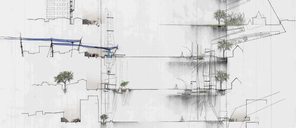
In order to address multidimensional considerations and overlapping spatial and temporal concerns, designers will rely on a range of analytical tools for generating and evaluating design. Some of these tools, such as systems modeling, come from emerging fields such as industrial ecology, while others, such as analytical sectional drawing—are native to designer’s training and draw on our unique disciplinary strengths.
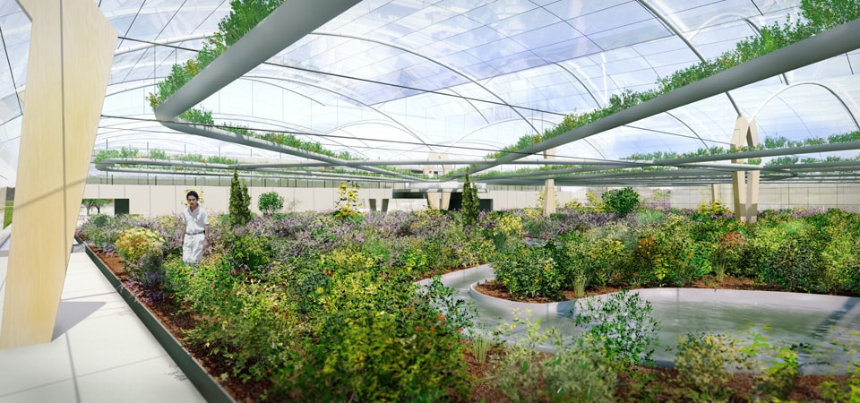
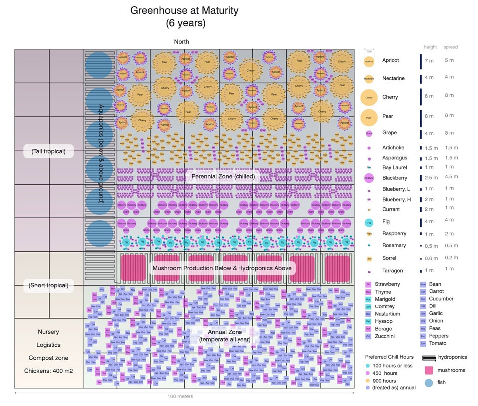
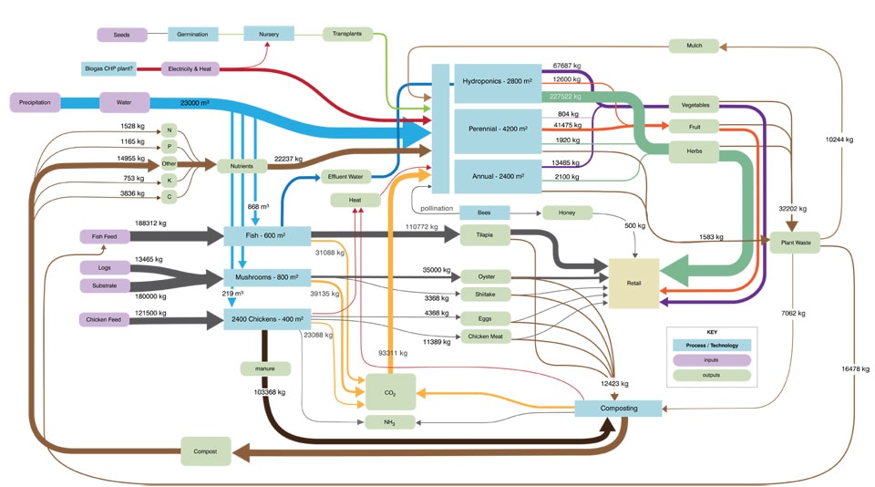
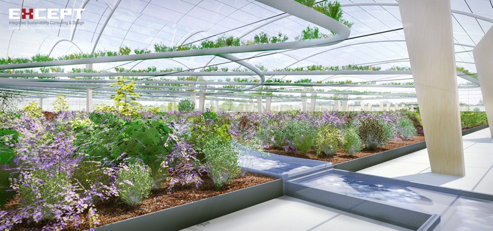
Ari Bain and Eva Gladek propose an integrated design methodology that merges research and iterative modeling in order to develop a high performance permaculture greenhouse that challenges conventional approaches to food production and distribution. While their Polydome model represents a highly sophisticated data-driven methodology that recognizes the deep complexity of the constructed urban landscape, designers can also express this richness through techniques of drawing. We posit that the deep section—one which brings together design elements, site conditions and ecological processes in a single drawing—allows designers to interrogate the interrelationship of distinct elements and flows in space and time.
If landscape urbanism aspires to take a leadership role in driving urban change and improving the way our cities perform, we must be prepared to ask the tough questions required to feel confidant in the quality of our proposals. The diverse approaches and perspectives collected in this issue seek to expand the tools available for addressing the critical problems of designing tomorrow’s cities.
 Nicholas Pevzner is a designer at Michael Van Valkenburgh Associates in New York City. His work explores the role that infrastructural landscape moves can play in structuring and sustaining healthy cities. Nicholas received his Bachelor of Architecture from the Cooper Union in New York in 2005. He later received his Master of Landscape Architecture from the University of Pennsylvania in 2009, where he has also been a visiting lecturer and critic in landscape architecture.
 Stephanie Carlisle is a designer and environmental researcher at KieranTimberlake Architects in Philadelphia. Her research focuses on the relationship between the built and natural environment and employs interdisciplinary design methodologies and data-driven modeling to study complex urban systems. Stephanie holds a Master of Architecture from the Yale School of Architecture and a Master of Environmental Management from the Yale School of Forestry and Environmental Studies. She is a co-editor of this issue.
Changing The Land: Integrating Ecological Science With Design
Looking out over any city today, imagine that in two or three hundred years, only a very few – if any – of the built structures you see today will still be standing. Most buildings aren’t designed to last a hundred years. As each structure comes down, what will replace it? Will the next generation of cities be more sustainable? Urban people can use less energy and material per capita than rural ones in rich countries, but as the world urbanizes and human population expands, cities are expanding along with their footprints – land transformed, resources used and waste produced.
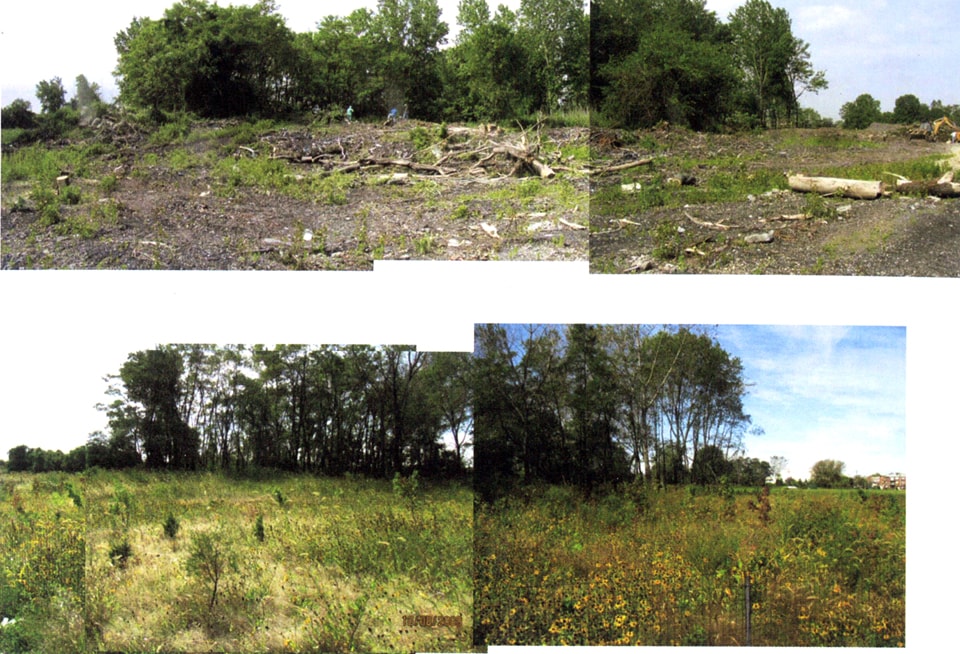
Urban ecologists, urban planners, landscape architects and other designers will be part of the transformation of today’s cities into whatever they will become. They set the stage for trajectories of change. They share a common lens: when contemplating a former building site grown over with weeds, an abandoned industrial park’s expanses of asphalt and concrete, or a landfill’s mounded slopes, both the landscape architect and the restoration ecologist see possibility where others might see a wasteland. Where these viewpoints converge, there is fertile ground for collaboration that can expand the ecological potential of cities.
Building scientific design into urban design and planning will give us better information sooner.
The effects of a career of work have the potential to ripple out into landscape-level benefits, connecting and enhancing the ecological value of the urban matrix. The interacting effects of many decisions across the urban fabric become the future landscape. The degree to which each of these can provide environmental benefits at a variety of scales and create interconnected flows between patches of resources is the degree to which the city will become a more functional ecosystem.
Sustainability, biodiversity, resilience, and ecosystem services like clean air, carbon sequestration, and water quality are now increasingly incorporated into planning and design of urban spaces. However, the connection between these general goals and the specifics of implementation is complex terrain, and the realized impacts of most projects are simply unknown.
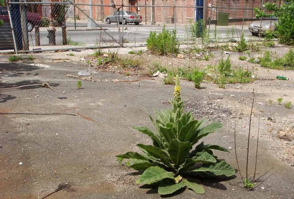
Image by Lea Johnson
This, I would argue, is a strong reason for scientific ecologists, public land managers, and urban design professionals to integrate their work to improve the quality of the urban environment. Designers, managers and planners are in a unique position to improve the future of cities, and ecological scientists can offer tools and perspective to guide the process.
Incorporating ecological science into the design of urban spaces has the potential not only to improve the ecosystem services provided by the places where people live and work, but to increase our understanding of these systems. Urban ecologists are working to tease apart the complex dynamics of these coupled social-ecological systems, but much remains to be understood. Humanity has been altering the ecosystems we encounter for a very long time, and the science of how best to encourage the recovery of ecological functions is a young one. In many cases, the information we need to make good decisions about urgent questions simply does not yet exist.
Building scientific design into urban design and planning will give us better information sooner. As land managers and designers change the landscape using the best of current knowledge, they essentially create experimental conditions for understanding the dynamics of urban ecosystems. Observing, recording and analyzing the practices and outcomes of these changes to the land can reveal surprising insights into the nature and function of the city as an environment, and provide valuable information to guide future decision-making and policy, as seen in the work of the collaborative Baltimore Ecosystem Project. All designs can be evaluated, but the most useful information will come from projects where prior conditions are recorded, a monitoring plan is set in place, and data are recorded methodically with hypotheses in mind. The field of urban ecology has produced some important understandings that are relevant to the integration of science, planning, management and design: [1,2]
Cities are ecosystems
Most of their energy comes from outside the urban core, and much of their waste is exported, but ecosystem processes are at work in and through cities. Urban areas are characterized by higher toxicity, lower groundwater infiltration, more flooding, fewer native species, hotter temperatures, large-scale transformation of land cover, and a host of other changes. These transformations are more permanent than any other type of land use change that humans engage in, largely because of the drastic changes to the surface of the earth that urbanization produces – removing soils and paving or building on top. Yet many wild plants and animals persist, bacteria and insects abound, and more than half of humanity now depends on cities to provide basic environmental benefits like clean air and clean water. The interrelationships between ecological functions and land transformation need to be acknowledged and incorporated into decisions that determine how those transformations unfold. This is one key to improving how well cities will provide essential services to the expanding urban population.
Image by Lea Johnson
Ecological and human processes are intertwined in cities
Water, carbon and nutrient cycles don’t respect borders. Urban trees take in carbon dioxide, filter pollutants, and provide us with oxygen. It rains, and water flows into rivers, streams and the ocean, carrying what it gathers from the gutters – and often overflowing the sewers. Gardeners kill pests with chemicals, and bees visit squash flowers. Garbage-fed squirrels are found at higher densities in city parks than in wilder forests. House centipedes come inside for the winter. Everyone eats. Everything we bring into the city for our use – hamburgers, cotton shirts, plastic – comes from somewhere, and it will go somewhere else when we are done with it.
This is one of the central understandings of ecology: systems are interconnected. In no way are cities apart from nature. They both contain and are inextricably imbedded within nature. Social-ecological systems are dominated by human beings, but we are not entirely in control; the effects of our actions are not always direct and not always immediate. The ecological health of urban systems is, however, in large part driven by our actions. We can choose to use the best information we have to make decisions about what direction we’re driving.
Cities are heterogeneous
Natural systems are patchy mosaics of change over time – an old-growth forest will have places where trees have blown down and created an opening. Urbanization increases that heterogeneity, fragmenting land into smaller and smaller pieces, each capable of supporting a smaller number of species. The history and condition of any given piece of urban land and its neighbor may differ drastically. Each site is unique, and has its own set of possibilities. Similar patches – parks, industrial areas, residential neighborhoods with yards – may be grouped or scattered. Whether the prior use of a given site was a refinery, a farm, a dump, a grassland, a parking lot or some combination makes a difference to the plants and animals that could live there now and in the future. The mix of uses and green spaces has important effects on the city’s human residents as well; a growing body of evidence shows that ready access to natural areas is important to psychological and physical health.
The matrix matters
Whether a university or corporate campus is surrounded by agricultural fields or dense apartment buildings makes a difference to its potential biodiversity and ecological functions. Temperature and moisture differ between hot asphalt and cool forest shade. The movement of animals, plants and insects in and out of any piece of urban land depends on how hospitable – or how deadly – the matrix around it is to its actual or potential inhabitants. Some species may never get there, or never come back on their own once gone. Corridors and stepping-stones can make connections between islands of similar habitat. Bluejays, moths, and wind-blown seeds can set up shop regardless of local zoning ordinances. Small lots, edges and other interstitial spaces become important in cities – coyotes migrate along highways while butterflies travel above the roofs from garden to garden, and mud on a truck tire carries seeds.
Scale matters
Planning and decision-making are not always aligned with the scale of the processes at work in ecological systems. Remote sensing will give a different picture of the city than walking inspection. Properties emerge at different scales; citywide tree-planting initiatives can have large effects, but knowing what trees to plant and how to encourage stewardship in the neighborhood so that a tree survives requires a different focus. Many ecological processes do not function in the same way at different levels of scale, and the heterogeneity of the urban environment only complicates matters. Microclimates, soil histories, and social and cultural factors like community boundaries can have profound effects on the long-term fate of planned and designed environments. Information describing the environment at appropriate levels of scale is needed to make better decisions. By generating and analyzing this kind of information about projects as they are built and age, we can increase the effectiveness of our actions over time.
Change is constant
This is perhaps the most difficult and most important contribution that ecology can make to understanding how to improve cities as ecosystems. Even in cities, storms and other natural disturbances influence the abundance and distribution of life. Organisms change their environments over time by building up soil, or changing size and structural complexity, causing shifts in plant communities. The processes that cause bare ground to eventually become a forest are also the processes that cool and clean the air, store carbon in the soil, and create diverse habitats. To capture the benefit of ecological processes in cities, the design of cities will have to embrace this type of change. A long-term approach is needed to understand how to increase the real health of urban ecosystems. Changing our view of complexity to see diversity rather than mess will need to be part of this process. Knowing that change is inevitable makes it easier to design solutions that succeed, both in providing environmental benefits and in improving our understanding of how urban ecosystems work.
One approach is to incorporate adaptive management into the processes of design and planning. Adaptive management is a cyclic, iterative process of planning, acting, monitoring, evaluating, and deciding whether to change the plan based on new information. It has gained traction in land management over the past decade, and its model could be productively used to meld the production of useful scientific information with the design of more sustainable cities.
The transition to a more integrated relationship between science, design, planning and management of urban land will involve a learning curve for all involved. There are challenges to be faced in a number of departments. Funding for ongoing research, evaluation and adaptive management may need to come from mixed sources. In some cases, this may mean firms with staff ecologists; it may also mean long-term collaboration with academic institutions with student and facility resources. A voluminous literature has been developed on advantages, pitfalls and strategies of collaboration and multidisciplinary research, which I won’t recapitulate here. A few points particular to the intersection of design and ecological science seem worth mentioning.
Image by Billy Oh
Breadth and depth
The term ecology, like the term landscape, has multiple meanings. People within a discipline likely have clear meanings of terms in mind, and may spend significant time defining and arguing about them, while people outside of a field may be familiar only with more metaphorical usages. When precise and vernacular meanings are confused, it can hinder communication. Outside of a few university programs and firms, most landscape architects and planners receive little formal training in the sciences related to environment and ecology, while scientists are rarely trained in landscape design or planning. Academic programs considering this type of cross-training must struggle with the question of balancing depth and breadth. Depending upon the level of expertise needed, breadth and depth in many cases may not be found in the same person. Equipping ourselves with a basic understanding of each other’s languages makes clearer communication and collaboration possible.
Moving targets
In attempting to integrate ecological function with landscape design, clear articulation of goals and assumptions is important for evaluating and learning from outcomes. As our understanding increases, our goals may change. Goals for a specific project need to take into account the scale of the project, its location in a broader geographic and ecological context, and the nature of the specific site. Restoration ecology now mixes use of historic reference sites, which give us an idea of what was once possible in a place, with indicators of ecosystem function and health to create targets that are attainable in current conditions. A project may have both very local goals, such as providing food sources for native pollinators or cooling a neighborhood street with shade, and broader-scale goals, like providing connecting habitat through which organisms can move from one higher-quality habitat to another.
Comfort with uncertainty
Planning and design can approach a project as if completed work can be made static, and often regards change from the original design as a lapse or failure. However, natural systems are always in flux. Scientists are trained to be comfortable with the idea that there are things we don’t know, and that one can still make conclusions based on what is known – with appropriate caveats. They are trained to see surprises and counter-intuitive findings as interesting opportunities. However, the idea that there are important questions with no certain answer is disturbing to many people. If we approach improving urban environmental quality as an experiment, it becomes less of a problem when results are not exactly what was expected. It is an exciting challenge, but not one that we should expect to give us all hoped-for results in every case. Expecting surprises, and that plans will need to be adapted, will go a long way toward avoiding disappointment.
Humanity is very good at taking things apart. We have elaborate machinery and centuries of experience in extracting what we need and making messes as we go. As Aldo Leopold put it, to keep every cog and wheel is the first rule of intelligent tinkering. In urban systems, however, we find ourselves in a changed world. Out of the pieces that were left, different relationships have formed. Novel assemblages of plants and animals never before seen together are now commonplace. Urban development creates similar patterns across the planet. The long-term and widespread effects of the urbanizing world are yet to be seen.
Design, planning, land management and scientific research are all processes of generation and evaluation. People who influence the shape of the land, in patches large and small, are forming the shape of future cities. As we envision these futures, we need to learn from the effects of our efforts to increase the environmental health of cities. We need to understand the dynamics of the world humanity has shaped, to encourage resilience, and to maximize the ecological function of the transformed environments that half of humanity now calls home.
 Lea Johnson is an ecologist and doctoral candidate with the Center for Urban Restoration Ecology and Department of Ecology, Evolution and Natural Resources at Rutgers University. Her work combines plant ecology, urban ecosystems, ecological restoration and applications to land management. She has managed urban ecological restoration projects, taught courses in ecology, urban ecosystems, plant ecology and urban botany, consulted on ecological design, developed long-term ecological monitoring and evaluation programs, and studied urban vegetation in New York City, Portland and Santa Fe.
[1] ML Cadenasso and STA Pickett, “Urban principles for ecological landscape design and management: scientific fundamentals,” Cities and the Environment 1(2) (2008)
[2] Steward Pickett, ML Cadenasso, JM Grove, CG Boone, PM Groffman, E Irwin, SS Kaushal, V Marshall, BP McGrath, CH Nilon, RV Pouyat, K Szlavecz, A Troy and P Warren, “Urban ecological systems: Scientific foundations and a decade of progress,” Journal of Environmental Management, 92 (2011): 331-362.
[3] Aldo Leopold, Round River. (New York: Oxford University Press, 1993) 145-146.
Additional References:
Bolund, P. and S Hunhammar, “Ecosystem services in urban areas,” Ecological economics 29 (2009): 293-301.
Cummings, J. and S Kiesler, “Collaborative research across disciplinary and organizational boundaries,” Social Studies of Science 35 (2005): 703-722.
Fuller, RA, PH Warren, PR Armsworth, O Barbarosa and KJ Gaston, “Psychological benefits of green-space increase with biodiversity,” Biology letters 3 (2008): 390-494.
Janssen, W, and P Goldsworthy, “Multidisciplinary research for natural resource management: Conceptual and practical implications,” Agricultural systems 51(1995): 259-279.
Lee, J, B-J Park, Y Tsunetsugu, K Takahide, and Y Miyazaki, “Restorative effects of viewing real forest landscapes, based on a comparison with urban landscapes,” Scandinavian Journal of Forest Research 24(2009): 227-234.
Lovasi, GS, JW Quinn, KM Necerman, MS Perzanowski, and A Rundle, “Children living in areas with more street trees have lower prevalence of asthma,” Journal of Epidemiology and Community Health 62(2008): 647-649.
S Pickett, STA, WR Burch, SE Dalton, TW Foresman, JM Grove, and R Rowntree, “A conceptual framework for the study of human ecosystems in urban areas,” Urban Ecosystems 1(1997): 185-199.
Pretty, J, J Peacock, R Hine, M Sellens, N South, and M Griffin, “Green exercise in the UK countryside: effects on health and psychological well-being, and implications for policy and planning,” Journal of Environmental Planning and Management 50 (2007): 211-31.
Tzoulas, Konstantinos and K Greening, “Urban ecology and human health,” in: J Niemelä, ed. Urban Ecology: patterns, processes and applications (New York: Oxford University Press, 2011) 263-271.
The Evolution Of Performance Metrics At Mithun
Buzzwords such as “sustainability,” “green” and “eco” are now ubiquitous in our contemporary dialogue about landscape architecture and urban design. Many firms and practitioners freely use these terms when describing their built work. Very little measurable data has been collected about the performance of many of these green projects, leaving these claims unsupported. It is becoming essential however, that practitioners begin to quantify the performance of their work in order to make a stronger and more legitimate case for the benefits of sustainable landscape infrastructure in urban design projects.
Mithun, a multidisciplinary design firm integrating urban design, planning, architecture, landscape architecture and interior design, has long been committed to developing and implementing performance metrics in its projects. The practice is keenly focused on looking beyond the building and the site to the district or neighborhood scale. This essay will examine how the thinking and approach at Mithun has evolved towards the use of predevelopment baseline metrics and new tools for measuring the impacts of design projects on human and community health.

Overview of Lloyd Crossing Catalyst Project. Image © by Mithun
The Lloyd Crossing Sustainable Urban Design Plan
The Lloyd Crossing Sustainable Urban Design Plan created a vision for Portland, Oregon’s Lloyd District that could be both environmentally and financially sustainable. Begun in 2002, it predated the development of the Living Building Challenge, SITES or LEED for Neighborhood Development. The multidisciplinary design team led by Mithun, which included landscape architects Greenworks, was asked what it would mean to create a beyond “LEED Platinum” neighborhood. The client’s goals were to use the plan’s deep sustainability as a mechanism to help strengthen neighborhood identify within Portland, which would provide a model for development efforts throughout the rest of the city.
Since no neighborhood-scale rating systems were yet in place, the integrated design team first developed a set of predevelopment metrics – an environmental performance benchmark based on the “carrying capacity” of the 47 acre site prior to urbanization. The design and stakeholder team understood that an innovative district-scale approach would be required to achieve the seemingly contradictory goals of a fully developed urban site that met predevelopment metrics benchmarks. This approach was a powerful organizing force that allowed stakeholders to think beyond traditional limitations of property lines and existing urban systems.
The primary predevelopment metrics were organized around habitat, water, energy and carbon use. These baselines provided the framework for evaluating and understanding the systemic nature of the interconnected design strategies. They were also central to establishing the financial and governance frameworks for exploring new models of public/private partnerships to support the project goals for the year 2050.
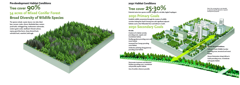
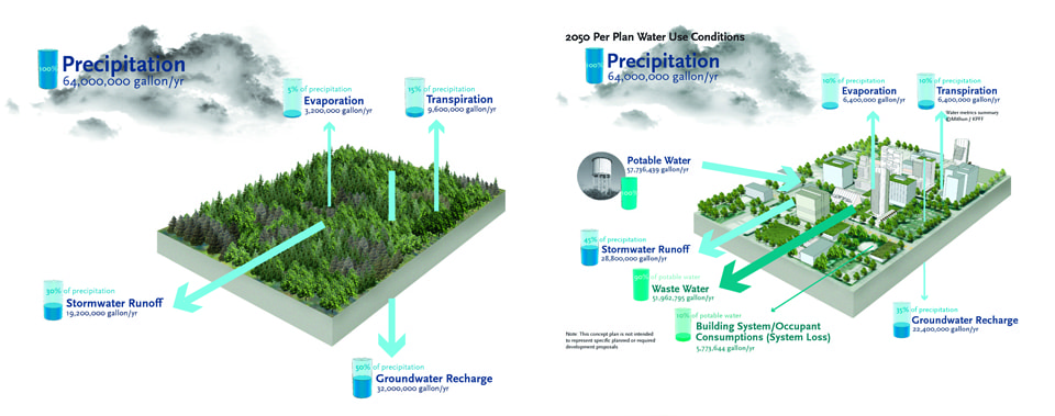
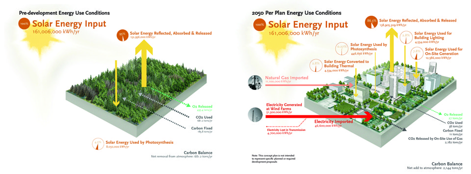
Predevelopment baseline conditions and Lloyd Crossing 2050 proposal for habitat, water use, and energy. Image © by Mithun
Habitat
At Lloyd Crossing, the predevelopment habitat was a mixed conifer forest with 90% tree cover and broad diversity of wildlife species. The goal was to increase native tree cover to 25-30% of the site, create structurally diverse planting schemes both the ground plane and on vertical built elements, create two acres of mixed-conifer forest “patches” and provide aquatic habitat through stormwater treatment. Most importantly, the plan sought to create, when possible, partial habitat corridors that link the Lloyd Crossing area with significant natural habitat patches.
Water
The predevelopment site received 64 million gallons of precipitation per year of which 30% was stormwater runoff, 50% was infiltrated into the ground, 15% transpired and 5% evaporated. The plan envisioned a “water neutral” site that lives within the average annual rainfall budget that falls on site. The design would use buildings, landscapes and engineered systems to closely mimic the predevelopment conditions while accommodating a five-fold increase in urban density.
Energy & Carbon
Solar energy and carbon cycles were also calculated to determine pre-development energy cycles. The resulting energy design goals were to exceed pre-development solar utilization conditions and reduce carbon emission to pre-development levels. This would be achieved through a number of building, landscape and infrastructure strategies, such as designing high performance buildings, maximizing renewable on-site energy generation, district energy and water systems, and utilization of the carbon sink potential of green spaces.
Integrated water & energy systems at Lloyd Crossing Catalyst Project. Image © by Mithun
The study concluded that energy and water systems could provide a clear return-on-investment, while habitat provides intangible value. To demonstrate the benefits of investing in the whole system, the design team suggested the use of a new type of financial model, a Resource Management Association, which gave property and systems owners an ongoing source of funds for achieving water, energy, carbon and habitat goals, while also providing funds for adopting new technologies.
In a high-density urban context such as Lloyd Crossing, it becomes quite evident that landscape or buildings alone cannot achieve the goal of returning the ecological performance of the site to predevelopment levels—in order to do so, the design needs to consider the total constructed urban system.
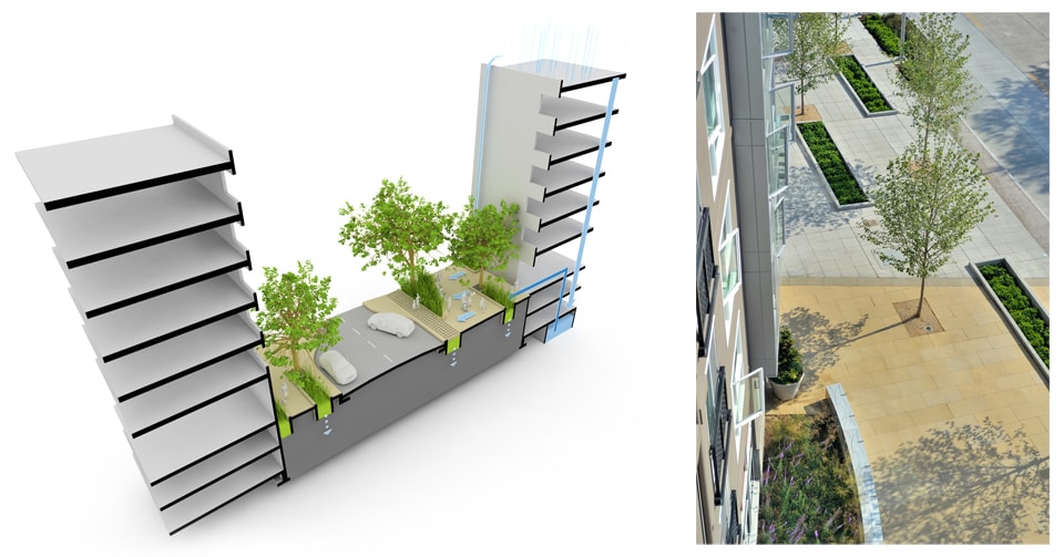
Streetscape at Taylor 28, with integrated street & building stormwater systems, [left]
Apartment-level view of sidewalk plaza after installation, [right]. Images © by Mithun
Taylor 28
Lloyd Crossing exemplified a district-scale design and planning effort, yet many urban projects take place on the much smaller scale of the block or parcel. Begun in 2004, Taylor 28, a 1.2-acre residential, mixed-use development in Seattle, Washington, showcases how metrics and integrated design tactics can be implemented on a smaller site, but with larger urban systems in mind.
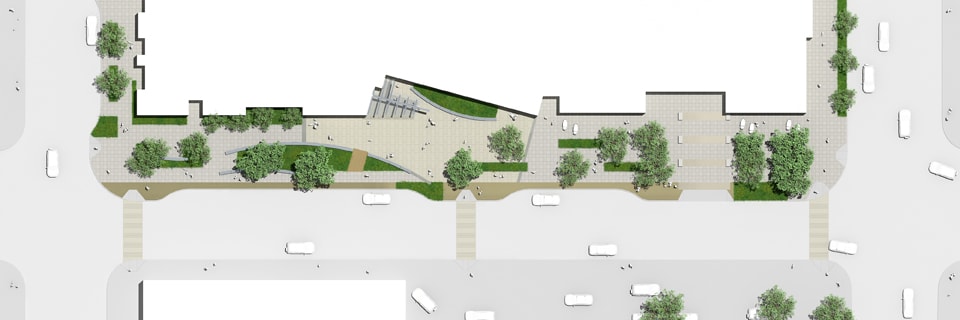
In order to achieve its goals, this project implemented a boundary-breaking strategy that supports district-level landscape performance strategies. From the outset of the design process, the developer was eager to create a sense of place in a location characterized by both busy streets and empty buildings. Thus, public right-of-way was reorganized to provide more beneficial public space and developed and maintained with an agreement by private owners. The design team reclaimed twenty feet of underutilized public roadway in order to enhance public space and the quality of urban experience. The rainwater collected on the private land was used for irrigation in both public and private areas.
Pedestrian Environmental Quality Index of street intersections and streetscape at Taylor 28, existing and proposed conditions. Image © by Mithun
Taylor 28 also highlights the use of emerging metrics that measure the pedestrian environmental quality of streetscapes, in concert with artful stormwater design in a high-density location. A Pedestrian Environmental Quality Index (PEQI) was used to measure a baseline for pedestrian quality of the streetscape before and after the project was completed.
The PEQI was developed by the San Francisco Department of Public Health to assess the quality of the physical pedestrian environment and inform pedestrian planning needs. The PEQI draws on published research and work from numerous cities to assess how the physical environment impacts whether or not people walk within a neighborhood. A observational survey that quantifies street and intersection factors empirically known to affect people’s travel behaviors, the index is organized into five categories: traffic, street design, land use, intersections and safety. Within these categories, thirty indicators reflect the quality of the built environment for pedestrians and comprise the survey used for data collection. These indicators are aggregated to create a weighted summary index of pedestrian quality. This summary index was used as a framework at Taylor 28 to measure the success of the streetscape improvements.
The measured improvement of the pedestrian environment was designed in concert with several quantifiable strategies inspired by the Lloyd Crossing Sustainable Urban Design Plan. Canopy tree coverage and planting contribute to measured heat island reduction and CO2 offsetting. Rainwater runoff from the newly created sidewalk plaza percolates through permeable paving and into a series of urban rain gardens.
Plan view of enlarged sidewalk with plaza space, and stormwater planters. Image © by Mithun
The 197-unit apartment complex also utilizes strategies for energy use reduction, additional heat island reduction and stormwater collection that are integrated with site. For example, rainwater is captured from the roof and stored in a 16,000-gallon cistern. Annually, this rainwater provides over 58,000 gallons for all of the site’s irrigation needs, and 64,000 gallons to flush toilets in the retail areas. The overall stormwater strategy, which utilizes building and landscape, measurably reduces pressure on both potable water and combined sewage municipal systems.
The use of performance metrics contributed to the success of this project by helping to quantify the benefits of the design. By using a hybrid tank to meet the City’s detention requirement, the client was able to leverage the additional cost of incorporating rainwater reuse. The long-term water savings offset the added costs for flow sensors, filters, and doubled supply pipe to the non-residential toilets. The combination of right-of-way rain gardens and a roof rainwater harvesting system relieved the stormwater loads on city’s overburdened combined sewer system. By measuring the pre- and post-development conditions, the project clearly demonstrated its contributions to larger environmental goals and positive health outcomes, while the artfully designed and safe streets can be promoted as a neighborhood amenity and redevelopment catalyst for the area.
South Lincoln Redevelopment
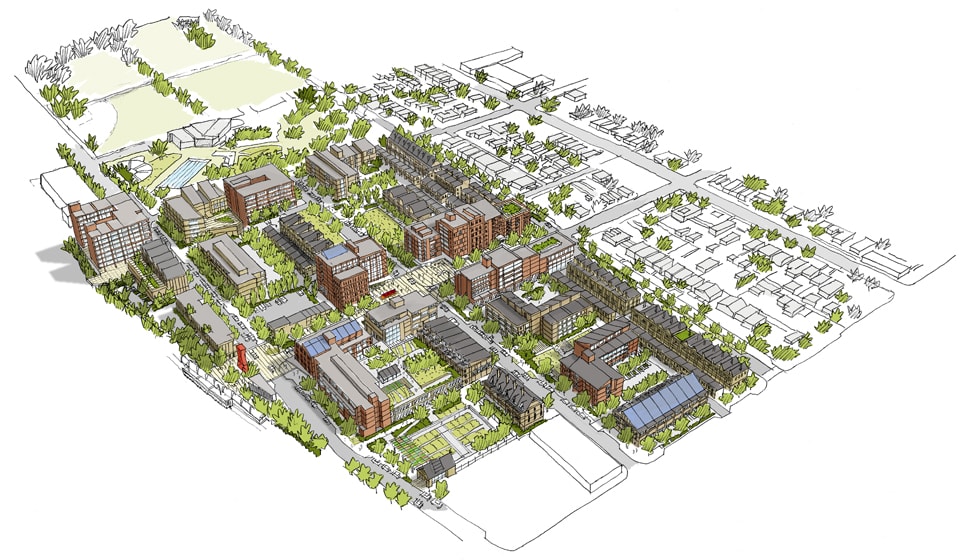
Going further than Taylor 28, the South Lincoln Redevelopment in Denver, Colorado takes metrics to a much greater level of detail, and will be implemented on a comparatively larger scale. This HOPE VI funded project is a mixed-income redevelopment of the Denver Housing Authority’s South Lincoln Homes public housing site. The goal is to create a transit-oriented community where people experience a neighborhood that is environmentally sustainable, culturally diverse, close to downtown and offers a spectrum of housing options. Begun in 2009, the seventeen-acre master plan included many of the environmental strategies proposed at Lloyd Crossing.
Overview of proposed South Lincoln Redevelopment Master Plan. Image © by Mithun
The client and design team used metrics to provide a compelling way to define social sustainability and quality of life. The interdisciplinary design team including, which included a public health consultant, utilized a community-driven design process that included several health metrics, such as a Health Impact Assessment (HIA) and use of the Healthy Development Measurement Tool (HDMT).
An HIA involves a combination of procedures, methods and tools to evaluate how current conditions and future changes (of a project, policy or program) impact the health of a population. Conducted concurrently with the design team’s site analysis, the South Lincoln HIA analysis included not only the South Lincoln Homes, but also the broader South Lincoln neighborhood. Through the HIA process, the design team used evidence-based health data to assess potential human health risks and identify key issues.
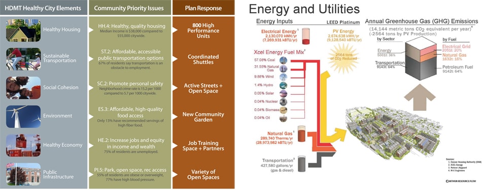
Redevelopment Healthy Development Measurement Tool Analysis, [left]
Energy use analysis for South Lincoln Redevelopment Master Plan, [right]. Images © by Mithun
As the team moved from analysis to designing site options, it used the Healthy Development Measurement Tool to guide design strategies. The HDMT, developed by the San Francisco Department of Public Health, is a comprehensive tool and checklist geared toward improving health in urban development. The HDMT is organized into six categories: Environmental Stewardship, Safe and Sustainable Transportation, Social Cohesion, Public Infrastructure (amenities and services), Adequate and Healthy Housing, and Healthy Economy. Ultimately, both the HIA and HDMT process proved to be successful in attracting funding for the project, which has just completed its first phase of construction and has been cited as a best practice by the HUD-DOT-EPA Interagency Partnership for Sustainable Communities.
Next Steps: EcoDistrict Planning
Technologies and strategies for enhancing neighborhood sustainability such as district energy and water management systems, walkable green streets and resource conservation are well known, but their widespread deployment has been slow to develop. This is due not only to the lack of metrics that demonstrate ecological and financial value, but also to the lack of scalable project capital and public policy support.
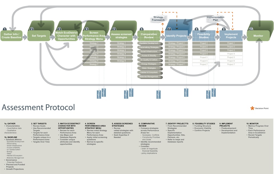
The EcoDistricts Initiative focuses on removing these implementation barriers and creating an enabling strategy that accelerates neighborhood-scale sustainability in existing communities. Since 2010, Mithun has been collaborating with the Portland Sustainability Institute (PoSI), City of Portland and Portland State University on the EcoDistricts Initiative and neighborhood sustainability plans assessment protocol. A very comprehensive strategy, the EcoDistricts Initiative integrates building and infrastructure projects with community programs and individual action.
Assessment protocol for EcoDistrict planning. Image © by Mithun
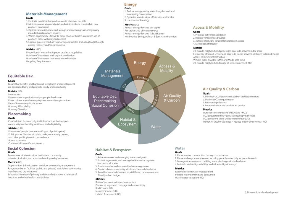
The assessment protocol is part of a toolkit for EcoDistricts to understand their current district performance, set targets and develop district strategy recommendations in seven key performance areas, such as Habitat and Ecosystem, or Community Vitality. It is coordinated with a prototype system for collecting and visualizing relevant data, that is focused on informing decision-making and monitoring over time.
To test these concepts, the PoSI is working with five Portland pilot districts with distinct typologies, including the Lloyd District, to guide strategic planning, community engagement and catalytic investments. District stakeholders agree to set rigorous goals, develop a roadmap and implement projects. In return, PoSI and its public partners are providing technical and financial resources to support the work. As the essential building block of the city around which urban communities are organized and understood, the neighborhood can be seen as the most effective scale for radically improving urban environmental performance, and the EcoDistricts Initiative is putting in place the tools, strategies and support to scale up this change.
EcoDistrict Performance Areas with associated goals and potential metrics. Image © by Mithun
An Integrated Urbanism
In the decade since the Lloyd Crossing Sustainable Urban Design Plan, it has become increasingly clear that neither landscape nor architectural urbanism alone can achieve the results originally envisioned. Truly integrated and trans-disciplinary design teams are needed that include private developers, public agencies, institutions and non-profits who are willing to utilize both ecological and human health assessment tools to quantify the benefits of their work. These tools, coupled with neighborhood-scale financing techniques, public policy strategies and behavior change, must be incorporated into the design and planning process in order to radically improve human health and the urban environment.
 Christian Runge is a landscape designer at Mithun—an integrated design firm with offices in Seattle and San Francisco. He is passionate about working at the intersection of ecological and cultural processes within metropolitan and rural environments. His current work ranges from campus open space planning and design in the Puget Sound, to restoration planning in Yosemite National Park. He holds a MLA in landscape architecture and a BS in environmental biology and is an avid musician.
NYC High Performance Landscape Guidelines
“Parks are a crucial component of the urban infrastructure that will help our city address the challenges of the twenty-first century…With High Performance Landscape Guidelines, we’ve created a new blueprint for how parks are designed, built, and maintained.”
– Mayor Michael R. Bloomberg
Image by Angus McCullough
Produced through a collaboration between the New York City Department of Parks & Recreation and the Design Trust for Public Space, High Performance Landscape Guidelines: 21st Century Parks for NYC is a comprehensive design manual for a new generation of parks and public landscapes. The Guidelines weave together current research and best practices for design, construction and maintenance of parks and open space, and brings together leading expert knowledge on soil, water management and vegetation in order to comprehensively address the full range of ecosystem services and landscape performance – including social, ecological and economic factors.
The High Performance Landscape Guidelines is the third publication in The Design Trust’s ongoing series, following the publication of the High Performance Building Guidelines (1999) and the High Performance Infrastructure Guidelines (2005). The Design Trust, a nonprofit think tank dedicated to improving public space for all New Yorkers, supported and facilitated the project, bringing their long experience in engaging multiple stakeholders and government entities. The Trust recruited and funded an interdisciplinary team of landscape architects, engineers and sustainability experts. These Design Trust Fellows : Michele Adams, Steven Caputo, Jeannette Compton, Tavis Dockwiller and Andrew Lavallee authored major sections of the book and provided expert guidance in its content. They worked under the Direction of Deborah Marton the executive Director of the Design Trust, and Charles McKinney, the Chief of Design at Parks.
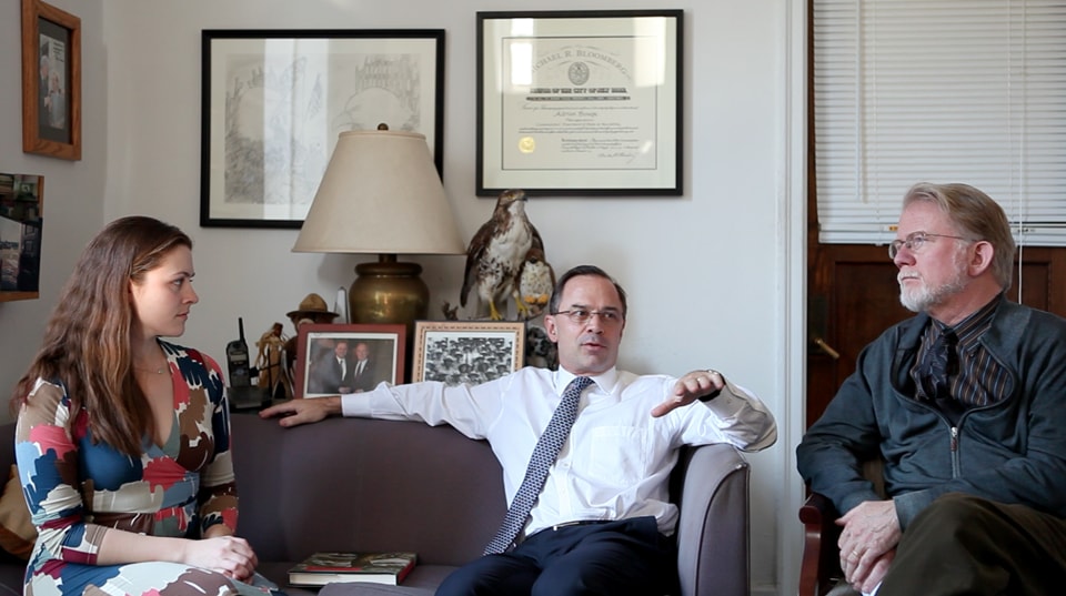
Last month, we sat down with Adrian Benepe, New York City Parks Commissioner; the primary authors for Parks Charles McKinney, Principal Urban Designer; and Jeannette Compton, Director of Green Infrastructure, to talk about the creation of the Guidelines and the role of High Performance Landscape design in the future of New York City.
Stephanie Carlisle (SC): This book required a great deal of time, effort and collaboration in order to produce a comprehensive and interdisciplinary manual. What was that spark that set the process off?
Adrian Benepe (AB): I’m not sure it was a spark so much as a lot of things smoldering at once that just burst into flame. You had all of these plans being developed; you had simultaneously the development of design guidelines for streets, for infrastructure, for active living coming out of various agencies against a backdrop of a mayoral administration deeply committed to a design excellence program, deeply committed to parks and to activating the waterfront, deeply committed to sustainable development. All of these initiatives were being worked on disparately, and then simultaneously you had a 20-year heritage here at the Parks Department of trying to design more in cooperation with nature based on the early work of the Natural Resources Group. On the other hand we still have the great historical landscape parks and the traditional playgrounds, and are having to build new projects that are going to last a long time without a lot of complicated maintenance. You had a tension between traditional park and playground design and a desire to do things in a more environmentally sustainable way. So we knew we had to meet all of these needs, and I suspect it was all of these things smoldering at once. Do you think that’s accurate, Charles?
Charles McKinney (CM): I’ve never heard it described so well. We figured out there were a lot of people within the Parks Department and among our consultants who were striving separately with similar goals, but there was no shared body of knowledge. We realized that if we had a manual that everybody could go to and find an approach that we endorse, it saves everybody lots of trouble. If it could be as easy to use as a car manual, where you don’t need to read an encyclopedia but could just turn to the page about carburetors, and then when you present a project to the Parks Department, you know you’re presenting a method which is pre-approved.
Jeannette Compton (JC): it is important to keep in mind the sheer scale of our Parks Department—both the 29,000 acres of New York City park space and also the many hundreds of people that work towards the design and construction and maintenance of those landscapes. In such an organization, having a central document to look to is incredibly valuable. We have well over 50 RLAs, plus engineers and project managers and architects, and that’s just our in-house staff. Having a document like this allows us to succinctly communicate concepts and ideas in a much more organized fashion. Before this, we relied on project advice such as “this is a tree person and you really have to talk to them,“ and “this is the person who knows wetlands super well,” but “oh, that’s the saltwater wetland person.” In such a large organization it’s really hard to know all those people and make all those connections, so our approach was to infuse all that knowledge and expertise into one written document.
One of the great strengths of the Guidelines was the team that came together to work on the document. Within that core group of people we had 3 landscape architects, an engineer and an architect who now works in policy at the Mayor’s office along with members of the Design Trust and Charles [McKinney]. I can’t tell you how many times we sat around the table and talked about what these Guidelines should be, how should they work, how should they function, and having these different perspectives broadened our aspirations and capabilities. When you read the document, you will see a long list of people, both part of the peer review and people within the Parks Department who wrote individual sections or reviewed sections—ecologists, arborists, maintenance staff—and that interdisciplinary group is really what makes it so informative and successful.
Park Typologies, High Performance Landscape Guidelines
Nicholas Pevzner (NP): Many of the Parks Department’s new initiatives (such as Greenstreets or Million Trees), rely on collaborative agreements between agencies. How do these relationships improve the Parks Department’s ability to reach out across the city?
JC: I think the collaboration between different agencies is really important, and the impetus for that came from the Mayor’s office. There’s a real emphasis on working together, and that influence has then brought a lot of people to the table. I meet with three agencies every week to review designs and make decisions ranging from curb cut details to what size gravel to use. In an area where budgets are small, we’re looking for efficiency and value in what we can build. If you can work on infrastructure projects that satisfy the goals of four different agencies rather than just one, then you’re doing a lot more for New Yorkers.
AB: Interagency cooperation was not always a given—whatever classic terminology you want to use: silos, fiefdoms—we had them. You saw different departments, sometimes working at cross-purposes, and sometimes fighting with each other. Early on in the Bloomberg administration, this situation was sort of typified by the bullpen they set up in City Hall, where all of the deputy mayors and all of the senior staff worked in one big room like a trading floor with everyone having the same sized desk. So there was no hierarchy; everyone had to work together, and the mayor gave a very specific message. He called all the commissioners together early on and said, “You must work together. You have to work together. There is no fighting with each other and that’s just the way its gonna be.” And that’s the way things evolved.
Now the Department of Transportation and the Department of Environmental Protection and the Parks Department will all work together on creating a Greenway System and DEP will fund us to create Greenstreets which capture stormwater and then we will work with the Department of Transportation to create street tree bioswales and the funding will come in for us to build them and we’ll maintain them and DEP will pay us to maintain them so its pretty great. In some ways, it gets back, in a very different way, to some of the systems we depend on now—the highways, the parkways and the parks, the bridges. They were all built essentially by one person in the 1930s, by Robert Moses, but that was a more autocratic situation. Now we have a more of a collaborative effort with the majors and the deputy mayors keeping a lose hand on things and trusting the experts in the agencies to work together and to want to work together. Frankly, it accrues benefits to each of the agencies. You can get more done working together than working separately and fighting with each other.
Restoration work in Canarsie Park, Brooklyn
SC: There is a quote from Deborah Marton, the former Director of the Design Trust in the beginning of the Guidelines, in which she says that the Guidelines codifies an important shift in our conception of parks “from park as end-product to park as work-in-progress.” How does this type of thinking change the relationship between design, construction and maintenance? Also, what do these changes mean for designers in terms of their relationship to a project?
CM: I’ve been involved in both the design of parks and the operations of parks, so I have sympathy for the gardener. I think the person who has just about the most to do with the success of a project is the gardener and if the designer does not consult with the gardener, the plants aren’t going to live. The person who knows the microclimate and the soil conditions knows a lot. Designers are often under time constraints and don’t have the time to develop that sort of hands-on experience. We hope the manual causes an acknowledgement that you’ll have more success if you have more direct site knowledge. And the person who has that site knowledge is the person who works there.
AB: The old way of doing business was to come in and reinvent the park—new drainage, new structures—strip everything off and start afresh. I think there were some projects, like the restoration of the central woodlands in Prospect Park, which led to a new way of thinking. [The Central Woodlands] wasn’t done as a “strip it down and plant new” approach, but was worked over the course of ten years. This project encouraged us to come in and start from the beginning; start at the top of the watercourse; restore the watercourse; restore the eroded slopes; plant native plants; don’t necessarily go back to the old Olmsted plants. And then protect it for ten years while it grows in. This way, it can become a self-sustaining landscape. In this case, that has largely happened. It’s a miraculous project.
Now, we don’t have the luxury of a ten-year grow-in with most projects. The other advantage we have now in a number of parks is the innovative development of public/private partnerships that give you the luxury of transcending administration changes. So, if you have a Central Park Conservancy or Prospect Park Alliance or Brooklyn Bridge Park Corporation or a Park Trust, you have an organization that doesn’t change when the mayor does. In these cases, you do have the luxury of doing long-term interventions in an ecosystem.
JC: In terms of the role of the landscape architect within these sites, we are undergoing another important shift in the profession where what we are designing mandates expertise from a wider range than one individual professional can provide and an interdisciplinary approach is essential. As a landscape architect myself, I’ve always felt that landscape architecture is a node and a translator to all these different groups. The landscape architect is someone who understands the landscape and soils and plants and water, and how people move through a space, but it is also someone who knows the limitations of the knowledge and knows to bring in an ecologist and an environmental engineer, an architect or an urban planner. When we are designing spaces to provide many diverse functions and services, you recognize that you need to bring people who represent those different goals.
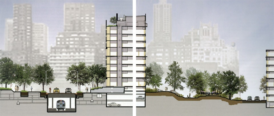
Prototypical urban sections, High Performance Landscape Guidelines
NP: Speaking of complex ecological systems, The Guidelines seems to de-emphasize the traditional turf and big old specimen tree approach to parks and moves instead towards a more ecological principal-driven design process. How do we judge success when designing parks that behave like ecological systems?
AB: That’s a really complex question because there are many answers. There is not one type of success. In a city like New York, parks have to serve a multiplicity of functions. If every park were simply a wildflower meadow or freshwater wetland or a salt-water wetland with wood chip paths going through it, you would not be providing what the citizens need. Between Title Nine and parents wanting little leagues in the city and people refusing to grow up and wanting to play soccer until they are ninety, there is just a huge demand for athletic fields. So, what do you do? When Robert Moses wanted more athletic fields, he filled in the Hudson River. You can’t do that anymore. He did the same thing in the East River. There aren’t any large tracts of land on which to build ball fields anymore. So, one of the early things that we came up with was turning asphalt play yards into synthetic turf fields.
Now some people are against synthetic turf fields, but we thought the balance of having a field you can play on 24 hours a day, 7 days a week, all year round without having to use a lot of chemicals and energy to maintain it, and without having to close it half the year so you could grow the grass – it kind of made sense. From an environmental point of view, is it better to have asphalt or synthetic grass? Its probably a wash, but from a usability viewpoint, it’s certainly better to have synthetic grass because you won’t get killed playing on it. Suddenly, kids can play soccer and adults can play Ultimate Frisbee, and you are able to expand dramatically your footprint of athletic facilities. At the same time, we respect our naturalistic parks, and are also are committed to maintaining romantic landscapes that are historically designed, and are committed to doing so in environmentally appropriate ways. There is even room for the 20th century Brutalist landscapes. There is no one right answer. But I think you can approach all projects with a sustainable design ethos. You can do that in a traditional landscape park, and you can do that in a ball field.
JC: In creating the Guidelines we talked a lot about the relationship between theory and practice. We wanted to acknowledge the theory end of that spectrum, but we wanted to have the document strongly couched on the side of practice. And so we made some practical decisions such as outlining park types, even though we knew we couldn’t ever capture all of them. But in capturing some common park types, it helps us break down tangible opportunities and constraints. For example, we know that a playground is going to have a lot of built infrastructure, but you can look to balance this by incorporating more planting areas. Perhaps the educational opportunities of sustainable design are more a priority in a playground where you have a captured audience than in a ball field.
We tried to help guide designers in thinking about what to focus on. We realized if you go through a list of all the Best Practices in the guide, you are never going to hit all of them on one site. It’s just never going to happen. I think even if you had all the space and money in the world, it would not be possible. So, we really wanted to help frame the thinking of approaching an individual site so that the design could meet all the needs and demands as much as possible and be the best version of that design. It may not be the most ecological site ever with the highest biodiversity, but may be the best that individual place could be with all the needs and constraints of that location.
CM: When you look at [performance] metrics, you have to understand both the scale of the project and also the scale of the city. When making a city that is going to accommodate another million people while also becoming cooler and greener, we are interested in knowing how many more trees we are adding, how much more permeable surface we are adding, how many more miles of bike trails, how many playgrounds and ball fields are we putting in under served neighborhoods, so that we can act as an organization at the scale of the city.
Leaf litter from local residents was added to enrich soils at this stormwater detention basin, helping a diverse range of newly planted vegetation to survive.
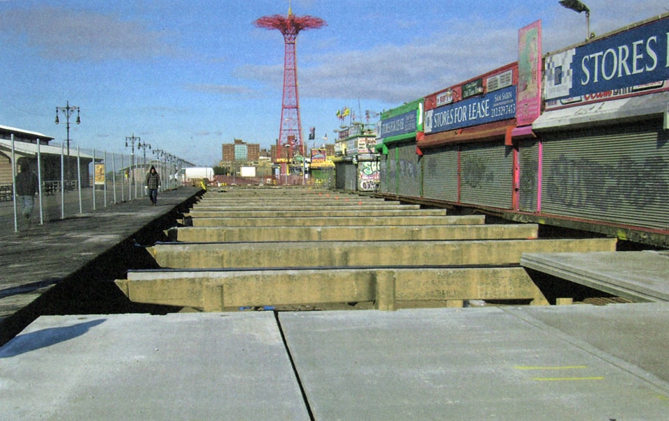
The Parks Department used recycled fly ash, an industrial byproduct, in new concrete boardwalks throughout New York City, including this one at Coney Island
SC: The Guidelines takes great pains to decouple “best practices” from prescriptive techniques or products that may quickly become outdated. This seems to be a different approach from the general BMP mentality that can be quite rigid. How does the Guidelines balance to need for raising a basic performance of all projects with a desire for innovation and experimentation?
JC: [This approach] is definitely a challenge for the Parks Department. We have a high standard for quality: generally speaking, if a material can survive in a New York City Park, it’s a pretty good material. We have our own specifications because there is an industry standard, and then there is what we beef it up to be. Part of our ability to be innovative is that we have experience with customizing specifications, evaluating materials, and a sense of what to look for. That being said, it’s always difficult to anticipate what may happen in the field, but we do have the advantage of such a large portfolio of places to try things out. We also run much smaller experiments. I don’t know if you’ve ever been to our design office, but it has eight benches and untold numbers of bench slats that we are sort of watching to see how they do. We try to talk to other cities about what they are trying out as well.
Coming back to the Guidelines and the open-ended component of them, we often get asked, “where are the specs and details? Why don’t you have that in your document?” But the minute you publish a spec or detail, it needs to be updated. We are very aware of that, we already have a living collection of specs and details within our office. We wanted the Guidelines to be more of an ethos, a guiding framework with which you could evaluate new products that we couldn’t anticipate in writing the Guidelines. So, we have a section on materials and we go through what factors you should consider, and some pros and cons. We don’t come out and say, “this is the best wood to use,” because it will change in a year.
Frankly, if you were building a new walkway today, you wouldn’t use a nineteenth century technology. And if they had the technology that we have today, in the 1860’s, they probably wouldn’t have built a wooden boardwalk, they probably would have said, “who wants to come back here every year and replace these planks?”
AB: And it may change in a year for a variety of reasons. For years we used tropical hardwoods for benches, piers, boardwalks. Why? Because it was incredibly durable: it looked good unpainted and lasted forever and you could drive a truck across it and it wouldn’t splinter. The city made a political decision, based on environmental sustainability not to use tropical hardwood anymore, or to use it in very limited ways. So, then you are faced with asking, “What are the alternatives?”
We look at concrete, we look at recycled plastic lumber, we look at other kinds of hardwood. So far, although there are some promising leads, there isn’t another hardwood that does what the tropical hardwoods do. There is some promise in black locust, but as far as reliable supplies of adequately dried and seasoned, dehumidified lumber—we don’t know that that exists yet. It might exist in Europe, but we don’t have a steady supply of that yet. So, if the idea is to say, “You must use black locust for all bench slats and boardwalks,” we are just not ready for that. Instead we say, “Here are the things to explore.”
We are busy exploring this very issue over at the boardwalk at Coney Island. We used traditional tropical wood in the historical area, because he wanted to maintain the look and feeling. In another area we are using recycled plastic lumber on concrete stringers, and then we are using cast concrete wood slats, recycled stringers, cast concrete panels… and we’ll see how it works. Some people are very upset, they want their traditional boardwalk.
Frankly, if you were building a new walkway today, you wouldn’t use a nineteenth century technology. And if they had the technology that we have today, in the 1860’s, they probably wouldn’t have built a wooden boardwalk, they probably would have said, “who wants to come back here every year and replace these planks?” In the past, everyone complained when we had uplifting planks filled with splinters. I remember going to the Coney Island Boardwalk as a kid: if you fell down, your knees were filled with splinters. But now there is this romantic idea that wooden boardwalks were great. People complained for years about how terrible the Boardwalks were. There are other drivers beyond what’s right, like, what are people going to scream and yell about? So, we are in the middle of all of that right now.
CM: About experimentation, one of the things we talk about in the books is, “don’t try the experiment everywhere…” And when you experiment, you have to do due diligence, visit the site, see how it’s doing. And then, convey that knowledge to other people. We operate our parks pretty inexpensively. So, whatever we do, that has to be something that won’t be a burden to the people who have to take care of it.
NP: Can you talk a little bit about pilot projects, and the role they play in the rolling out of new technologies and techniques?
JC: I think calling something a pilot really helps in that discussion. In these cases, we’re saying, “we’re not asking you to accept this as a standard or telling you we are going to put this everywhere. All we are saying is that it is hard to evaluate new technologies without putting it in the ground. So, lets just try it.” I think that tentative commitment can make people a lot more comfortable with trying something that is out of their comfort zone.
With the Green Infrastructure Projects, there are several generations of pilots for stormwater capture. The Greenstreets division has been doing pilots for stormwater capture for five years. And you can see the evolution of how we get water from one place to another. We have really come a long way from the early PVC pipe method. In each iteration, by going back, by seeing how things are working, by talking to the people who are maintaining the system, you are adding more knowledge and functionality. So, years later, as DEP is ramping up to building hundreds of bioswales across the city each year, we now have a lot more information and knowledge built into the effort. That pilot phase allows us to gather that knowledge. And I think that is really crucial in figuring out how to approach many of these design challenges.
Marsh restoration at Randal’s Island involved extensive removal of invasive species.
SC: By explicitly referring to projects as experiments, you allude to certain expectations of how that project will be structured and managed – (i.e. experimental design, monitoring budgets, management plans, knowledge transfer etc). All too often when these steps are skipped, feedback loops break down and conflict arises. How does the Parks Department manage applied research and experiments in the field?
JC: We have been pretty active in developing partnerships with universities and other partners that have more of a structure for monitoring. It often ends up as a very successful partnership in that we have the land and we want to do the work. They need a place to monitor and have the understanding of research and data and understand how to set up an experiment. You see this with some of our historic tree restoration and a lot of our forest restoration work. Some of the Greenstreets projects have full hydrological modeling equipment built into the swales and basins. We partner with these universities on specific projects where we can do what we do well, and they can do what they do well, and we both benefit for that outcome.
AB: In addition to universities, there are other governmental agencies whose sole mission is to do research. We have a partnership with the United States Forest Service, who helped develop the environmental modeling that led to our tree planting and Greenstreets programs and now thy are helping us on the back end, to monitor and calculate how much stormwater they actually capture. Additionally, we also have a US Forest Service urban field station that is concerned with long-term ecological monitoring. So, universities, other governmental agencies that have research capabilities, and our own Natural Resources Group all work side by side.
One of the first things I learned from gardeners and ecologists and natural resource experts is that a project begins and ends with soil…if you don’t have appropriate soil, your project is going to fail. Simple as that.
NP: In the intro to the book, Charles, you say that there are three challenges that the parks department needs to take on: scientific understanding of soil, water and vegetation for maximum performance and ecological benefit, designing parks for changing recreational and social preferences in ways that are social equitable, and, and park resiliency in terms of maintenance. Are these new challenges? How do you treat them? Are they separate issues or all part of one problem?
CM: These are not new challenges, but we would like for them to be understood in depth, For example, we focus a lot about the intersection of soil, water and vegetation. The reality is that so often, the designer has very little time to think about the full range of biological and social concerns. So, you plant what you think will look nice, but you may not really know that the soil is soggy or compacted. And you may not really stick with the project enough to prevent all that heavy equipment from driving across the roots. What we are trying to do is increase everybody’s awareness that soil is not just something that you strip and put back after you’ve driven everywhere. We think that we all know that, but we might not all understand just how important it is.
AB: I have no professional background in landscape architecture or landscape management, but I’ve learned a lot from various jobs within the Parks Department. One of the first things I learned from gardeners and ecologists and natural resource experts is that a project begins and ends with soil. And I’ve begun to be able to look at soil and say, “well, that’s not good soil.” You have different kinds of soil for different applications. But, if you don’t have appropriate soil, your project is going to fail. Simple as that.
JC: I think [soil management] is a profession-wide topic. Once we understand how important soil is, then what do we do? How do you realistically preserve soil in a construction environment? What are your options? What are your tools for improving these conditions? It’s important to acknowledge that we are talking about very high performance soils. When you are talking about a soil in Central Park, or anywhere really in New York City… we are asking so much more of these soils than you see in a typical forest situation where you don’t have such elevated levels of compaction or salts or sediment deposition. So when we are thinking about how to approach these issues, it is a huge challenge to fold in all the various concerns of a project. But we are trying a lot of different techniques and are really trying to stay on top of current approaches.
CM: We are also concerned with education on this topic. How much time do you have to research soils? Where do you start? Andrew [Lavallee], who wrote the soil section, has a great depth of knowledge about what is important and he is able to make it easier for the designer: he can separate out what is important. He took [the soil section] all the way from philosophy of the soil to design and engineering, to construction practices. I think it’s a huge help to have that all in one spot. Another thing you encounter on a job is the organizational difficulties of doing everything right. We tried to make this section expose some of our organizational difficulties as well.
Boardwalk and playgrounds are designed to allow for universal access to views, habitat and play experiences
SC: Before we end, I want to talk about the word performance. There have been several documents coming out of the Parks Department and other NYC agencies that explicitly use the word performance, such as the High Performance Infrastructure Guidelines, and the High Performance Buildings Guidelines. What does the word performance mean to you? Why do you use it?
AB: I’ll take a stab at it, because I am a layperson. When I think about performance, I think about an actor. And an actor has to play roles. So, how will the materials that you use act over the long term? Are they maintainable? Do you have to spend a lot of money maintaining them? Or you could ask, how will this park perform as a player in the great play of environmental sustainability? Those are just two areas of performance: Is the material playing a positive role in the environment and how will the materials that you use stand up for your purposes in the long run.
CM: When you said “many roles,” I think that is the heart of the answer. High performance doesn’t mean faster or necessary longer. But it does mean the design can play more roles and provide greater multiplicity of services – you don’t have to pick one goal or service to achieve. They are all important. I think Hillary Brown coined the term when she did the High Performance Building Guidelines. In that document, she was calling attention to the multiplicity of functions that architectural elements can serve. The client asks you to make a house, they are not necessarily asking you to make an energy efficient house but you can bring that agenda to the table.
JC: I would say too, that when we talk about performance, or infrastructure, I think that there has been a huge paradigm shift in how we think about the landscape and what role it plays in the urban environment. On the one hand I think that many people still look at the landscape as superficial or not a core requirement, but feel that we have to have roads and we have to have sewers, and wouldn’t it be nice if we could have some parks too. But I think there has been a huge paradigm shift to say, not only are parks an essential component of our cities, but they are actually a piece of how our city works. The more we talk about functional landscapes, the more we shift towards landscapes that not only provide beauty and recreation, but also provide services to the city in terms of air quality, water quality, stormwater capture and also just livability of the city, the more we acknowledge that these landscapes are a crucial piece of what makes New York work. When we talk about landscape performance, when we talk about landscape as infrastructure, we are emphasizing the importance of these spaces. And when we design high performance landscapes, we fold the weight of that function into how they are created.
 Adrian Benepe has worked for over 30 years protecting and enhancing New York City’s natural and historic beauty. He has continued this effort as Commissioner of the Department of Parks & Recreation, appointed by Mayor Michael R. Bloomberg on January 25, 2002.
After graduating from Middlebury College in Vermont, he became a member of the first corps of Parks & Recreation’s Urban Park Rangers in 1979. He then served in several positions including Director of Natural Resources & Horticulture, Director of Art & Antiquities and Vice President for Issues & Public Affairs for the Municipal Art Society. After six years in the non-profit sector, he returned to Parks & Recreation in January 1996 as the Manhattan Borough Commissioner. He served in that position until promoted to Commissioner of Parks & Recreation, where he now oversees the operation of over 29,000 acres and nearly 5,000 properties. Adrian Benepe holds a B.A. in English Literature from Middlebury College and a Master’s Degree in Journalism from Columbia University, where he was awarded a Pulitzer Fellowship.
 Charles McKinney, the Principal Urban Designer for Parks, leads the preparation of Master plans for flagship parks and new acquisitions. Under his direction, the Department is exploring responses to the design imperatives of the 21st century, web based planning tools and communication, as well as the role of planning in creating community.
He is the prior Chief of Design at Parks. For four years, he provided design direction for landscape and architecture projects throughout New York City. The award winning Design Manual for 21st Century Parks was prepared under his direction in collaboration with the Design Trust for Public Space. He has a Bachelors of Architecture from the University of Arkansas, a Masters in Urban Design from City College; he was a Loeb Fellow at the Harvard Graduate School of Design in 1994.
 Jeannette Compton, RLA, ASLA, is the Director of Green Infrastructure for the New York City’s Parks Department. She was project manager for Parks’ High Performance Landscape Guidelines, and now works in partnership with the Department of Environmental Protection on their Green Infrastructure Plan. She has worked on sustainability initiatives with multiple city agencies over the past 5 years. She holds a MS in Urban Ecology and is an adjunct professor at Fordham University.
 Nicholas Pevzner’s work explores the role that infrastructural landscape moves can play in structuring and sustaining healthy cities. He is currently a designer with Michael Van Valkenburgh Associates in New York. He is a co-editor of this issue. Read his complete bio here.
 Stephanie Carlisle is a designer and environmental researcher whose work focuses on the relationship between the built and natural environment. She works in the research group at KieranTimberlake Architects. She is a co-editor of this issue. Read her complete bio here.
Coding Urban Metabolism
Within the disciplines of landscape architecture and urban design, Charles Waldheim´s publication on Landscape Urbanism[1] motivated a radical re-thinking of how newly designed landscapes could integrate ecological and cultural performance as an extension to their traditional programmatic assignment. Five years later, as evidenced by landscape urbanism’s new incarnation in Ecological Urbanism,[2] much of the sustainability-oriented work undertaken by architects remains confined to the building scale. At the same time, rapid growth continues along the edges of US metropolitan areas and development continues to consume increasing amounts of land and resources per person, as evidenced in Alan Berger’s book Drosscape: Wasting Land in Urban America.[3] This style of low-density growth demands investments into infrastructure three times higher than in core urban areas with higher population densities.[4] Much of the infrastructural burden of new developments is borne by the government and these costs are never transferred directly to the consumer – a situation which keeps prices artificially low and propels further growth.
While we used to think of gated suburban communities as an American phenomenon, they can now be found in megacities across the globe, exhibiting similar development patterns and even higher population growth rates.[5] This combination of an economy that motivates ever-increasing land and energy resource consumption, global population growth, and the absence of large-scale systematic control mechanisms will irrefutably lead to a crisis without precedent through human history. While the strategies of Landscape Urbanism have begun to influence the design and performance of public green spaces and sites of remediation, there remains a lack of strategies capable of addressing issues at the scale of urban fabric and metabolism.
The current response to those rapid urbanization processes is articulated in LEED certificates—a rating system that measures the “greenness” of buildings—and which is intimately tied to evaluation of buildings as individual objects. Since 1998, when LEED was initiated by the USCBG, the rating system went through multiple iterations and finally added the LEED ND system to address projects at the neighborhood scale.[6] Though this new approach takes into account that current models of urbanization are not sustainable and tries to motivate denser patterns of mixed used settlements along existing infrastructure systems, we have to question if the LEED approach—one articulated as merely a “motivation” to integrate green building technologies and to consume less resources—can be considered a sufficient response to global ecological challenges. Is it appropriate to keep on going with the same mode of thinking that we have access to endless resources or do we have to re-think our understanding of urban metabolism?
In his proposal for the Expo 2015, Stefano Boeri [7] argued that future urbanism—if successfully implemented—will be in need of innovative models of urban economy that are coupled with urban ecology and suggested an inverted model of urban metabolism: rather than consuming water, energy and land, the city of the future needs to produce those resources. Boeri suggests five large-scale urban subject matters that articulate a coupled model of urban ecology and green economy. These proposals investigate the relationship between sustainability and democracy, agriculture and ground consumption, nature and control, desertification and subsidiary, as well as the need for ecological compactness. His guidelines are directed towards future cities that cease to grow by consuming natural reserves and that instead re-direct their urban metabolism towards environmental recovery and regeneration. These challenges are not only solvable through engineering and policy making, but more than ever need design strategies that couple ecology, economy and environment in order to generate a spatial as well as material value for future neighborhoods.
Urban Reef. Kyle Belcher, Dylan Barlow and Geoffrey Gregory, 2009.
Rethinking Zoning as an Urban Ecological Framework
A response to the conditions of contemporary urbanism must be prepared to address present cultural, economic and environmental challenges with solutions that combine tectonic and performative aspects of design. As we struggle to bring population density and energy consumption back into alignment, a new ecological code and framework may be needed to drive design decisions and to strengthen the connection between energy consumption and renewable energy production.
In the fields of urban planning and design, traditional zoning restrictions and ordinances have remained rooted in limitations and regulations rather than guidelines for enhanced performance. Traditional zoning emphasizes public rights to resources (light, air, or services and infrastructure, for example), rather than productive initiatives or other transformative strategies. Current initiatives, such as the Solar America Communities Program initiated by the U.S. Department of Energy have begun establishing foundations to build sustainable solar markets, and increase the demand for renewable energy through policies and incentives. However, these strategies are currently not linked to citywide ecological frameworks and codes that can support design strategies.
While current LEED certificates and similar programs address the performance of the singular object, an urban ecological framework—referred to here as an EZONE—recognizes the need for a larger intervention that creates intelligence through a systematic approach. The EZONE is not just the aggregation of many green objects, but a holistic approach to optimizing urban metabolism through the implementation of collective energy and water strategies, which promote self-sufficiency and resource production through performance-based zoning parameters and design strategies. The term urban metabolism is a useful concept, as it understands the city as a man-made organism that exists within the natural environment. Throughout history the dialectic between consuming urban territories and producing rural areas was maintained by the plenitude of natural resources. With new patterns of urbanization and population growth, this relationship has undergone a dramatic change. Generating a balanced relationship between urban consumption and production as a restoration of resources is a key component of EZONE codes. While the EZONE strategy strives to decrease consumption, it also actively incentivizes the creation of productive landscapes on public and private properties distributed across the city. This technique is then combined with regeneration and restoration strategies, promoting a more robust dialogue on sustainability.[8] The concept of EZONE replaces traditional zoning requirements by applying a required ecological performance to a parcel which is generated through an understanding of the local urban metabolism within the larger system.
Form Follows Ecological Performance and Urban Metabolism
Since 2008, the CCA Architecture URBANlab has directed a series of urban design studios that are framed through EZONE parameters. These studios explore the relationship between population density, building massing, building envelope configuration, and ecological performance through the lens of performance-based design. EZONE serves as a framework for new urban typologies which explore the urban block as a self-sufficient or surplus-producing unit. The ecological framework integrates solar energy production in form of yellow footprints, water re-cycling and harvesting in form of blue footprints and food production in form of green footprints. Through the integration of architectural typologies and ecological performance, EZONE seeks to transform the current model of consumption into a new paradigm of production.
Horizontal Ecology and Vertical Economy
URBANlab Studio Fall 2009 TRANSFORMATIVE LAND: Re-envisioning Bay Link Pier 70
Student work “Urban Reef”: Kyle Belcher, Dylan Barlow, Geoffrey Gregory, Instructors: Mona El Khafif, David Fletcher
Urban Reef. Kyle Belcher, Dylan Barlow and Geoffrey Gregory, 2009.
The studio TRANSFORMATIVE LAND: Re-envisioning Bay Link Pier 70 investigated strategies for remediation on the former industrial waterfront in San Francisco. For the last two centuries, the site has been in use for shipbuilding, steel production and other heavy industrial uses. In recent years, industry has disappeared, leaving the site abandoned and contaminated. As a postindustrial brownfield, Pier 70 is a prototypical example of an unresolved urban metabolism and can be categorized as one of Alan Berger’s LOTs: Land of Transition. The project Urban Reef is a strategy of regeneration that brings together public land policy, development and urban ecology, to expand the possibilities allowed by the underlying zoning and previous land use.
The Urban Reef begins with an understanding of Pier 70 as an artificial landscape in which the cycle of the resource consuming industry may be transformed into an ecologically informed landscape of education, recreation, food production, and energy production. Urban Reef represents an ecological and economic prototype for the rehabilitation of former brownfields in which newly generated urban plots provide adjacent neighborhoods with water access while creating a productive space in an interstitial void. The structure of the reef is formed by interwoven bands of horizontally layered and publicly accessible ground planes that support vertical, private plots. These horizontal grounds create a network of landscapes flowing above, below and throughout the green roof area.
Short-term rental agreements that currently allow non-maritime programs are coupled with the long-term land management and agricultural cycles of cultivation and restoration. Three horizontal architectural typologies, dedicated to food production, energy production, and public recreation form a public platform, capable of supporting a private, vertical economy of residential buildings. Storm water run-off and grey water from adjacent neighborhoods are fed into the constructed wetlands, making their water and nutrient resources available for agriculture. Biomass, wind, and solar energy are mobilized as energy sources, and harvested crops are made available to the public. Weekly markets, workshops, public events, local recreation, and development represent the social dimension of the proposal. Horizontal ecology and vertical economy enter a symbiotic urban metabolism that is calibrating the consumption of the new urban fabric with its potential for production. The vertical densification of the plot is interdependent with its horizontal expansion. A Public Private Partnership, which finances the public regeneration surface in order to support vertical densification, creating an integrated economic code and balance between energy consuming and energy producing surfaces.
.
Urban Landscapes of Production
CCA Ulab/ Elab Studio Fall 2009 AGROPOLIS: Sustainable Systems xl-m
Student work “Algae Scape”: Molly Anderson, Instructors: Mona El Khafif, Nataly Gattegno
AGROPOLIS: Sustainable Systems xl-m was a cooperation between the CCA Architecture’s URBANlab and Elab questioning the traditionally disconnected relationship between agricultural producing rural areas and consumptive urban areas. The studio investigated the viability of urban agriculture to provide on-site resource production by creating complex, robust urban ecosystems. The research studio explored several urban block sites in San Francisco and focused on urban and architectural typologies, which integrate energy, water and food systems generating hybrid typologies while applying issues of temporality, seasonality, and performance. AGROPOLIS seeks to build an alternative gene code for the city by rethinking existing zoning restrictions and recalibrating them to foster a complex urban realm.
The studio offered a series of workshops on GIS and ECOtech software tools and invited local professionals to be a part of the design process. The city of San Francisco, with its widely varied terrain, microclimates, and commitment to its Climate Action Plan was an ideal laboratory for testing EZONE concepts at both the macro and micro scales.
The project ALGAEscape recodes the current master plan of Treasure Island according to the predicted population density and future energy consumption. The agricultural cultivation of algae is the basis of a multitude of applications, related to current research in a wide variety of fields: medicine, pharmacy, food and cosmetic industry, animal nutrition, bio fuel production, and water treatment.[9] Balancing average per capita energy consumption and the productive capacity per square feet of algae production for biofuel, an algae farm of 300 meters depth wrapped around Treasure Island would be able to replace San Francisco’s current fossil fuelconsumption while contributing to its wastewater treatment needs. The algae farms feed the larger urban metabolism by supplying the city with energy, drawing out and processing waste and creating new public space for recreation.
The incorporated algae farms are sustained primarily by nutrients from an integrated grey water re-cycling system that threads through the city. A network of facetted green roofs channel rainwater into canyons that also serve as vertical public green spaces between buildings. Constructed wetland strips run through the city, creating park space along the waterfront.
Through the implementation of water catchments surfaces and productive algae farms, ALGAEscape articulates a new typological metabolism for the city, in which energy production is not only calibrated to the consumption patterns of the site but the city as a whole. The Treasure Island blocks perform as urban prototypes, transforming parts of the bay into a productive landscape while simultaneously integrating water re-cycling systems into the architectural typology. The overproduction of the prototypes holds the potential to generate bio fuel for San Francisco, while the developed scheme spread along the waterfront of the San Francisco Bay has the potential to generate renewable energy for the Californian market. The Treasure Island urban blocks establish a self-sufficiency regarding energy resources, yet the strength of the design proposal lies in its contextual approach that incorporates surplus to accommodate the city wide urban metabolism, while simultaneously generating a new typology of public green spaces.
Algae Scape. Molly Anderson, 2009.
Beyond FARMAX
URBANlab Studio Spring 2011 MADE FOR CHINA: Rapid Urban Prototyping Tianjin
Student work CIDEmax: Souzan Kachabi, Salar Safaei, Pranay Mowji, Instructors: Mona El Khafif, Antje Steinmuller
CIDEmax. Souzan Kachabi, Salar Safaei, and Pranay Mowji, 2011.
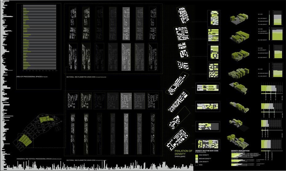
Using the identified density and porosity code from Wudadao’s fabric, the project CIDEmax adopts the local modular system based on the 10’x45’ “pixel” as an organizational principle for the recoding process. As a critique to current developments in China, CIDEmax combines the need for community, identity, and density with the principles of ecology. Each unit is made up of inhabitable space, a grey water garden, community space, and solar surface. Aggregating these metabolic units creates a system of community plazas and semi public spaces that combine social and ecological functions. As a result, the recoding produces an understanding of the spatial consequences and limitations of the urban metabolism that frames population density through its embedded self-sufficiency and offers a spectrum of public, semi public, and private out-door spaces that support the ecological performance. In this process, the coupling between population density (consumption) and EZONE (production) with local spatial parameters allowed for the development of a systematic approach towards a more sustainable fabric likewise addressing the existing identity: a three-dimensional garden city that supports the establishment of local culture and life.
Towards Cities of Eco Production
The causes and effects of rapid horizontal urbanization processes are not yet fully understood, but current theoretical discourse shows that the strategies of Landscape Urbanism are shifting scholarship and practice towards landscape and away from architecture.[11] The design of urban fabric—either understood as a dense vertical condition or as its horizontal opposite—can’t be disconnected from the surrounding ecological system. As rapid global urbanization continues into the 21st century, we are missing a great opportunity if the city’s fabric (with its embedded consuming metabolism caused by population density, mobility and life style) is not synthetically coupled with its potential to simultaneously produce renewable energy. Just as we decided historically that heavy industrial usage should not interfere with residential areas, it is time to question if current zoning codes are leading us towards a sustainable future. Though California’s title 24 and green building codes as well as initiatives like Solar Boston [12] start to move into the right direction, we are still far away from a holistic approach that radically re-directs the metabolism set in place.
Urban Kidney. Jeremy Bramberger, Bo Cao, Erin Avera, Gustavo DeLeon, 2011.
We should listen to Alan Berger when he proposes that current wastelands be utilized as a new territory for design strategies and performative landscapes. These spaces provide an opportunity to both fill-in the footprint of left over land in suburbs, and also should be considered in dense urban core areas, where the lack of green space along with other social and economical drivers continue to push people to the city’s outskirts. Though urban farming seems to be a successful program for inner city sites, productivity can also be extended to incorporate renewable energy production and water re-cycling via constructed wetlands. The three research studios described build on a new zoning code that explores the potential of on-site eco production while simultaneously offering a new set of urban programs, semi-public landscapes, and an embedded green economy.
An EZONE that extents the restrictions of current zoning criteria and defines a required ecological production on site would not only move beyond LEED certificates but would address the stigma of dense urban core areas. Active “green” spaces are combined with urban density, public infrastructure, and mixed neighborhoods allowing an upgraded living within the urban core areas. City wide strategies that take into account that some territories are more advantaged to harvest sun than others will allow to establish a systematic approach of eco production that is more than the simple addition of individual objects.
 Dr. Mona El Khafif is an Associate Professor of Architecture and Urban Design and Project Coordinator of the new CCA URBANlab at California College of the Arts. She holds a professional architecture degree from the RWTH in Aachen, Germany, and a doctorate in urban design from the TU in Vienna. After teaching in the core studios for the urban design program at the Institute of Urban Design and Landscape Architecture at the TU Vienna from 2000–06, El Khafif joined the URBANbuild program at Tulane University in New Orleans in 2006 to support studios at the urban and architectural scales in the aftermath of Hurricane Katrina. She is co-author of URBANbuild: Local/Global (William Stout Publisher 2009) and has published Staged Urbanism: Urban Spaces for Art, Culture and Consumption in the Age of Leisure Society (VDM Publisher 2009). Her current research operates at multiple scales, examining the interdisciplinary aspects of urban regeneration strategies and urban ecologies.
Refrences
[1] Charles Waldheim ed., The Landscape Urbanism Reader (New York: Princeton Architectural Press, 2006)
[2] Mohsen Mostafavi,“Why Ecological Urbanism? Why Now?” in Ecological Urbanism, ed. Mohsen Mostafavi and Gareth Doherty, (Harvard University Graduate School of Design, Lars Mueller Publisher, 2010):13
[3] Alan Berger ed., Drosscape Wasting Land in Urban America (New York: Princeton Architectural Press, 2006):18
[4] Friedrich Schindegger, Raum, Planung, Politik (engl: Region, Planning, Policies) (Wein, Bohlau Publisher, 1999)
[5] Alan Berger ed., Drosscape Wasting Land in Urban America (New York: Princeton Architectural Press, 2006):19
[6] “LEED ND rating system for sustainable neighborhoods,” LEED, accessed at http://www.usgbc.org
[7] Stefano Boeri, “Five Ecological Challenges for the Contemporary City,” in Ecological Urbanism, ed. Mohsen Mostafavi and Gareth Doherty (Cambridge: Lars Mueller Publisher, 2010) 444
[8] Ila Berman and Mona El Khafif, Urban Ecological Zoning Frameworks: Approach and Methodology (NSF Grant Submission, San Francisco: CCA Architecture Elab, Mlab and Ulab, 2009)
[9] “Algae technology,” Ecoduna, accessed at http://www.ecoduna.com/pages/en/mainsite/technology
[10] Adrian Hornsby and Neville Mars, The Chinese Dream. A Society under Construction, (DCF: 101 Publisher, 2008)
[11] Drosscape Wasting Land in Urban America, Alan Berger ed., Princeton Architectural Press New York, 2006, p.19
[12] “Renew Solar Boston,” Renew Boston, accessed at http://gis.cityofboston.gov/solarboston.
Uncertainty And Anxiety
The Call for Data
When it comes to reading about sustainable landscape design, it’s practically a given that you’ll encounter a call for more research. This thread runs strong through the academic literature on green infrastructure, in the recently released spate of sustainable design guidelines, and in day-to-day professional practice. [1, 2, 3] Regardless of the medium, the message is surprisingly consistent: we – the researchers, the architects, the landscape architects, the planners, the policymakers – want to do the right thing but until science tells us what the right thing is, we’re doomed to do the wrong thing. We want more information. Why? Because we are uncertain and uncertainty begets anxiety.
There’s nothing wrong with wanting more information but we should not forget that more information is not necessarily the cure for uncertainty.
For decades, designers have sought to fold ecological knowledge into the design and construction of the built environment. Leaving aside the question of success, there has been considerable and consistent tension in this effort. The reasons for this are varied, including many of the challenges typical to interdisciplinary work. The tension between the supply, by scientists, and the demand, by designers, for more information has significant impact on efforts at ecologically informed design.
Grappling With Uncertainty
There’s nothing wrong with wanting more information but we should not forget that more information is not necessarily the cure for uncertainty. In some cases, data can even lead to increased uncertainty for a number of reasons, including the nature of data, the methodology of science, and the biases inherent to research.
In order to understand this situation, it’s important to distinguish between different types of data and to acknowledge that information can be mapped on to a gradient of certitude. There’s a reason why there’s a term, “physics envy”, but no such thing as “ecology envy.” Mathematical precision and fundamental laws are unique to physics but we nonetheless expect precision from all scientific research; in this, we will always be disappointed. For example, we have a precise understanding of electricity but only partial understanding of forest ecosystems. In both cases, however, one of great certainty and one of great uncertainty we have made decisions of tremendous import. We have built electricity infrastructure across the globe and managed forests for resources and recreation, both with varying degrees of success. The data that exist for forest ecology increase every year, but we are nowhere near and may never attain the precision and irrefutably of physics.
Uncertainty is, in fact, the foundation of much scientific research. Scientists understand that “science depends not on the inductive accumulation of proofs but on the methodological principal of doubt [whereby any] scientific tenet… is open to revision… in the light of new ideas or findings.”[4] Ecology, in particular, is notable for its lack of a generalizable theory. There are three reasons for this: one, the field of ecology, and in particular urban and landscape ecology, is young; two, ecological research is synthetic, focusing on systems as opposed to single elements; and third, every ecosystem is unique.
In seeking data for our decisions, reasonable expectations are essential. As the statistician George E.P. Box said, “all models are wrong, some are useful.”[5] Not only can data be useful when incomplete, an expectation of uncertainty is crucial. We must not conflate actionable data with irrefutable data and we should expect that much data will, sooner or later, be called into question. In addition, if ecology can, at present, only provide case specific answers that are locally relevant but cannot provide answers about ecosystems that have not been directly studied, we would do well to accept that there can only be so much research and only so much data available. Given the enormous number of ecosystems that exist at any given moment, the task of amassing knowledge about each of them is elusive. Every bit of ecological research may get us closer to the broad principles we are seeking in making land use decisions, but not in the time frame that interests us. As designers, we must move from anxiety to acceptance of uncertainty.
The urgency with which we seek information is understandable: the plans we draft today have long-term impacts. Our burden of responsibility is heavy. Still, we would be remiss if we did not ask: is information what really stands between us and a good decision? The answer to this question is context dependent, but it is often true that facts ultimately take a back seat to beliefs, values, biases, politics, and power. It’s entirely possible that we would get closer to our goals by calling for better environmental education or environmental policy than by consistently focusing on information as the most effective leverage point. We are justifiably anxious to make the best decision possible but, in focusing on a call for more information, we may be reducing our ability to do so.
Coping with Anxiety
Since humans built the first sedentary settlements, we have designed and built in the absence of complete knowledge; we know much more than we did thousands of years ago, but we still toil in ignorance. The ongoing native vs. non-native plant debate is a good example. When choosing plants we must balance calls for native plants, both from scientists and the public, with the constraints of site conditions—soil, hydrology, micro climate, etc.—that bear little resemblance to those that preceded human disturbance. In some cases, we can find data that support the decision to use native plants. For example, a recent study on the impacts of suburban non-native plants on bird and butterfly diversity reveals that native plants better support local insect populations that in turn support bird species of local regional concern. The authors are careful in their abstract to state that their conclusions apply only in their study area.[6] So how should we balance these conclusions about the performance of native plants with the knowledge that keeping non-native plant species out of the suburbs requires tremendous resources including financial, chemical, energy, and human?
A project rarely has a single goal or measure by which all decisions can be evaluated. The conclusions of the aforementioned study may support the choice of native plants but we must still grapple with the knowledge that the very concept of “native plants” is a human construct we bring to bear on our ecosystem manipulations. In direct conflict with the conclusions of that study, a recent review paper co-authored by eighteen scientists takes a strong position against the dominant practice of favoring native plants over non-natives stating that, “it is time for scientists, land managers and policy-makers to ditch this preoccupation with the native–alien dichotomy and embrace more dynamic and pragmatic approaches to the conservation and management of species — approaches better suited to our fast-changing planet.” [7] Both papers are from highly respected, peer-reviewed journals, demonstrating that there is no scientific consensus on the issue. The native vs. non-native debate is not unique; scientific consensus is consistent in that it is always elusive. To navigate through these complexities, we have to turn from quantitative information to qualitative information, acknowledging that it is our human values that determine many of our decisions. Decisions are made based on a wide range of factors including experience, values, power, politics, time, budgets, public opinion, and yes, the so-called facts. No amount of data will clear the path to clear-cut decisions.
Even though our knowledge may be incomplete, or subject to revision, and may not be generalizable, we can and should make decisions based on the best available data.
There is another field of applied science that is equally, if not more so, riddled with uncertainty and ambiguity: medicine. In a recent article in the British Medical Journal, Dr. Des Spence wrote,
“We are scientists… The only certainty of science is uncertainty. Medicine is often little more than an opinion, a faith system: We believe that what we do is right. This is despite history telling us that what we do now is almost certainly wrong.” [8]
Although Dr. Spence may be unique in publicly discussing the topic, the dilemma of uncertainty is incorporated from the start into the medical school curriculum when new students are told that everything they are about to learn may soon be obsolete. [9] What is remarkable about the medical profession is that, in spite of this acknowledged uncertainty, doctors not only take action, they do so with authority. Although there are fundamental differences between treating patients and designing the built environment, both entail long-term care that is largely beyond the scope of work. The two professions differ, however, in one crucial way: follow-up. In many cases, doctors follow up with patients to assess the course of treatment and make any necessary adjustments. Designers, however, are often disconnected from both the construction and maintenance of their work. This exacerbates the impact of uncertainty on decision-making since designers feel they only have one shot at making the right call. This robs designers of both the opportunity to take corrective action and to learn from their projects. The solution to this condition lies not in chasing a certitude that cannot be found but in folding uncertainty into the process. Monitoring and adjustment need to become standard items in design contracts. Just as doctors cannot wait for knowledge that will never be complete, designers must do the same in applying ecological data to the design of our built environment. We must act with both uncertainty and authority.
Although uncertainty forms the baseline of scientific understanding, this doesn’t mean we cannot and should not make use of it. We can bolster the public perception of our decisions because even if all data are subject to revision, human psychology tilts us towards information-based decisions. Clients and the public feel more secure knowing that decisions are made using the best available data. We can also treat information as protean, making decisions based on it even as it shifts. Even though our knowledge may be incomplete, or subject to revision, and may not be generalizable, we can and should make decisions based on the best available data. This is, in effect, what we’re already doing but we do so with tormented minds, yearning and calling for more information.
Will we ever be comfortable with uncertainty? As designers, data can seem the perfect counterpoint to a field that many see as trafficking in the subjective. Although aesthetics are but a small part of what we do, they are the most visible and therefore the most dominant in public perception of design. The prospect of legitimizing our decisions with indisputable data holds tremendous appeal.
Fortunately, we do not need to look only to other professions for a way out of this quandary. Within the broader community of landscape design and management, there already exists a mechanism for folding uncertainty into the decision-making process: adaptive management, an iterative framework that works from the premise that data, and therefore best management practices, are forever evolving. Adaptive management institutionalizes both monitoring and modification, integrating adaptation into a design/construction/maintenance process that has traditionally been discrete and monolithic, thus creating a loop in place of linearity. Adaptive management also works from an understanding that generalized approaches need to be field-tested, with each harvest of data informing the next round of changes.
By taking uncertainty as a given, adaptive management harnesses it as a tool. Instead of working to eliminate uncertainty, adaptive management places it at the center of the process, thereby robbing of its bite. Some designers have embraced this mentality and begun to write contracts that allow them to monitor and then change elements of a design post-construction. Although there are financial and legal aspects to such contracts, as designers we have to take responsibility for our unwillingness to admit to uncertainty. The call for more research should not be muted but matched with an equally powerful call to act with authority and an acknowledgement of uncertainty.
 Renee Kaufman is a landscape architect and urban ecologist who seeks to wield a diverse array of tools in the management of urban natural resources. In other words, she wrestles with the design, ecology, policy, and public perceptions of urban space to achieve the best possible outcomes for competing needs. At the moment, she is trying to understand how academic concepts such as ecosystem services and biodiversity can best be applied to decision making in the built environment. Renee is currently working with the Yale Office of Sustainability to develop on ecosystem services plan for the university.
[1] Diane Pataki et al., “Coupling biogeochemical cycles in urban environments: ecosystem services, green solutions, and misconceptions,” Front Ecol Environ 9(1) (2011): 27–36.
[2] ASLA, Sustainable Sites Initiative Performance Guidelines and Performance Benchmarks (Report, 2009) accessable at http://www.sustainablesites.org/report/.
[3] Steven Windhager, Frederick Steiner, Mark T. Simmons and David Heymann, “Toward Ecosystem Services as a Basis for Design,” Landscape Journal 29 (2010): 2-10.
[4] Giddens, Anthony. Modernity and Self-Identity: Self and Society in the Late Modern Age (Stanford: Stanford University Press, 1991)
[5] George E. P. Box, and Norman R. Draper, Empirical Model-Building and Response Surfaces (Hoboken: Wiley Press, 1987): 424
[6] K. Burghardt et al., “Impact of Native Plants on Bird and Butterfly Biodiversity in Suburban Landscapes,” Conservation Biology, Vol.23, No. 1(2009): 219–224.
[7] Mark A. Davis et al. “Don’t Judge Species on Their Origins,” Nature, Vol.474 (2011): 153-154.
[8] D. Spence, “ Bad medicine: cardiology” BMJ (2011): 342
The Performative Ground: Rediscovering The Deep Section
Depth n.
1. a dimension taken through an object or body of material, usually downward from an upper surface, horizontally inward from an outer surface, or from top to bottom of something regarded as one of several layers.
2. the quality of being deep; deepness.
3. complexity or obscurity, as of a subject: a question of great depth.
4. gravity; seriousness.
5. intensity of color or darkness
6. emotional profundity: the depth of someone’s feelings.
7. an unfathomable abyss
Oyster-tecture, MoMA Rising Currents Exhibition. © SCAPE / Landscape Architecture, 2010.
Introduction
Deep Urbanism is a reading of the city that acknowledges the complex ecological and biogeochemical processes taking place above, below and within the urban ground. In the city, nothing can simply be placed on the surface; the composition of the urban ground requires that structures inevitably extend deep into a complex mix of disturbed soil horizons, construction rubble, pipes, subways, utilities. The most innocent-looking walkway may sit on 30-foot piles driven deep into silty soil; small hillocks might be braced with highly engineered geotextiles. A simple meadow may require the complete reconstruction of a “natural” soil profile; a sunken garden may require drainage infrastructure and thousands of pounds of concrete to keep the water table at bay. Much of the action of landscape is deep underground, buried in space or time.
With more and more landscape projects today being built over infrastructure, over unstable soils, or even atop capped landfills, it is critical for landscape architects to deepen their understanding of complex site dynamics. While the visual action of landscape happens above ground, landscape architecture’s intelligence, technical problem solving and performative attributes often occur beneath the surface. However, landscape’s increased emphasis on highly graphic and conceptual plans has led to the de-emphasizing of depth and its associated behaviors and qualities, resulting in a shallow section.
The sentiments of deep urbanism recently surfaced in the 2010 “Rising Currents” exhibition at the Museum of Modern Art, where sectional drawings received a prominent showing as wall-length murals. This project brought together five interdisciplinary teams of architects, landscape architects and engineers to tackle the complex challenge of reimaging New York’s coastline and harbor in light of the pressing issues of climate-driven storm surge and sea-level rise, pollution and degraded coastal habitat. The long and detailed section became the dominant drawing for many of the teams due to its unique ability to address these issues and the underlying processes at play, in time and space, with more nuance and dynamism than conventional plans and perspectives could achieve.
While landscape plans and perspectives have achieved high levels of graphic refinement over the last decade, helping to increase the visibility of landscape architecture, sectional representation has lagged, not receiving the same level of graphic exploration and experimentation. Developing a fluency with “deep sections,” or sectional representation techniques that make visible the wide range of site complexity while providing a critical tool for interdisciplinary collaboration and design exploration, can be a start of a shift towards a deeper grounding in how landscapes perform.
Sectional axonometric: structural and landscape systems, Hudson River Park. MVVA, 2011. [left]
Section perspective: Salon de Pinos, Madrid Rio. West 8, 2006-2011. [right]
Section of Grand Central Terminal. Scientific American, 1912
The Layered City: Urban Depth
For landscape architecture projects to perform and persist over time, landscape architects need to not only design the benches, plantings, and pathways on the surface of the ground, but to have a deep understanding of the site’s underlying substrate, of the flows of water, traffic, and nutrients, of the architectural and infrastructural context of the site. No longer are these elements a disconnected pre-condition of a project, relegated to the purview of engineers or transportation planners, but an intimate part of the newly expanded scope of landscape. The urban landscape includes the actual ground on which the city is built and through which course its urban ecological flows and processes.
These ideas were well understood by the architects and engineers at the turn of the mid-nineteenth century who designed and built much of the conveyance infrastructure that lies beneath the feet of city dwellers today. The deep section draws inspiration from architects of the time—who argued fiercely for a better-performing city with wider streets, modern sewage, and faster new transportation systems—and architects of the 1910s and 1920s reveling in the complex newly infrastructural section of the modern metropolis.
European architects like Idelphons Cerda, in his search for a rational, scientific urbanism, and Adolphe Alphand, in his search for the ideal Haussmannian boulevard, drew new types of sections, through the street and its associated infrastructure. Cerda’s formulation of a new “ism”—urbanism—underscores the moment of excitement about the city that the Enlightenment was bringing to architecture.[1] Observing the young gridded cities of the Americas, here was an architect developing a philosophy of city-making and infrastructure in order to prepare for the radical expansion of the urban territory out from the old medieval urban cores. A decade later, Adolphe Alphand was experimenting with crafting new optimized sewered, planted, and traffic-separated streets through the existing medieval urban fabric of Paris. Alphond included street sections in his 1867-73 Les Promenades de Paris; as Jacqueline Tatom describes in her essay “Urban Highways and the Reluctant Public Realm,” Alphand’s representation of Haussmann’s Paris “reveals a programmatic richness that is enhanced by a careful exploration of the existing city.” [2] These urban sections acknowledge both the urban flows above ground and below it.
Infrastructural conditions of the present and future street, The Cities of the Future. Eugène Hénard, 1910.
In the 19th century, these were not considered interdisciplinary drawings; disciplinary boundaries between architecture, engineering, urban design and landscape had not yet hardened. Architects of the time understood that these elements were intimately connected, and that in order for the distinct elements of the project to be in conversation with each other, they needed to all appear on the same drawing.
In the first decades of the 20th Century, this urbanistic excitement continued, with exuberant sections exploring the multiple infrastructural levels of the layered city. A famous section drawing from the time, published in the Scientific American in 1912, shows New York’s Grand Central carved away to reveal all the flows coming together in this urban node. The city was being changed, mechanized, modernized, and urban society was fully engaged with these changes as they were taking place.
Modern architects continued to draw prototypical urban sections throughout the 20th Century, with influential urban sections being developed by Le Corbusier, Hilbersheimer, and later Paul Rudolph. But as disciplines such as civil engineering became codified and the below-grade infrastructure moved out of architects’ purview, architectural interests shifted upwards. The information below ground, or below the architectural foundation, faded from view, its memory relegated to the white emptiness of poché.
The use of poché –the hatched or shaded space inside the cutline–in sectional drawings indicates material or space which does not need to be considered. In architectural drawings, poché traditionally represents the space inside the wall, indicating areas not experienced or deemed superfluous to the focus of the drawing. In Nolli’s architectural mapping of public space of Rome, the city’s building fabric was represented as poché while the streets, plazas, and select architectural interiors were represented as an interconnected public “figure” within the larger field of urban fabric. Architectural drawings routinely represent the ground, and everything below the cutline or outside of the building foundation as poché, implying that this material is beyond the scope of the project.
Drawings are always partial views. The omission of information provides clarity and legibility of the design problem being worked out or expressed on the page. If we understand drawings to be a critical space for construction and exploration of architectural questions, then the designation of material, zones or properties as poché is a clear expression of the limits of the designer’s inquiry. When the properties relegated to poché matter deeply, then this omission should be cause for concern.
in-depth adj.
1. carefully worked out, detailed and thorough: an in-depth study
2. thorough, extensive or profound: an in-depth analysis of the problem.
Programmatic sections, Parc de la Villette, competition entry. Office for Metropolitan Architecture,1983.
Iconic/Graphic: The Shallow Section & The Programmed Surface
Half a century later, in the wake of decades of disastrous urban renewal projects and ongoing suburban explosion– architects, urban designers and landscape architects again sought a new mode for understanding the goals and guiding principles of contemporary city making. In the 1970’s and 80s, the popularization of the environmental movement, urban ecology and systems theory created a paradigm shift in our understanding of the complexity and dynamism of the urban fabric.[3] Again, descriptions of urban environments became infused with a language of flows and flux—this time not just the high-speed movement of the automobile and train, but also the varied and invisible flows of water and waste, migratory birds and hydroflurocarbons.
A new generation of architects and landscape architects were suddenly asked to operate on a landscape that was neither wholly natural nor machinic[4]. While this may have been a critical moment for a return to a critical understanding of subtle depth and process, instead design moved in the opposite direction, casting its vote for a simplified and ambiguous clarity.
Movements are born from a leader and an image. While the environmental movement galvanized around Rachel Carson and dying birds, landscape architecture inherited Rem Koolhaas and Parc de la Villette. OMA’s proposal for the Parc de la Villette competition remains a seminal project for contemporary landscape architecture, presenting a conceptual approach to landscape process and heralding the era of a new drawing style, the diagrammatic plan. The competition took at its foundation two critical challenges of the time—an artificial flatness of the post-industrial landscape and the heroic nature of large-scale land development.
The conceptual foundation of OMA’s submission is a celebration of program, whose diagrammatic clarity relies on the de-emphasizing of natural processes and their replacement with a field of architectural objects—some of which happen to be trees:[5]
“Nature—whether the thematic/discovery gardens, or “real” nature—will also be treated as program. Blocks or screens of trees and the various gardens will act like different planes of a stage set: they will convey the illusion of different landscapes, of depth, without offering, in passing, the substance.”[6]
OMA’s radical emphasis on program is a means of coping with, and perhaps mirroring, the impermanence and dynamic nature of cities. The project—conceptually and literally—exists purely above ground, and all elements that do not add to the construction of a visual experience are rendered mute. Sectionally, the park is built up (never down) in a series of theoretical and literal layers. The existing site, even the soil is characterized as “sterile” [7] and a tabula rasa condition is assumed. All fertility, all interest is imported. The weight of that effort is marked by topography—making all effect, all effort visible.
Koolhaas’ La Villette proposal is important to note, not for its failings, but for its conceptual strength and its graphic clarity—which proved capable of captivating landscape architecture and architecture for nearly two decades. The technique and polemic freed landscape architects to sell proposals through manipulation of program, rather than just physical elements, broadening the field of what was considered landscape and providing landscape architecture practitioners the agency to operate across large swaths of the urban fabric. By the late 90’s, however, the iconic diagrammatic flatness of landscape proposals had run its course, as evidenced by the demise of OMA’s winning Tree City competition proposal for Downsview Park.
Thirty years after La Villette, landscape architects and architects are still struggling with the flatness that came with the diagrammatic, ungrounded approach to landscape. Academic and professional exploration of folded and thickened surfaces within the city exhibit a desire to counteract this purported flatness of landscape, in order to express a more didactically complex reading of the urban surface. Topo-mimetic building projects such as FOA’s Yokohama Ferry Terminal, however, rely on a formal representation of landscape as a proxy for the desired complexity and dynamic processes of material sites.
Of course, scientific and experiential understandings of landscape patterns and processes challenge a purely formal rendering of landscape or architecture as “an abstract surface.”[8] In interpreting the “thickened ground”[9] of the urban landscape as an architectural condition of horizontally expansive (if programmatically complex) buildings, such explorations ignore and negate the significant biochemical, geological, hydrological, or ecological complexity of urban ground.
Slope planting strategy, “Lifescape,” Fresh Kills competition proposal. James Corner/Field Operations et al., 2005.
While the “thick 2-D” of the architcturalized urban section is capable of reproducing moments of drama, its reliance on the treatment of landscape as a metaphor ultimately exposes the thinness and immaterial nature of such projects.[10] Urbanism, of course, operates in four dimensions– existing fully in space and time.
While architects continue to struggle to express depth and dynamic performance through largely formal and narrative devices, contemporary landscape architects have re-embraced process and a hyperconnected view of nature through a re-engagement with the urban ground and its messy complexity. In this view, site conditions and contexts are treated not as a disconnected engineering problem, but as integral to the design strategy. In the projects and writings of landscape urbanism, we see once again an excitement for the crafting of a better-performing city, where an expanded scope of landscape architecture now includes the project of city-making, both above- and below-ground.
beyond one’s depth , out of one’s depth idiom
1. in water deeper than one is tall
2. beyond the range of one’s competence or understanding
Early concept sections, North Grant Park. Michael Van Valkenburgh Associates, 2011.
Drawing Deep Urbanism
If a Deep Urbanism is a reading of the city as a complex system composed of interconnected layers of social and biogeochemical processes, then the deep section is its primary graphic device for communicating a synthetic view. The deep section is an essential representational tool in expressing and addressing design challenges holistically—allowing varied processes to become visible and be explored relationally, rather than analytically. The deep section breaks away from reliance on the visual and apparent—creating space for the visualization of the processes of urban nature more readily than do plans and perspectives. The deep section also brings infrastructure, hidden both underground and in plain sight, to the forefront, expanding our understanding of the pre-conditions of projects and the boundaries of our interventions.
By extracting select elements from their usual places in spreadsheets and reports, and placing them together on the page, the designer is able to spatialize these processes or materials, while creating a dialectical tension between parameters that are usually relegated to different disciplines. Through a deep section, subsurface hydrology may be understood in relation to above-ground planting patterns, and below-ground structural capacity can communicate with above-ground topography and landform’s programmatic potential, all on one drawing.
Thirteen years before La Villette jolted landscape towards program and plan, Ian McHarg challenged landscape architects to learn the lessons of dynamic landscape systems, so that they might create more environmentally responsible projects. As ecology popularized discussion of flows, process, and systems of disturbance rather than equilibrium, McHarg opened the door to sectional explorations of process by focusing on dynamic landscapes such as shifting sand dunes and representing their behavior through sectional diagrams.[11] McHarg explained and popularized the use of diagrammatic sections during his tenure at the University of Pennsylvania during the 1960’s, 70’s, and 80’s.
A generation of McHarg’s students has continued to experiment with and adapt these techniques in order to explore a diversity of landscape dynamics. From McHarg’s original explorations, we can trace three primary types of deep section—the landscape transect, the structural section and the sequential section—each providing a critical method for the toolkit of deep urbanism. Each technique represents a field of concerns and drawing practices, some borrowed from other disciplines and others rooted in landscape architecture practice.
Ian McHarg’s Dune Community Types, from Sea and Survival, 1969
Landscape transects explore the interconnection between vegetation on the surface and the soil and hydrological behavior below ground. Transects drawn by ecologists are rooted in a methodology of sampling across a target site, represented in the composition of vegetative gradients which index shifts in the properties of soil and hydrology. Landscape architects can build on this technique in order to explore a wider range of conditions, many of which are specific to the constructed ecology of urban landscapes. Rather than cataloging found conditions, a deep landscape transect might start from the intended vegetation patterns of a landscape design and move down to describe the requisite soil horizons, drainage or irrigation regimes, and biological conditions necessary to support that vegetative community, acting as a generative tool for establishing proper growing conditions. It may need to incorporate elements of our second sectional lineage, structural and construction sections.
Whereas ecological transects are full of gradients, structural and construction sections, describe the actual dimensions, notations, and relations needed for building a landscape. Their principal tool is the measured line. This sectional typology makes a clear shift from description to prescription; hard lines in this type of representation are essential—at the very least lines of dimension and lines of movement. The structural section engages the spatial and temporal realities of acting on a heavily constructed ground, responding to the need to describe coordination among utilities, the work of various trades, structural loads, or relational properties of materials. Rather than emphasizing the fluid and dynamic properties of landscape, the structural or construction section embraces the conceptual and practical benefits of measurement and spatial precision.
(Infra)structural sections, New Urban Ground. ARO and dlandstudio’s competition entry for Rising Currents Exhibition, 2010.
With ARO and dlandstudio’s Rising Currents entry, “New Urban Ground” for Lower Manhattan, we see an example of a deep (infra)structural section, where multiple flows (water, sewage, data, power, traffic) are managed through a smart and precise recalibration of the street and urban edge, re-thinking how the city can perform through optimized street details. The proposal argues that a re-consideration of street design can lead to a hydrologically better-performing city in an age of sea level rise and increased storm surge potential. These sections comment on the existing mess of utilities that lie below typical New York streets, and propose a new street section where utilities are reorganized into neat new ducts, livability has expanded with asphalt giving way to grass in the porous pavement, and the attenuating quality of a soft coastal edge to dissipate the destructive effect of storm surge has been carefully considered.
Sequential sections make use of multiple sectional cuts to express depth across space or time in order to show a narrative progression. On the surface, these sections often focus on the visible and spatial conditions of interiority, light, or landscape experience, but they can also be cut through time. For example, several notable projects have explored the processes of plant succession as a dynamic progression in order to explain the relationship between initial moves (i.e. creating furrows, planting seedlings in hedgerows, overplanting with the intent of later thinning out) and eventual outcomes. Field Operations used this technique to explain their planting strategy for Fresh Kills, illustrating the “successional development of ‘thicket’ planting on slopes into mature, multi-aged, stratified woodland,” while Michael Van Valkenburgh Associates used a similar approach to explain the spatial implications of pruning and maintenance in shaping their “successional hedgerows” for Brooklyn Bridge Park. STOSS LU borrows from Field Operations’ graphic convention and pushes it further to explain the relationship between forest succession and the creation of programmatic diversity through targeted landscape interventions such as the introduction of furrows, fences, and boardwalks.
Successional Hedgerow Development, Brooklyn Bridge Park. MVVA, Graphic by Mike Smith and Matthew Urbanski.
Physical operations: Minimal incisions and constructions that spark change, Mount Tabor Resevoir. stossLU, 2003.
In deepening these three examples, we might draw on our understanding that in addition to above-ground vegetation and biomass changes over time, shifting soil characteristics and root growth are also important factors to consider in the appropriate care of plant communities. A deep section approach might overlay information of below-ground dynamics in order to express the connections or synergies between aspects of maintenance activities (i.e. both the pruning of plants above ground and the addition of soil amendments, microorganisms or subsurface irrigation).
Sequential sections can also be used to move the viewer through space rather than time. As with the example below, this more experimental approach to sectional exploration seeks to move away from the dominance of the surface of plan in order to explore flows in three dimensions. Work from Anuradha Mathur and Dilip da Cunha’s Mumbai studios at the University of Pennsylvania has used the sequential section to trace a narrative progression through streets, waterways, rail lines and other infrastructural routes. Specific spatial conditions are represented in each individual section, while the entire progression of section cuts becomes a place to map flows and relationships.
Like the other deep sections typologies listed above, the sequential section remains a narrative and critical drawing—one which reserves the privilege of picking and choosing which pieces of information or spatial moments are important to render on the page. Sequential sections offer considerable flexibility and freedom to test design interventions and critically explore relationships without the need for an even coding or development of the plan.
Sequential sections through maidan edges, Filter/Collector: Anchoring the Edge in Mumbai’s Maidans. Nicholas Pevzner, 2009
In his introduction to Recovering Landscape, James Corner argues that it is less the formal characteristics of landscape, than the agency of landscape that is critically important for intervening in cultural convention. The focus, he argues, should be on “how it works and what it does” rather than what a landscape looks like.[12] Whereas other forms of architectural representation may better communicate the formal or aesthetic concerns of a project—whether a project is “naturalistic, rectilinear, curvilinear, formal, or informal”—sectional drawings cut right past the plan aesthetic. Able to be drawn quickly and early in the design process, sections offer a powerful generative, communicative and analytical tool. The deep section designates a physical space in which a project’s unknowns, goals and constraints can be drawn and tested. The “deep section” holds out promise as the graphic platform for convening the interdisciplinary conversation necessary to solve the complex and layered challenges of contemporary urban landscape projects within a medium that is native to landscape architecture.
Nicholas Pevzner is a designer at Michael Van Valkenburgh Associates in New York City. His work explores the role that infrastructural landscape moves can play in structuring and sustaining healthy cities. Nicholas received his Bachelor of Architecture from the Cooper Union in New York in 2005. He later received his Master of Landscape Architecture from the University of Pennsylvania in 2009, where he has also been a visiting lecturer and critic in landscape architecture. He is a co-editor of this issue.
Stephanie Carlisle is a designer and environmental researcher at KieranTimberlake Architects in Philadelphia. Her research focuses on the relationship between the built and natural environment and employs interdisciplinary design methodologies and data-driven modeling to study complex urban systems. Stephanie holds a Master of Architecture from the Yale School of Architecture and a Master of Environmental Management from the Yale School of Forestry and Environmental Studies. She is a co-editor of this issue.
[1] David Grahame Shane. Recombinant Urbanism (Hoboken: Wiley Press, 2005) p208
[2] Jaqueline Tatom. “Urban Highways and the Reluctant Public Realm,” from the Landscape Urbanism Reader. Charles Waldheim ed. (New York: Princeton Architectural Press, 2006) p 185
[3] Fritjof Capra. The Web of Life: A New Scientific Understanding of living Systems (New York: Anchor Books, 1996)
[4] Reyner Banham. Theory and Design in the First Machine Age (Cambridge: The MIT Press, 1980)
[5] Sébastian Marot. “Sub-Urbanism / Super-Urbanism: From Central Park to La Villette,” AA Files 53 (2005): 25
[6] Rem Koolaas, S,M,L,XL. (New York: Monacelli Press, 1995): 923
[7] Ibid.
[8] Stan Allen. “Mat Urbanism: The Thick 2-D,” in CASE #2: Le Corbusier’s Venice Hospital and the Revival of the Mat Building, ed. Hashim Sarkis (Munich: Prestel, 2001): 124
[8] Alex Wall. “Programming the Urban Surface,” in Recovering Landscape, ed., James Corner (New York: Princeton Architectural Press, 1999): 237
[8] Eduardo Rico, “Deep Ground Project: Thickened Ground Concept,” AALU LAndscape Urbanism, March 3, 2008, accessed March 1, 2012, http://aa-landscape-urbanism.blogspot.com/2008/03/thickened-ground.html.
[10] Stan Allen. “Mat Urbanism: The Thick 2-D.”
[11] Ian McHarg. Design with Nature. (Garden City, NY: Natural History Press, 1969)
[12] James Corner, “Introduction,” in Recovering Landscape: Essays in Contemporary Landscape Architecture, ed. James Corner (New York: Princeton Architectural Press, 1999): 4
Social Performance: Prototyping User Behavior
User behavior generating park design. Image by Michael Miller
Rating systems like LEED and the Sustainable Sites Initiative (SITES) reflect a recent interest in evaluating and predicting design performance. Both rating systems focus on environmental aspects of performance, and understandably so. But to form the basis of lasting urban interventions, projects must be socially, economically and environmentally sustainable. While SITES acknowledges sustainability’s three components, its rating system relegates social and economic concerns to one of five topic areas, undervaluing their importance. Moreover, social credits within SITES focus less on measures of actual performance than on a checklist of features expected to promote social equity, healthy lifestyles, and so forth. Evaluating projects before occupancy simplifies the task of rating projects, but misses the opportunity to examine actual rather than predicted performance. This essay will explore how we can measure social performance directly, and how integrating social research with the design process can produce more dynamic, responsive, and sustainable landscapes.
Social performance – or “human health and well being,” as SITES frames it – encompasses many issues: public participation, ADA access, construction wages, physical fitness, and mental health, to name a few.[1] Without diminishing the importance of these concerns, one element stands out as the essence of a landscape’s social performance: user experience. Much of landscape’s magic lies in the dialogue between people and place. Focusing on this interplay raises questions that matter deeply for our designs: Is it a landscape that people will like, or better yet, love? Is it the kind of place you find an excuse to wander down to on Saturday morning, that you bend your commute to pass through? Does it make your life more peaceful, more interesting, more joyful? As important as the full breadth of social concerns remain, I would argue that if a designed landscape does not offer a compelling experience, the landscape will be a failure. In a profession that contrives and conjures places for other people to enjoy, this question precedes most others.
Images from William Whyte’s The Social Life of Small Urban Spaces:
The New York Public Library steps [left];
Whyte’s time-lapse photography equipment, [center];
Office workers demonstrate the importance of flexible seating, [right]
Popularity and Behavior
Even focusing on this one element of social performance, two complex and related questions remain: how can we measure user satisfaction, and how can we understand its causes? Popularity is the clearest indicator of success, often measured by the number of people that use a place. Popularity, or visitorship, is landscape architecture’s analogue to sales in product design or the number of hits in web design. Although mute on the subject of cause, visitorship is a convenient proxy for the many reasons that people might choose to visit a landscape.
Of the many landscape types, urban plazas are the most studied, thanks in large part to the work of William Whyte. In the late 1960’s, Whyte began applying direct observation techniques from the social sciences to the study of urban spaces. Through field observation, film, and time-lapse photography, Whyte provided the foundation for our current understanding of human behavior in public spaces. His work identifies physical elements that tend to produce success, such as a variety of seating and its proximity to busy paths, elements that may not, like proportion, and the famous finding that “what attracts people most, it would appear, is other people.”[2]
Despite Bryant Park’s position as a rare patch of park amid the extreme density of midtown Manhattan, [left], Bryant Park had, by the late 1970’s, become a catalog of vices, [right]
If Whyte’s research is the classic work on public landscapes, then Bryant Park is the canonical case study for its application to design. In 1979, the newly formed Bryant Park Restoration Corporation (BPRC) commissioned Whyte to study a park that was then dominated by “dope dealers” and “undesirables.”[3] According to Whyte, the undesirables were an effect, not a cause, of under-use. “The nub of the matter,” he wrote, “is access”—both “physical” and “psychological.”[4] Based on his earlier research, Whyte suggested simple but profound changes: removing the iron fence and shrubs that impeded views in and out, creating more frequent entries from the street, and piercing the internal balustrade.[5] He also encouraged the BPRC’s efforts to step up programming, improve maintenance, and increase security, while arguing that these moves needed to be paired with structural, physical changes.[6]
Three years later, the BPRC hired Hanna/Olin to design a physical restoration of the park. Laurie Olin synthesized Whyte’s analysis, a close reading of the site, and historical precedent into a subtle redesign that made few formal changes but radically improved the park’s social performance. The park’s now-iconic café chairs illustrate this synthesis: although Whyte advocates moveable chairs in the Social Life of Urban Spaces, his report on Bryant Park makes no mention. Olin’s idea for the chairs and a more open, transparent space beneath the framing London planes was inspired not only by Whyte’s research, but also the French gardens on which Bryant Park’s 1934 design was modeled.[7]
Bryant Park after establishment of the Bryant Park Corporation and a successful design intervention by Hanna/Olin.
The interventions worked: the result was a dramatic increase in the number of visitors and a park that drew both popular and critical praise. That the project was an intervention in an existing park proved a significant aid to integrating research. Although Hanna/Olin and the BPRC had to overcome the park’s nasty reputation, they were able to study the park, create a social model informed by Whyte’s broader research on public spaces in Manhattan, and then propose targeted changes. They were even able to prototype some of their interventions: before the full redesign, the BPRC tested programming ideas with a schedule of events and temporary kiosks selling food, books, and Broadway tickets. After initial success, they continued with a more permanent, ambitious agenda for design and management. The temporary actions alone doubled attendance, and today Bryant Park boasts 4.2 million annual visitors.[8]
Bryant Park offers a compelling model, yet every site has a different context. The park is now wildly popular, but on an average day, 188,000 people live in, work in, or visit the two-block radius surrounding Bryant Park.[9] From this perspective, its initial abandonment and disrepute is more shocking than its current success, an index of how far New York had fallen in the 1970’s. Were on-site changes solely responsible for its turnaround, or did the park benefit from larger urban trends, both in midtown Manhattan and nationally? Between 1990 and 2001, crime in the surrounding police precinct had declined by two thirds: which was the cause and which the effect?[10] Parks can be agents, victims, or beneficiaries of urban change. For designers to learn from a park’s success or failure, it is critical to begin parsing these causes. Such a study of Bryant Park might well reveal that a synergy between multiple forces—design, programming, management, and urban context—led to Bryant’s dramatic success. Post-occupancy evaluations of any park should place discussions of popularity and visitorship within this larger context.
Image courtesy OLIN
Understanding Popularity: Large Parks and Qualitative Research
Popularity metrics are appealing because they can neatly and quantitatively capture a range of behavioral cause and effect—from prosaic physical parameters like the frequency of park entrances to the ineffable experience of awe or wonder. These metrics avoid the rote checklist of features that may or may not result in a place that people love. With visitorship, you don’t need to understand what people are feeling; you just know they’re feeling something that draws them there. That’s the strength of this approach, and also the weakness: popularity may be easy to measure, but hard to act on when the motivations remain hidden.
In the case of Whyte and Bryant Park, an explanation was supplied by Whyte’s extensive and rigorous observation of similar spaces in similar contexts. Large parks present a different and difficult case. For example, is it always true that people seek other people, as Whyte found in Manhattan’s plazas? Large park users may be in search of different but equally potent experiences like quiet and solitude. This tension between popularity as the yardstick of success and the allure of the empty landscape is illustrated perfectly by Philadelphia’s West Fairmount Park.
Since moving to Philadelphia five years ago, I’ve been visiting and puzzling over this large park. It’s a thousand acres, bigger than Central Park but only one part of the core Fairmount Park system—about 3,000 acres of land along the Schuylkill River set aside for watershed protection in the nineteenth century. Despite initial ambitions to rival Central Park, West Fairmount Park was never designed as a coherent whole. Rather, West Park has been shaped by long intervals of benign neglect punctuated by moments of architectural and infrastructural intervention: the eighteenth century mansions that predate the public park; the 1876 world’s fair; a privately operated leisure trolley; a freeway that severed the upland park from the river below; and sporadic attempts to establish a cultural district of museums and performance venues.
Currently, the park is lightly used, lightly funded, and lightly maintained—at least by the city. Nonetheless, the park inspires a surprising degree of user engagement and maintenance, both formal and informal. In 2010, as part of graduate research at the University of Pennsylvania, I undertook a study to understand the patterns I had noticed casually as a park user, with the goal of exploring how user research could be integrated with large-scale design. Although the initial question, of why there was so much engagement among so few users, stemmed from a quantitative estimation of visitorship, answering the question required a deeper understanding of the complexity of people’s needs, motivations and responses. It required qualitative research.
To understand this qualitative dimension, I interviewed a range of users and non-users, casual visitors and committed stewards. The interview process began with direct observation to identify typical uses, followed by outreach through established organizations such as running clubs, friends groups, and educational non-profits operating in the park. Given the preponderance of organized users in West Park, this method was both appropriate and efficient—although it missed unorganized visitors. Interviews were conducted in a variety of formats, from phone interviews to participatory sessions where the interviewer accompanied users to the park. While the ease of phone interviews raised response rates, the participatory interviews were the most revealing: moving through the landscape provoked comments and questions that would not have been raised out of context.
Participatory interviews proved to be one of the most useful research methods in the West Fairmount Park study. A group of runners unfamiliar with West Fairmount Park did not perceive the connection to a larger park system while running on the river drives, [left]. Even users who had been to the park multiple times tended to perceive it as a sparse constellation of attractions rather than a coherent landscape, [right].
In one series of interviews, I accompanied members of a running club on their typical routes and then on a first-time visit to West Park. These interviews suggested three key insights. First, it became clear that the runners would go to great lengths to follow a loop. One runner complained about her run’s first half, then praised the return leg. When I asked her why she didn’t follow the second half in both directions, she simply replied “because then it wouldn’t be a loop.” Second, it became clear that people did not perceive West Park as a connected whole. Runners on the river trail would be surprised by questions about what lay on the terrain just above – even if they had been there in a different context. Finally, the directional confusion and tangible nervousness of runners new to the park highlighted the impediment posed by its obscure and forbidding edges.
In early 2012, the figure of West Fairmount Park disappeared from Google Maps, [left]. Although accidental, this representation encapsulates many Philadelphians’ perception of the park: white space crossed by indifferent roads and sprinkled with sparse attractions. A few days later, Google restored the park’s official outline, [right].
Over the course of the interviews a consistent picture began to emerge: people who rarely used the park did not recognize it by name or as a cohesive place; it lacked identity. Most visitors did recognize and had often visited discrete architectural and programmatic attractions within the park, such as a museum and a performing arts center. When looking at or recalling other parts of the park, they found them confusing and sometimes scary. Frequent visitors, in contrast, returned for three types of experience that mapped spatially onto three distinct topographies. In the park’s steep and densely wooded ravines, people spoke of escaping from the city. On a long ridge punctuated by open fields and scattered buildings, users often belonged to a group with a specifically defined turf, sometimes assiduously maintained. The park’s wide, open plateaus drew the broadest population of users for events large and small, from barbecues and family reunions to circus performances and summer concerts.
This understanding of how the park currently operates can provide a platform for design proposals. New design interventions might seek to increase attendance by improving the park’s spatial legibility and emphasizing the powerful experiences of escape, belonging, and gathering for new visitors—so long as they do not threaten the deep but sometimes informal stewardship of current users. A research-based understanding also provides a clear benchmark for evaluating design interventions. And although the results of this research were both site- and context-specific, similar methods could be applied to understanding any existing site or adding experiential depth to a post-occupancy evaluation.
Reconfiguring West Fairmount Park’s trail network to accommodate user patterns, while engaging the adjacent neighborhoods currently isolated from the park, and the river drives that are currently Fairmount Park’s biggest draw.
Prototyping Landscape
Research will have limited impact on practice if it remains purely academic and external to the design process. Although landscape architects can learn much from the social sciences, we should also look to the applied design disciplines, like industrial and web design, for ways to integrate research. The common thread of design brings similar time constraints and a drive to turn research into action. Collecting data through interviews, for example, can be incredibly time consuming and large samples may not be possible in a fast-moving design process. In the industrial design literature, researchers often suggest seeking out a few extreme users rather than many ‘typical’ users.[11] Triangulating between the experience of first time visitors, avid users with specialized knowledge, and a few people at the extremes of age or ability—children, seniors, the disabled, competitive athletes—can provide a quick but rich basis for design.
Comparisons to product design are compelling but also frustrating for architects and landscape architects. Our ‘product’ is always custom, never mass-produced; our budgets are small and shrinking; our projects are large, long-lived, and difficult to prototype. But prototyping lies at the heart of iterative design research: it allows designers to test their work not just against an abstracted model but with increasingly realized versions of the thing itself.
So how does one prototype a landscape? It’s easier if you’re considering relatively minimal interventions—redesigning an existing park, say, rather than creating a plaza on a former parking lot. Such is the case in West Fairmount Park, with its long history of official neglect and user modification. Through its 200-year history it has remained unfinished and largely undesigned, permanently in flux, prototyping itself. My design ideas for the park involved emphasizing, tweaking, twisting, and extending the existing structure, as well as expanding the park’s tradition of user modification, which allows for adaptation to changing needs.
This all sounds good, and ties neatly into contemporary notions of process and indeterminacy, but even the most open-ended landscapes require a structure – and that structure may not be small or cheap. Jane Suri of IDEO draws a useful distinction between “appearance prototypes” that show what a product will look like and “experience prototypes” that may look different but seek to produce, quickly and on the cheap, the essence of the designed experience.[12] She also outlines three functions of prototypes: “understanding existing experiences, exploring design ideas, and communicating design concepts.”[13]
In landscape architecture, we often focus on appearance prototypes that communicate—and sell—our unbuilt design concepts. A broader approach that includes programming, event, and temporary installation allows for experience prototyping and user feedback in advance of expensive permanent construction. Bryant Park again provides an early example, with its temporary kiosks and events. Recently, more cities and design firms have begun to incorporate event and installation into design and planning projects, particularly in large parks or where major changes to infrastructure are at stake. For example, New York prototyped new bike lanes and road closures with temporary markings in order to gather traffic and ridership data. Similarly, West 8 in Toronto staged a brief shut-down of an expressway that its waterfront plan proposes to remove, curating a weekend-long bicycle festival on the elevated roadway. Brooklyn Bridge Park and Governor’s Island have both employed light and sometimes temporary infrastructure—pop-up parks, paths, loaner bikes, hammocks—to permit early use and visitorship before completion.
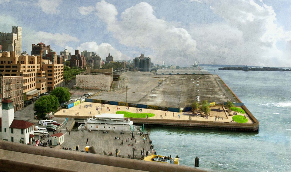 dlandstudio‘s 2008 Pop-Up Park at Pier 1, a temporary landscape prototype that drew user activity to the site of what would soon become Brooklyn Bridge Park
Often, though, these prototypes are conceived as demonstrations rather than tests; they should be both. If we treat them as experience prototypes providing crucial user feedback—as part of the design process, not just initial implementation—we can incorporate the lessons into more permanent versions of the design. By reframing temporary interventions this way, designers could offer park amenities sooner than if they wait for the full design to be completed and built. Making this flexibility clear to the public could also increase stakeholder buy-in.
What, then, should integrated research and design look like? In an ideal scenario, site-specific observation and interviews might help frame an agenda for design and establish criteria for success. Contextual research could identify potential users and larger urban forces influencing the site. Combining this project-specific research with a broader body of academic literature might give designers a working social model of the site and its context. They might then be able to make reasonable predictions about how their interventions might change the model and be able to quickly, intuitively evaluate early drawings. As ideas become more concrete, designers could test user responses to both appearance prototypes, like perspective renderings, and experience prototypes, like events and pop-up parks. They could then evaluate, rinse, and repeat, to produce iterations that perform increasingly well. This process might sound impossibly laborious at first, but by building up a body of knowledge over time, the application of user research can become more intuitive and less formal. When we project a multitude of happy parkgoers, or draw a path we like in plan but worry that it won’t satisfy desire lines, we are employing a social model—it just might not be based on research. And when we build a landscape, we are releasing a prototype into the world. Wouldn’t it be good to have done some beta testing?
 Michael Miller is a landscape designer and urbanist working in Philadelphia. He holds a Masters in Landscape Architecture and a Masters in City Planning from the University of Pennsylvania, where he has also taught. After working with the non-profit PennPraxis on Green2015, a plan for Philadelphia’s future park network, he moved across the Schuylkill to OLIN where he now works on research initiatives and designs for landscapes large and small.
[1] “Human Health & Well-being,” The Sustainable Sites Initiative, accessed March 1, 2012, http://www.sustainablesites.org/human/. The full Guidelines and Performance Benchmarks 2009 can be downloaded at http://www.sustainablesites.org/report/. Human Health and Well-Being Credits, 142-169.
[2] William H. Whyte, The Social Life of Small Urban Spaces (Washington, DC: The Conservation Foundation, 1980), 19.
[3] William H. Whyte, Report to the Rockefeller Brothers Fund, November 26, 1979, 1.
[4] Ibid.
[5] Ibid, 6.
[6] Ibid, 9.
[7] Laurie Olin, “One Size Rarely Fits All,” Landscape Architecture (March 2007): 138.
[8] “Bryant Park today,” Bryant Park, accessed March 1, 2012, http://www.bryantpark.org/about-us/today.html.
[9] Glenn Collins, “Bryant Park Braces for a Tidal Wave of Traffic,” The New York Times, June 5, 2008.
[10] “Compstat,” New York Police Department 14th Precinct, accessed March 1, 2012, http://www.nyc.gov/html/nypd/downloads/pdf/crime_statistics/cs014pct.pdf.
[11] Dev Patnaik and Robert Becker, “Needfinding: The Why and How of Uncovering People’s Needs,” Design Management Journal Vol. 10, No. 2 (Spring 1999): 41.
[12] Marion Buchenau and Jane Fulton Suri, IDEO San Francisco, “Experience Prototyping,” DIS ’00 Proceedings of the Third Conference on Designing Interactive Systems: Processes, Practices, Methods, and Techniques, 424-433. See also: Peter Coughlan, Jane Fulton Suri, and Katherine Canales, The Journal of Applied Behavioral Science Vol. 43, No. 1 (March 2007): 1-13.
[13] Ibid.
Polydome: Healing The Industrial Agricultural System
In 2009, a group of us at Except Integrated Sustainability began to formulate a vision for a truly sustainable agricultural system. Over the following year, we applied our company’s interdisciplinary, systems-based methodology to develop Polydome, a greenhouse that eliminates agriculture’s negative environmental impacts while producing high yields. It presents a new paradigm for sustainable agricultural production that applies to any context–from dense urban lots to large tracts of agricultural land. Polydome presents new perspectives and approaches for related fields and subjects including agronomy, ecology, economics, sociology, planning and design.
Polydome uses a symbiotic ecosystem of plants, animals, and fungi to maximize food output, eliminate environmental impact, connect biophysical and social flows, and create meaningful jobs. Fundamentally, it shifts agriculture from the current practice of large, isolated monocultures, to distributed, localized polycultures. Such a transformation could reshape the structure of our cities, help localize our economies, and circularize the material flows of our societies. We outline below why and how we developed Polydome, and our vision for seeing it realized in the short term.
At Except, we see sustainability as a property of systems, not objects. True sustainability emerges from the complex interactions within society and how these unfold through space and time.
Why Agriculture?
Human impact now extends across all systems on the planet and agriculture is at the center of this influence. In recent years, the implications of industrial agriculture in particular have been well documented in movies like Food, Inc. and books like The Omnivore’s Dilemma.
All images by Except Integrated Sustainability
Agriculture and livestock are the largest human source of the greenhouse gas emissions that drive climate change, and they are also highly vulnerable to its effects.[1] Livestock production and supply chains cover one third of all land[2] while industrial fishing fleets have depleted or fully exploited over 70% of the world’s fish species.[3] Globally, 1.5 billion people are overweight or obese [4] while 925 million are hungry, [5] and both of these sub-populations are growing. Food both nourishes us and is an underlying factor in many diseases — either through actual consumption [6] or the influenza and drug-resistant MRSA infections bred by high-density livestock facilities. We have increasingly little insight into where our food comes from, and fresh, healthy food is becoming increasingly expensive and sometimes unavailable in daily urban life.
These are all symptoms of our food system’s structural flaws. As a system, it has some pressure points, or “places to intervene” that are more powerful than others. Eating is one of the few things that all humans have in common and is at the heart of our cultures and traditions:
“So many of the social and cultural and psychological challenges we now face—obesity, deteriorating family relationships, lack of connection to something larger—things we now attempt to manage separately and often pharmacologically, intersect at the table. By turning our food over to someone else’s care, we have handed over much of the control of the rest of our lives as well. Conversely, by reclaiming even a piece of the task of food production, by changing food from the passive object it has become to the vital and active enterprise it once represented, we could restore a great measure of balance to our lives.”[7]
Growing and eating food is a metabolic driver for economies, societies, and bodies. While seemingly simple, routine, and inconsequential, choices about agriculture and food dictate our present and determine our future. Rather than continue to attempt to incrementally reduce the harm from industrial agriculture, we have completely rethought the role of agriculture in our food system so that eating can become an ecologically regenerative and socially just act.
Some of the structural problems in the food system can be traced back to our pursuit of efficiency through economies of scale. Industrial agriculture consists of monocultures: huge swaths of single crops or single animal production facilities. While lauded as efficient, monocultures actually perpetuate inefficiency and malfunction by:
- Decreasing the resilience of the system by facilitating the spread of pests and diseases, necessitating chemical control.
- Creating the structural need for complex value chains that siphon money away from farmers and alienate consumers from their food sources.
- Concentrating and separating material flows that would normally cycle between diverse elements in an agroecological system (e.g., animal manure and the plants that require the nitrogen within it).
- Marginalize the farmer in an increasingly complex value chain, and make farming economically fragile.
What is sustainable agriculture?
At Except, we see sustainability as a property of systems, not objects. True sustainability emerges from the complex interactions within society and how these unfold through space and time. A food product cannot be sustainable if it leads to broader patterns of ill health. Nor can it be considered sustainable if it is produced in a way that depletes valuable resources such as high-quality, living soil. This systemic understanding of sustainability is central to the Polydome project, and is at the core of our company’s philosophy and design methodology.
Truly sustainable agriculture addresses multiple issues at once:
- Feeding the world’s growing population in the face of competing land uses and unreliable fresh water supplies,
- Reconnecting consumers with the sources of their food,
- Making farming more profitable for producers, and
- Creating a regenerative system rooted in the beneficial complexity of ecosystems for the cycling of nutrients and the control of pests.
What is Polydome?
Polydome accounts for these issues and envisions how agriculture fits into and drives sustainable societies of the future. Polydome is a design process and a paradigm for creating highly efficient, agricultural ecosystems for greenhouse production that has been followed to create a first example model for a temperate greenhouse. We combined knowledge from permaculture and industrial ecology to create a system that maximizes spatial and temporal efficiency and produces more food output per resource consumed than any existing agricultural system. Our approach creates the possibility of an ecologically regenerative food system that improves local economic and social resilience.
The first Polydome model is a sample design for a 1-hectare greenhouse with over 50 crops, mushrooms, fish, chickens, beneficial insects and support crops. The primary goal was to evaluate the financial feasibility of the approach, evaluate the implications of this system for environmental impact reduction, and investigate what it could mean for social interaction, local economies, and quality of life.
Data, in combination with local contextual factors, drive the Polydome design process. The outputs optimize more than a dozen variables to determine crop selection and arrangement. During the first phase of research for the Polydome project, we developed custom datasets on over 400 crops, fungi, algae, and livestock. We used these to optimize over a dozen variables for determining crop selection and arrangement, its overall system parameters driven by specific local conditions such as supply and demand, culture, spatial constraints, logistics and climate. The Polydome approach offers practical solutions to the problems of industrial agriculture and creates a level of design intelligence that does not currently exist in commercial agriculture.
The Polydome concept is rooted in a flexible systems model rather than any one technology or crop. It accounts for locally available resources and conditions, and can be scaled to any size: from urban rooftops to ground-based, multi-hectare production facilities. It therefore does not have a predetermined shape, typology, or technological system, but it creates those based on the particulars of its local conditions. Polydome is therefore essentially a highly optimized design process, rather than a specific design. The embedded performance criteria ensure that this process results in a highly productive system customized to local conditions and producing negligible environmental impacts.
To facilitate local adaptability, the model includes:
- A wide variety of potential crops that can be customized to cultural and market demands.
- Climate control systems to accommodate any climatic variations efficiently.
- A process for considering social inclusion in decision-making.
- A business case and profitability profile.
In the Polydome system, crops are co-located based on their resource preferences to create the potential for fully connected material and energy cycles: hydroponic production is layered with soil-based crop production, internal logistics systems simplify harvest and processing, and biophysical flows between different elements are beneficially coupled. While advanced greenhouse technology supports the system, it is not essential to it and Polydome systems can be customized for low-tech scenarios.
Spatial layout of greenhouse crops for one hectare plot
Polydome also creates a new financial and labor structure for agriculture by cultivating a polyculture system instead of a single crop. A Polydome greenhouse produces a variety of high-value products that can capture a large portion of a product’s value chain through direct or local sales rather than growing a single product for low-margin wholesale through national distributors. Polydome can be coupled with social programs and neighborhood resource cycles such as water, waste, and employment. When producers sell directly to customers, they earn more money while diversifying the types of labor that they perform. The high variety and productivity of even a small Polydome can provide a healthy food supply for a large population, making it particularly applicable in urban contexts.
Distributed, diverse, and locally appropriate human systems are key trends in sustainable development. This shift increases societal resilience and encourages a more equal distribution of power, resources, knowledge and financial gains. The Polydome approach improves food access and quality, local biodiversity, and neighborhood resilience. It adds new layers of financial feasibility, physical scalability, and data driven management to this movement and uses polycultures as a key strategy for economic, ecological, and social value creation. The result is a cornerstone of a new landscape that can revitalize depressed areas, assure long-lasting sustainable redevelopment, and serve as a catalyst for social change and urban renewal.
Development Process
Polydome is the product of a diverse team representing over a dozen disciplines and four nationalities. The team drew on a variety of competencies and knowledge sets including agronomy, architecture, community and economic development, environmental engineering, graphic design, industrial ecology, and permaculture.
The report focuses on process and system integration over built form and represents one iteration amongst the many possibilities. It is available from our website for free under a Creative Commons license. The primary goals of this iteration were to evaluate the financial feasibility of the approach, look at the implications of this system for environmental impact reduction, and investigate what it could mean for social interaction, local economies, and quality of life.
Tools
Industrial Ecology is a field with tools for strategically mapping the material inputs and outputs of a system across its entire life cycle. The field seeks the optimization of these flows and has recently begun to include social considerations. We used an industrial ecology approach in quantifying the changes in the approximate material profiles of the model systems in terms of energy, material, water, waste, crop yield, labor, and other flows.
The word permaculture is a contraction of the words “permanent” and “agriculture.” It is a design philosophy developed in Australia in the 1970s, which has since gained popularity worldwide, but has generally been limited in its influence to rural contexts and field farming. The goal of permaculture is to establish long-term, self-regulating human systems that are largely modeled after natural ecosystems. Permaculture focuses primarily on agricultural design, though recent work has focused on extending its reach.
The permaculture approach contains twelve design principles which include: relying on diversity, transforming linear flows into cycles, and ensuring that each element within a system provides multiple beneficial functions. These principles were incorporated in our goal-setting process.
Our primary concern in this design was to create a functional ecosystem through the careful selection of crops and livestock. We used our in-house systems-thinking methodology, Symbiosis in Development (SiD) as a framework for combining these two sets of tools. The five steps in any SiD analysis involve:
- Goal setting: Establishing the performance criteria of the final design in regards to the primary SiD categories: energy and materials, ecosystems and species, culture and economy, and health and happiness.
- Mapping the system: Identifying the key elements that make up the system of interest and defining their connections. In this process, system mapping consisted of two key parts: defining system boundaries (e.g. what crop and livestock elements are we going to include, and why?) and then examining key relationships and flows.
- Synthesizing knowledge: Combining all the data from the system mapping exercises, gaining an overview of key leverage points.
- Optimizing the system: Positioning key elements in the most beneficial way relative to one another and scaling them appropriately. Considering effects in time, space, and context.
- Evaluating and iterating: checking our results against the goals we set out in the beginning, and returning to earlier steps as necessary. We are now in iteration processes for two potential sites.
Before designing the ecosystem, we identified and synthesized the many existing strategies for holistic, ecological agriculture. The project began with three months of interviews with horticultural experts and commercial growers and continued into a data gathering and modeling phase using SiD. In the phase prior to the SiD analysis, we also began assembling the required data: a large library on crop, livestock, mushroom, aquaculture production, and sales.
Ecosystem design method
In a natural ecosystem, plants and animals arrange themselves through a continuous process of trial and error. Living creatures are constantly traveling, reproducing, and dying out and a population’s pattern of distribution adjusts to changing conditions. Natural ecosystems are constantly in flux, facing climatic fluctuations, physical habitat changes, and varying concentrations of food availability. During periods of relative stability, species settle in patterns that take advantage of the current conditions.
For example, along any rocky coastline, plants and animals arrange themselves in bands dependent on factors such as the other species present and the distance from the water. Areas that remain under water even at low tide harbor the most water-dependent species, such as fish and anemones. As we move towards the shore, to areas that may dry out towards the end of the low tide period, we start finding species that are slightly less water-dependent and more mobile, such as sea stars, crabs, and snails. Even further towards the shore, we start to see areas densely packed with organisms that can seal themselves off from the dry air, giving themselves several safe hours of life without water, such as mussels and barnacles. This kind of stratification is based on the needs and survival capacities of each individual species.
Over time, organisms evolve together in shared ecosystems and create mutually beneficial relationships. Through these kinds of evolutionary pathways, all organisms have their specific patterns of interaction with others. Some are straightforward relations, such as the cycling of basic nutrients, while others are more complex, involving intricate defense, growth optimization and other symbiotic patterns. Frequently overlooked organisms such as fungi and bacteria can function as system supports or catalysts. Organic systems are more effective than any technological device and most of these organisms simultaneously serve multiple functions such as energy capture, defense, storage, production, and conversion. The organic symbiosis in the Polydome system increases output, resilience, and flexibility without involving any artificial technologies or inputs.
Our task in designing the Polydome ecosystem was to recreate the phenomenon seen in living ecosystems: an optimized species combination and spatial distribution for each species in the system. Our need to go beyond biological optimization and incorporate social and economic goals complicated the assignment. We also wanted to arrange species based on their maintenance frequency, economic productivity, and, in the case of animals, strong ethical considerations for their health and natural behavior.
Conducting such an optimization on paper, without an experimental space where we could place animals and plants next to each other, required collecting large quantities of data. First we had to determine which exact data points were critical for our work. These included information for individual species as well as their potential relationships such as light, soil pH, soil oxygen, moisture, nutrient levels, temperature hardiness, and chilling requirements. After determining the full range of necessary data points, we created a data filtering and optimization process. The Polydome model systematically filters a very large amount of information about crops and livestock, and optimizes it for over a dozen variables. Ultimately, the most important outcome of the initial phase was the design of a functional, replicable process for assembling a polyculture system rather than perfecting a single design.
We used the SiD method to develop Polydome as a tangible example of the potential to embrace and use the strength of complex systems to resolve societal issues. Highly effective solutions arise when design focuses on society as a system of interconnected relationships rather than individual “things.” The same method can be applied to other systems, such as cities and organizations. SiD maps whole systems and results in solutions as diverse as urban redevelopment plans, knowledge management systems and new business models for organizational innovation. The resulting symbiotic processes drive healthy, profitable, truly sustainable and feasible solutions.
Spatial design paradigm
Polydome’s approach offers many new perspectives on spatial design strategies. The systemic approach to solution development and urban landscape reformulation are the most important to focus on.
Polydome carries the seeds and the social connectivity to resolve many of the urban issues we face today. Polydome does not dictate a shape, form, or technology, and remains effective at much smaller scales than conventional agriculture. Therefore, designers can embed it in many existing environments and contexts as a central metabolic engine for area redevelopment. By finding the disconnected social connections of a given location, as may be present with elderly, young, unemployed and socially fragile individuals, and involving them within the system, Polydome could be a vital engine for social reform by involving marginalized populations in the system.
Polydome has substantial implications for architecture and landscape design. The green revolution relegated agriculture to the fringe of these disciplines. Polydome places food production at the center of design and harnesses its connection with everything we truly care about in our society. Its flexibility and independence from technological devices make it suitable for most cultures, locations and conditions. Polydome is an open-source project and we hope that this makes its solutions available to everyone in a time frame that can create meaningful change.
Next Steps
Our goal for the first Polydome is to evaluate the details of the system in practice. All of the individual technologies and crop combinations in the model are proven, and the next stage of research is to optimize the system based on an operating facility in context.
This year, we are working to site and build the first operational Polydome. We will explore partnering with Wageningen UR University & Research Centre and Innovation Network to create a Polydome system in an existing greenhouse facility in order to refine our model, test our ideas, and use it as a demonstration ground for attracting further capital and interested entrepreneurs. We are also currently putting the finishing touches on a new rooftop Polydome model for a site in Rotterdam and partnering with the New Haven Economic Development Corporation to develop a site in Connecticut.
Conclusion
Polydome presents a new type of biological, economic, and physical system for growing food. It offers a paradigm shift and addresses powerful places to intervene in the food system: from monoculture to polyculture, from linear to cyclical flows, from destructive to regenerative, from socially disconnected to engaging. These shifts must occur in order to create a truly sustainable food system, whether it takes the specific form of the existing Polydome model, or a future variation thereof. The system is based on long-term, perennial crops, ideally housed in lasting structures, that are embedded in the cultural landscape and provide value beyond the food produced, including the regeneration of rural and urban landscapes. As Polydome takes specific forms in the built environment to suit different local conditions, the project will create a new level of design intelligence through iterative and close collaboration between architects, planners, designers, and scientists.
We believe strongly in transforming the urban landscape through design processes that are rooted in systems-understanding and data, adaptable to local conditions, and judged using clearly defined performance criteria. It is both possible and imperative to design beautiful, complex creations that account for the constraints of our global system. By harnessing this knowledge, design can reshape our world more powerfully, whether it is in agriculture, products, or the built environment.
Polydome presents a design paradigm that can feed us well and contribute to the long-term resilience and health of our world. It offers one solution amongst the many other massive changes that are required to make the food system work for everybody, all the time.
We invite everyone to view the video and download the full Polydome report. Polydome is in the Buckminster Fuller Challenge and the St. Andrews Prize for the Environment for 2012. You can comment on our Buckminster Fuller entry in their Idea Index.
 Ariana Bain is an industrial and urban ecologist in the New Haven Except office. She thrives on finding tangible and quantifiable ways to synthesize and communicate seemingly disparate ideas like “industrial” and “ecology.” Some of her other projects have tracked scrap dealers through India, followed coffee beans in the Nicaraguan campo, started the first university-level sustainability education program in Bangladesh, and created strategic plans for US corporations.
Ariana is a Senior Fellow in the Environmental Leadership Program and holds a MESc in Industrial Ecology from Yale University and a BA in Political Science and Environmental Studies from Wesleyan University. She has coauthored two recent academic journal articles: Assessing the “short mental distance” in eco-industrial networks, and Industrial symbiosis and waste recovery in an Indian industrial area. Her work on industrial symbiosis, social networks, and social capital was presented at the 2011 International Society of Industrial Ecology conference. Over the past seven years, she has worked as a consultant, an academic, and a farmer.
 Eva Gladek, a native of New York City, is an industrial ecologist passionate about sustainability. Eva integrates knowledge from across the natural and social sciences to develop innovative solutions in sectors as diverse as agriculture, electronics and information management.
Eva began her scientific career as a molecular biologist, and continued on to work as a science journalist and television producer before developing her expertise in industrial ecology. She is an expert in technical environmental management techniques such as Life Cycle Assessment, Material Flow Analysis, and applying green design principles. Some of her recent projects include the conceptual development of Polydome, a high-yield greenhouse that functions like a natural ecosystem and offers the potential for net-zero-impact food production. She also recently worked on optimizing the material flows in a social housing neighborhood in Rotterdam, developing guidelines for the production of greener chemicals for a large chemical manufacturer, and designing a financing platform for sustainable development. Eva holds a Master in Industrial Environmental Management from Yale University and a Bachelor in Molecular Biology from Amherst College. Since 2009, she has served as Technical Director of Except Integrated Sustainability.
